Kenya
Vihiga, Kenya — Towns & Travel Guide


Vihiga is a small, tightly farmed hill county in western Kenya, the Maragoli homeland of tea, Quaker churches and crowded green ridges.
About Vihiga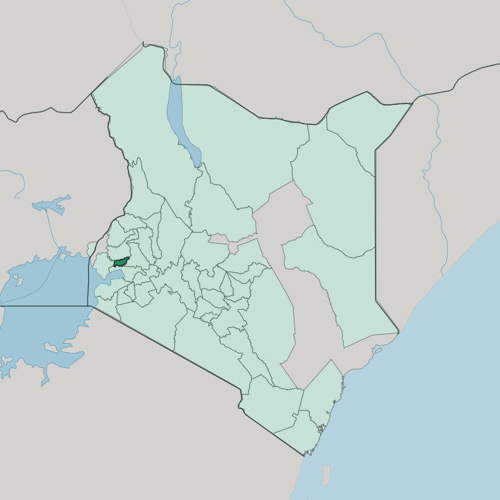


Towns & cities in Vihiga
Pick a town or city — each links to where to stay.
Beds cluster in Mbale, the county headquarters, where tea offices and the old market sit along the Kisumu-Kakamega highway. Rooms are simple. Luanda, the trading town on the Kisumu-Busia road, offers the busiest choice of guesthouses and the quickest hop to the Nganyi rainmakers' grove.
For a green retreat, Kaimosi pairs its Quaker mission with guided walks in the last patch of rainforest. Most travellers instead head down to Kisumu and drive the short road up into the hills.
About Vihiga
Vihiga is Maragoli country.
What is Vihiga known for?
The county packs some of the densest rural settlement in Kenya onto small green farms that climb the ridges around Mbale, its hilltop headquarters. Tea is the leading cash crop. It grows on tiny smallholdings squeezed between homesteads, feeds the local factories, and shares the red soil with the maize and beans that stock each family's kitchen.
Vihiga is also the cradle of Kenyan Quakerism, seeded by American missionaries who settled at Kaimosi in 1902. Above the farms stand the Maragoli Hills, whose Mungoma Cave the Maragoli revere as their ancestral home.
Where is Vihiga?
Vihiga lies in the western highlands of Kenya, on the fertile shoulder of land that rises east of Lake Victoria. It is one of the country's smallest counties. Kakamega wraps around it to the north, the Nandi escarpment climbs away to the east, Kisumu and its lakeshore sit to the south, and Siaya lies to the west toward the Ugandan border. Mbale, the compact headquarters town, stands near the middle, roughly a half-hour's drive up from the lake city of Kisumu.
The land here is high but not mountainous, a green plateau folded into ridges and stream valleys. The county slopes gently downward from the cooler northeast, near Nandi, toward the warmer Lake Victoria basin in the southwest. Granite hills break the surface across it.
The Maragoli Hills are the highest ground, a run of forested, boulder-strewn peaks above the farms, while the Bunyore Hills form a second ridge to the south. One river matters. The Yala River gathers the county's many streams and carries them west into Lake Victoria, and its tributaries thread almost every valley between the homesteads.
Deep red soils and heavy rain make this some of the most intensely cultivated ground in Kenya, where farms press right up to the roadsides and few patches of open land remain.
What is Vihiga like?
Maragoli culture shapes daily life here. The Maragoli are a subgroup of the wider Luhya nation, and their tongue, Logooli, holds a particular distinction: it was the first Luhya language into which the Bible was translated. Its dominant faith is Quaker.
The Friends Church that grew from the Kaimosi mission shaped schools, hospitals and Sunday life across the county, and Vihiga still counts among the strongest concentrations of Quakers anywhere in the world. Alongside the Maragoli live the Banyore of the Bunyore hills and the Tiriki to the east, each with its own customs but bound by the shared Luhya heritage. Culture here is lived, not staged.
Every December the Maragoli Cultural Festival fills Mbale with drumming, storytelling and initiation rites drawn from the old calendar. Near Luanda, the Nganyi rainmakers of the Abasiekwe clan still read the coming weather from a sacred grove of trees, a craft handed down through the clan's elders for generations. Land is scarce and precious.
Homesteads sit almost within talking distance of one another, sons are sent far for schooling and work, and money wired home from Nairobi and beyond keeps many of these hillside farms going.
What is the history of Vihiga?
The Maragoli trace themselves to Mulogoli, the ancestor said to have settled at Mungoma Cave in the Maragoli Hills after a long migration from the Congo basin. Their history turned sharply in 1902, when American Quaker missionaries founded the Friends African Mission at Kaimosi, planting churches and schools that still define the county. Colonial rule reshaped the map.
The area sat inside the sprawling Kakamega district of Western Province until Vihiga was hived off as its own district in 1990. Kenya's 2013 devolution then made it one of the country's forty-seven counties.
What is the climate of Vihiga?
Height keeps Vihiga mild. The county sits well above the Lake Victoria basin, trading the heat of the lakeshore for a gentle, spring-like warmth that holds through the year. Rain is the real story.
Two wet seasons soak the hills, the long rains from March to May and the shorter rains from about September to November, and between them the ground rarely dries out. That dependable water, more than anything, is why the Maragoli farms stay green and why the slopes can feed so many. The higher country toward Nandi runs a touch cooler than the warmer western dip toward the lake.
How do you get to Vihiga?
Vihiga County runs no airport of its own. The usual way in is through Kisumu, the lakeside city a short drive south, whose Kisumu International Airport connects the region to Nairobi and the coast by daily flights. From the airport the road climbs north on the A1 Kisumu-Kakamega highway, running straight through Mbale, Chavakali and the smaller trading centres strung along it.
Matatus and long-distance buses ply the same route from Nairobi. Nearly everyone arrives by road.
Good for
Updated July 2026