Morocco
Guelmim-Oued Noun, Morocco — Towns & Travel Guide


Guelmim-Oued Noun is Morocco's Saharan threshold, where the Anti-Atlas breaks toward the desert and a red-clay caravan town keeps its camel market.
About Guelmim-Oued Noun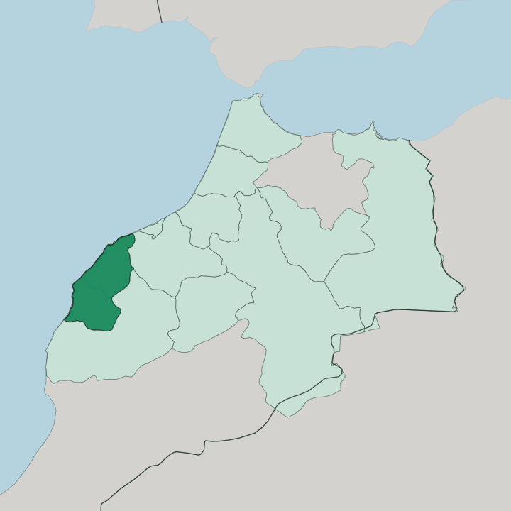
Towns & cities in Guelmim-Oued Noun
Pick a town or city — each links to where to stay.
Let what drew you to Guelmim-Oued Noun decide where you settle. The choice is inland or coastal. Guelmim, the inland capital of red clay, puts you at the camel market and the desert roads.
On the coast, Sidi Ifni trades desert heat for Atlantic air, its Art Deco streets rising above a fishing port and the red arches of Legzira a short way north. Mirleft, up the shore below the Anti-Atlas, is the surfers' pick. Push south to Tan-Tan for the deep Sahara and its yearly gathering of nomads.
Choose Guelmim for the market; choose the coast for the cliffs and the swell.
About Guelmim-Oued Noun
One thing above all: the camel market.
What is Guelmim-Oued Noun known for?
Every Saturday, traders lead their animals into Guelmim, the walled capital of sun-dried red clay that has funnelled desert commerce since caravans crossed to Timbuktu, and the region wears its old nickname as the gate of the desert. West of that inland heat, the Atlantic coast runs long and empty from Mirleft down past Sidi Ifni, where the red cliffs and sea-carved arches of Legzira meet the surf. This is a meeting-place of Amazigh, Sahrawi, and Arab desert life.
Where is Guelmim-Oued Noun?
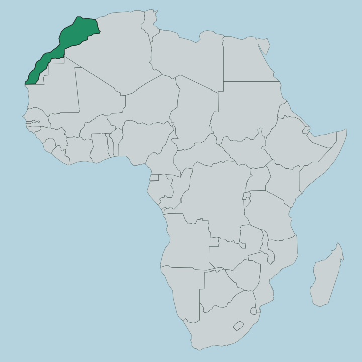
Guelmim-Oued Noun fills the far south-west of Morocco, the last region before the desert takes over. It is a broad, dry country. The Anti-Atlas, the southern arm of the Atlas ranges, drops away here toward the sands, and the Sahara stretches beyond its foot to the east and south.
Two watercourses give the land its shape and its name: the Oued Noun runs through the north around the capital, and the Draa, Morocco's longest river, cuts across the region from east to west toward the ocean. On its north-western edge the land meets the Atlantic, a coastline of roughly 240 kilometres running from Mirleft in the north down past Sidi Ifni and the port town of El Ouatia toward Oued El Waer. Souss-Massa lies to the north-east, and the region of Laâyoune-Sakia El Hamra begins to the south. Inland the borders run to desert.
Algeria's Tindouf province sits away to the east, while Mauritania's territory reaches the region's south-eastern corner across the open sand. The capital, Guelmim, stands where the mountains give out and the palm oases begin. From there the caravan tracks once ran south across the desert to Timbuktu.
Mountain, ocean, and sand. That position is the whole story of the place.
What is Guelmim-Oued Noun like?
Three worlds meet on this ground. The Amazigh of the Anti-Atlas foothills, the Sahrawi of the open desert, and the Arab traders of the old caravan towns have shared it for centuries, and the culture that grew from them still turns on the rhythms of the camel, the tent, and the market. Nowhere shows it plainer than Tan-Tan.
Its moussem, a yearly gathering of the region's nomads, brings tribes in from across the Sahara to pitch their camel-hair tents, and was written onto the UNESCO list of intangible cultural heritage in the year 2008. Fantasia riders charge and fire in unison. The Guedra, a slow hypnotic dance of the Noun country, is performed at weddings and festivals as it has been for generations, and the Hassaniya oral traditions of poetry, song, and desert lore run alongside it.
Sahrawi men here are still called the blue men of the desert, for the indigo of their robes. Food follows the land. Camel milk, dates from the palm groves that ring Guelmim, and mint tea poured from a height are the everyday hospitality.
Craft holds on too, in silver, leather, and woven wool. Arabic and Amazigh are both spoken. This is the least polished, most nomadic corner of Morocco, and it knows it.
What is the history of Guelmim-Oued Noun?
Trade built this land. In the Asrir oasis outside Guelmim stood Nûl Lamta, a caravan town founded around the eighth century and grown wealthy under the Almoravids, sitting astride the routes that carried gold and salt north from Timbuktu across the Sahara. That commerce is why Guelmim is still called the gate of the desert.
The coast has its own past: Spain held the enclave of Sidi Ifni until 1969, leaving its Art Deco streets behind. The region itself is new, drawn up in the year 2015 when Sidi Ifni province was joined to the desert provinces around Guelmim to form Guelmim-Oued Noun.
What is the climate of Guelmim-Oued Noun?
The desert sets the terms. Inland around Guelmim and Tan-Tan the climate is arid, hot by day and sharply cooler at night, with rainfall that is scarce, irregular, and sometimes withheld for years of drought. The Atlantic softens the edges.
Along the coast at Sidi Ifni and Mirleft the sea air keeps temperatures mild the year round and often draws a morning mist in off the water. Spring and autumn are the kind seasons, when the inland heat eases and the coast stays gentle, and the palm oases that ring the capital depend on the Oued Noun and the wells beneath the sand rather than on the sky.
How do you get to Guelmim-Oued Noun?
Most travellers come overland from Agadir. The main road runs south out of the Souss-Massa region and crosses the Anti-Atlas to Guelmim, the region's road hub, where the desert highways branch off toward Tan-Tan and the coast. Guelmim has a small airport of its own.
Sidi Ifni and Mirleft sit off the coastal road below the mountains, reached by bus or car rather than by rail, since no railway runs this far south. From Guelmim the tarmac carries on across the Sahara toward Laâyoune and, eventually, Mauritania.
Good for
Updated July 2026