Morocco
Laâyoune-Sakia El Hamra, Morocco — Towns & Travel Guide


Laâyoune-Sakia El Hamra is Morocco's Atlantic-facing desert south, built around the Saguia el-Hamra wadi and the city of Laâyoune.
About Laâyoune-Sakia El Hamra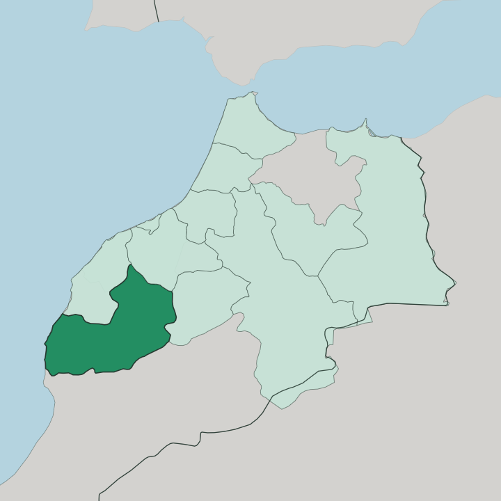
Towns & cities in Laâyoune-Sakia El Hamra
Pick a town or city — each links to where to stay.
Laâyoune is where almost everyone stays. The capital holds the region's airport, its hotels and its restaurants, and it sits close to the mouth of the Saguia el-Hamra. Smara, the inland town at the region's centre, suits travellers drawn to Ma al-'Aynayn's stone zawiya.
Along the Atlantic edge, the small fishing towns of Boujdour and Tarfaya offer a night by the water rather than a base for a long stay. Pick Laâyoune first; the coast and the desert interior reward a detour once you have a foothold there.
About Laâyoune-Sakia El Hamra
This is the desert south.
What is Laâyoune-Sakia El Hamra known for?
The region takes the second half of its name from the Saguia el-Hamra, the red-channelled wadi that runs west across the sand to reach the Atlantic Ocean near Laâyoune, its capital and by far its largest city. Phosphates pulled from the Bou Craa deposit inland, fishing boats working the coast at Boujdour and Tarfaya, and the walled zawiya that shaykh Ma al-'Aynayn raised at Smara are what fix the place in memory. Camels still cross the dunes.
Where is Laâyoune-Sakia El Hamra?
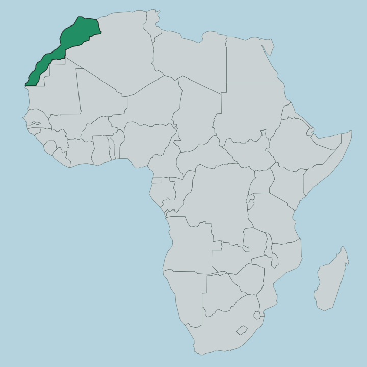
The region fills the far south of Morocco, in the northern part of the Western Sahara territory that Spain once governed. Its western edge is all Atlantic Ocean. Mauritania lies to the east, across long stretches of open desert, while the Moroccan regions of Guelmim-Oued Noun and Dakhla-Oued Ed-Dahab close it off to the north and the south.
It is vast and mostly empty. Sand and stony hamada cover the interior, and the population gathers at a handful of towns rather than spreading across the land. The Saguia el-Hamra gives the region half its name and much of its shape.
This intermittent wadi rises in the desert northeast, then runs west past Smara before reaching the sea near Laâyoune, carrying water only after the rare heavy rains. The capital stands just south of its dry channel, where Spanish settlers built the lower town. Down the Atlantic shore lie Boujdour, near the old headland of Cape Bojador, and Tarfaya in the north, close to Cape Juby.
Inland from the coast sits the phosphate settlement of Bou Craa, linked to the ocean by one of the longest conveyor belts ever built. Everything here bends toward water, whether the wadi or the sea.
What is Laâyoune-Sakia El Hamra like?
Sahrawi life sets the tone here. The people of the region are largely Sahrawi, a Saharan society with deep roots in camel herding and caravan trade, and they speak Hassaniya Arabic, the desert dialect shared with the tribes of neighbouring Mauritania. Tea poured in three rounds, wide woven tents and dark blue robes are ordinary sights across the towns and the open sand.
Music and poetry carry the old nomadic memory forward. The layers of colonial rule still show in the streets. Spanish shaped the lower town of Laâyoune, and traces of that period sit alongside the Moroccan administration that now governs the region.
Smara holds the region's spiritual heart. The stone zawiya that shaykh Ma al-'Aynayn built there in the desert once drew students to its library and made the oasis a centre of religious learning before French troops sacked it. Its ruined walls still stand at the town's core.
Along the coast, Tarfaya keeps a stranger memory: the writer and airmail pilot Antoine de Saint-Exupéry ran the Aéropostale relay station there in the late 1920s, and the flat shore that shaped his early books is marked at the town. Desert and ocean pull the culture in two directions at once.
What is the history of Laâyoune-Sakia El Hamra?
The desert here held caravan routes and holy sites long before any border was drawn. Shaykh Ma al-'Aynayn made Smara his capital in 1902, raising its zawiya and library on the Saguia el-Hamra. Spain took the coast as part of Spanish Sahara, and the captain Antonio de Oro is credited with founding the modern town of Laâyoune in 1938 south of the wadi.
Morocco assumed control after the Spanish withdrawal in 1976. Borders shifted again. The present region was drawn up in 2015, joining the four provinces of Laâyoune, Es-Smara, Boujdour and Tarfaya under a single administration.
What is the climate of Laâyoune-Sakia El Hamra?
Hot, dry, and very Saharan. The interior around Smara and Bou Craa bakes under a desert sun with almost no rain, and the Saguia el-Hamra runs empty for most of the year. The Atlantic changes the story on the coast.
Along the shore at Laâyoune, Tarfaya and Boujdour the cool Canary Current tempers the heat and pushes banks of morning fog inland, so the seaside towns stay milder than the sand behind them would suggest. Real rain arrives only in rare, heavy bursts.
How do you get to Laâyoune-Sakia El Hamra?
Most travellers fly into Laâyoune. Hassan I Airport on the edge of the capital is the region's main gateway, connecting the desert south to Morocco's northern cities and beyond. Coming overland means a long haul down the Atlantic road from Guelmim-Oued Noun in the north, the route that threads through Tarfaya and Boujdour on its way south.
Within the region, road is the only real link between Laâyoune on the coast and Smara in the interior. Distances are big and the towns few.
Updated July 2026