Nigeria
Bayelsa State, Nigeria — Towns & Travel Guide


Bayelsa State sits at the core of Nigeria's Niger Delta, an Ijaw homeland of creeks, mangrove and the Atlantic shore.
About Bayelsa State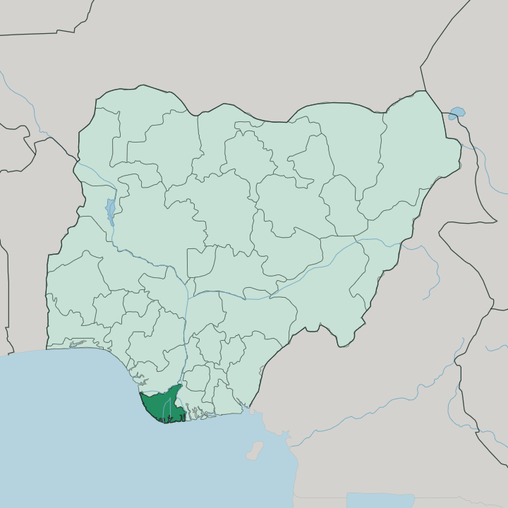
Towns & cities in Bayelsa State
Pick a town or city — each links to where to stay.
Yenagoa is the practical base for Bayelsa, and for most trips the only one. The capital holds the state's hotels and its single airport. Beyond it, beds vanish.
Nembe and Brass sit deep in the mangroves toward the Atlantic, reached mainly by boat, while Oloibiri in Ogbia draws the odd visitor for its place in Nigeria's oil story. Stay in Yenagoa if you want a room, a road and a flight; venture out to the delta towns only with local help and time to spare.
About Bayelsa State
What is Bayelsa State known for?
Bayelsa is Nigeria's watery corner. It lies deep in the Niger Delta, where the Nun River and a maze of creeks carry more traffic than any road. Oil made its name: the country's first commercial well came in at Oloibiri, in Ogbia, back in 1956.
It is also the ancestral heart of the Ijaw people, and the capital at Yenagoa is the one town most visitors ever see. Fishing, mangrove and flood define the rest.
Where is Bayelsa State?
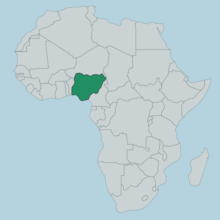
Bayelsa fills the core of the Niger Delta, in the South South of Nigeria. Water rules it. The Atlantic Ocean forms the whole southern edge, and the land dissolves into mangrove, tidal creek and estuary long before it reaches the surf. Rivers State lies to the east and Delta State to the north, the border there running along the Niger River and, for a longer stretch, the Forçados River.
The Nun River, a distributary of the Niger, threads down through the middle of the state and out to the sea. Much of Bayelsa is barely above the water. That setting shapes everything about moving through it.
Roads reach only so far before creeks take over, and many communities sit on islands or riverbanks that a boat serves better than any highway. Yenagoa, the capital, stands on the Ekole Creek in the drier interior, which is why the state grew up around it. Nembe and Brass lie out toward the Atlantic among the mangroves, closer to open water than to tarmac.
The state covers a little over ten thousand square kilometres, and a large share of that is river, swamp and floodplain rather than dry ground. When the rains come, the Nun spills wide and Yenagoa itself floods most years.
What is Bayelsa State like?
Bayelsa is Ijaw country to its bones. The Ijaw, or Izon, are the majority people here, and Bayelsa is often called the cradle of their culture. The language of daily life is Izon, spoken across the creeks alongside Nembe, Ogbia and Epie-Atissa, and it carries greetings that turn on the water and the night.
One Izon greeting asks whether you made it back from the dead, sleep read as a small death, waking as a return. Fishing and the river run through almost every custom. Canoe regattas, drumming and masquerade mark the festivals, and the delta's shrines and water spirits still hold their place beside the churches.
The state also carries a hard political memory. Kaiama, a town in the interior, is the birthplace of Isaac Adaka Boro, the Ijaw nationalist who declared a short-lived Niger Delta Republic in 1966. The same town gave its name to the Kaiama Declaration of 1998, when thousands of young Ijaw asserted a claim over the land and oil of their own territory.
That mix of fishing village and oil frontier is the texture of Bayelsa. The old life on the water and the newer life around the wells share the same uneasy creeks.
What is the history of Bayelsa State?
Bayelsa is one of Nigeria's youngest states, carved out of Rivers State in 1996. Its name is a knot of its own towns, the BA of Brass, the YEL of Yenagoa, the SA of Sagbama. Yet the ground beneath it is where the country's oil age began.
At Oloibiri, in Ogbia, Shell struck Nigeria's first commercial oil in 1956, and the delta has pumped ever since. The people came first. The Ijaw who live here are far older than any of that, a river people whose settlements at Nembe and along the Nun long predate the wells and the state lines drawn around them.
What is the climate of Bayelsa State?
Bayelsa is hot, wet and humid the year round, a tropical delta climate off the Atlantic. Rain dominates. The wet season stretches from roughly March into November, and the downpours peak around September, when the Nun River swells and the creeks brim over.
Yenagoa floods in most rainy years. Even the short drier spell around the turn of the year stays warm and close, with the air heavy over the mangroves. Bring for the wet, not the cold.
How do you get to Bayelsa State?
Most visitors reach Bayelsa through Yenagoa. The capital has the state's only airport, opened in 2019, with flights up to Lagos and Abuja. By land, the road in comes from Port Harcourt in neighbouring Rivers State, a few hours east across the delta.
From Yenagoa the creeks take over. Nembe, Brass and the seaward Ijaw towns are reached by boat far more easily than by any road, and a hired outboard is often the only way through. Come by plane or by the Port Harcourt road, then trust the water.
Good for
Updated July 2026