Nigeria
Rivers State, Nigeria — Towns & Travel Guide


Rivers State lies in the Niger Delta of southern Nigeria, threaded with creeks and mangrove, its capital Port Harcourt set on the Bonny River.
About Rivers State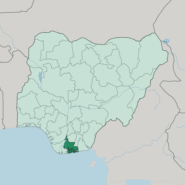
Towns & cities in Rivers State
Pick a town or city — each links to where to stay.
Port Harcourt is the natural base. The capital sits on the Bonny River, holds the state's hotels and its airport, and is where nearly every trip into Rivers State begins. The rest of the state divides by water and land.
South toward the Atlantic Ocean lie the mangrove creeks of the Ijaw and Kalabari, reached mainly by boat, with the oil-terminal town of Bonny at the river mouth. North of the capital the ground rises into the tropical rainforest of the Ikwerre and Etche. Choose Port Harcourt for a first visit; take the creeks or the upland when you want the delta away from the city.
About Rivers State
Oil made this state.
What is Rivers State known for?
Rivers State anchors the eastern Niger Delta, and Port Harcourt grew from a colonial coal port into the commercial heart of Nigeria's petroleum industry. Refineries at Eleme, tanker berths on the Bonny River, and export terminals downstream at Bonny give the state its nickname, the Treasure Base of the Nation. Water defines the rest of it.
Beyond the oil, a maze of creeks and mangrove reaches south toward the Atlantic Ocean, and the name Rivers itself comes from the tangle of waterways that thread the delta.
Where is Rivers State?
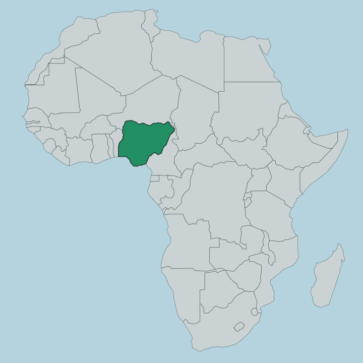
Rivers State occupies the eastern Niger Delta, in the far south of Nigeria, where the land meets the Atlantic Ocean. It takes its name from water. A network of rivers, creeks, and tidal channels cuts the state into a low, flat plain, and the ground rarely rises far above the tide.
The Bonny River runs past Port Harcourt and out to the sea, an eastern arm of the great Niger delta system, and the New Calabar and Orashi rivers thread the country beside it. The coast is all mangrove. Toward the southern edge the land dissolves into brackish swamp and shifting creeks that open onto the Gulf of Guinea, the corner of the Atlantic Ocean that washes this stretch of West Africa.
Inland the swamp gives way to tropical rainforest. Bayelsa and Delta states lie to the west, Imo and Anambra to the north, and Abia and Akwa Ibom to the east, so only the southern flank of Rivers State touches open water. Port Harcourt stands well back from the sea, some distance up the Bonny River rather than on the shore itself.
Bonny town guards the river mouth downstream. That watery geography, more than any road or border, has shaped how people here live and move.
What is Rivers State like?
Rivers State is one of the most crowded ethnic mosaics in Nigeria. Dozens of peoples share the delta. The Ijaw of the southern creeks are river folk, fishermen and traders whose settlements string along the waterways down to the Atlantic Ocean.
West of Ogoniland the Ikwerre hold the upland around Port Harcourt, while the Ogoni farm and fish the ground toward the eastern rivers. Each speaks its own tongue. Some thirty indigenous languages and dialects are counted across the state, drawn from the Ijoid, Benue-Congo, and Ogoni families, and English ties them together as the common and official language.
Masquerade and the water bind the culture. Boat regattas and masquerade displays carry the old stories of the delta clans, and the Kalabari mark ancestral valour in festivals held only once in several years. Food comes off the water.
Fresh fish, palm oil, and the produce of the creeks fill the markets of Port Harcourt and the smaller river towns. City and creek pull in different directions, and the contrast between the oil capital and the quiet waterside villages runs through everything the state does.
What is the history of Rivers State?
Rivers State was carved out on 27 May 1967, when the military government of Yakubu Gowon split the old Eastern Region into smaller states on the eve of the Nigerian civil war. Long before that the delta traded. Bonny and the creek ports had shipped palm oil out to visiting ships across centuries of coastal commerce, and earlier still the same waterways carried enslaved people to those vessels, which earned the delta its old name of the Oil Rivers.
Petroleum rewrote the story after the fields of the Niger Delta came into production, and Port Harcourt turned from a modest coal-export harbour into the industrial capital of Nigeria's oil economy.
What is the climate of Rivers State?
Heat and moisture rule Rivers State in every month. The rains dominate. A long wet season runs from about March into November, and the delta takes some of the heaviest downpours in Nigeria, far more on the mangrove coast than in the drier upland north.
Humidity hangs high off the creeks and the Atlantic Ocean, and the air stays warm through every month. A short, hazier dry spell settles in around December before the rains return to the Bonny River and the swamps once more.
How do you get to Rivers State?
Most travellers fly into Port Harcourt International Airport at Omagwa, north of the city, where domestic flights from Lagos and Abuja arrive alongside a handful of international links across West Africa and beyond. Roads run in from the neighbouring states. The rest is water.
Boats and water taxis carry people down the Bonny River from Port Harcourt to Bonny and the creek settlements that no road reaches, so a journey into the southern delta often ends in a canoe rather than a car.
Good for
Updated July 2026