Nigeria
Kano State, Nigeria — Towns & Travel Guide


Kano State fills the Sudanian savanna of northern Nigeria, its ancient walled capital the old crossroads of Saharan caravan trade.
About Kano State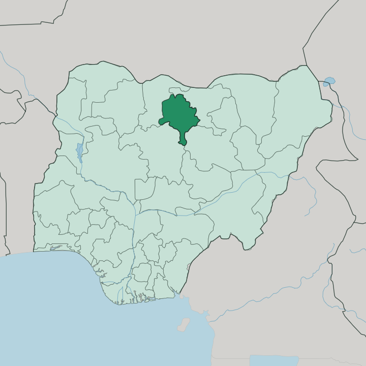
Towns & cities in Kano State
Pick a town or city — each links to where to stay.
Kano city holds the beds. Almost everyone bases themselves in the capital, where the old walled town and the newer districts sit on opposite sides of one sprawling city. Nasarawa GRA is the leafy government reservation laid out under colonial rule.
Its larger hotels cluster along Audu Bako Way, an easy run from the airport. The historic core around Kurmi Market and Gidan Rumfa is the reason to come, yet it keeps few rooms of its own. Base yourself in Nasarawa GRA for comfort, then head into the walled city for the markets, the indigo dye pits, and the Emir's palace.
About Kano State
Kano trades.
What is Kano State known for?
Its capital, also called Kano, is the second-largest city in Nigeria and the commercial hub of the whole northern half of the country, a place merchants have converged on for a thousand years. Caravans once crossed the Sahara to reach its markets, and the indigo dye pits at Kofar Mata have coloured cloth for six centuries. The Emir of Kano still rules from Gidan Rumfa.
That mud-brick palace was begun in the fifteenth century and has housed the ruler ever since. Groundnuts, leather, and woven cloth built the old walled city's wealth.
Where is Kano State?
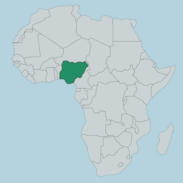
Kano State sits in the far north of Nigeria, on the open plains that run south from the Sahel toward the wooded savanna. It is landlocked, ringed by four other states. Katsina lies to the north-west and Jigawa to the north-east, while Bauchi closes off the south-east and Kaduna the south-west.
No sea touches it, and the desert edge is not far beyond its northern border. The land is a gently rolling plain of the Sudanian savanna, greener and more wooded in the south, thinning to scrub as it climbs toward the drier north. Water ties the state together.
The Kano and Challawa rivers rise in the highlands to the south-west and join near the capital to form the Hadejia, which then runs east across the plains toward the Lake Chad basin. Granite hills break the flatness in a few places; Dala Hill, inside Kano city, was worked for iron more than a thousand years ago. Around that watered core spread the farms that made the state the groundnut capital of the country.
The old walled city stands where those rivers, those trade routes, and that farmland all met.
What is Kano State like?
Kano is the cultural anchor of the Hausa world. The Hausa and Fulani make up most of the population, Hausa is the language of the street and the market, and Islam has shaped daily life here since it arrived along the trade routes roughly a thousand years ago. The rhythm of the city still runs on trade.
Kurmi Market has drawn buyers and sellers since the fifteenth century, when it took shape under the reforming emir Muhammad Rumfa, and it remains one of the oldest working markets in West Africa. Craft is everywhere. At Kofar Mata, dyers lower cloth into fermented indigo vats sunk into the ground, using a formula their trade has kept for six hundred years.
Leatherwork, weaving, and embroidery carry the same long inheritance. Above it all presides the Emir of Kano, whose court at Gidan Rumfa keeps a ceremony and a calendar that predate colonial Nigeria by centuries. The Durbar, a mounted parade of horsemen in bright robes marking the great Muslim festivals, is the year's grandest sight.
Scholarship matters as much as commerce, for Kano has been a centre of Islamic learning for generations.
What is the history of Kano State?
The story is old. Iron-workers were smelting on Dala Hill more than a thousand years ago, and the Kano Chronicle traces the kingdom itself to Bagauda in the year 999, one of the seven true Hausa states. Rulers walled the city over the following centuries, while Islam and trans-Saharan trade made it rich.
In 1805 the Fulani jihad swept away the old Hausa dynasty and folded Kano into the Sokoto Caliphate as an emirate. The British took the city in 1903. Kano State itself was carved from the Northern Region in 1967, though the emirate it is named for is far older.
What is the climate of Kano State?
Kano runs hot and dry, on the semi-arid edge of the Sahel. The year splits cleanly in two. A short rainy season falls between June and September, when the plains green up and the Kano and Challawa rivers swell; the rest of the year stays parched.
From roughly November into February the harmattan blows in off the Sahara, a dry, dusty wind that veils the sky and drops the nights to a cool that surprises first-time visitors. Then the heat builds hard toward April, the fiercest month before the rains break.
How do you get to Kano State?
Most visitors reach Kano by air. Mallam Aminu Kano International Airport, the oldest airport in Nigeria, sits just outside the capital and handles most arrivals for the whole north. Domestic flights link it to Lagos and Abuja, and international routes run to Jeddah, Cairo, and Addis Ababa, carrying pilgrims and traders as the caravans once did.
Overland, trunk roads fan out to Katsina, Kaduna, and Maiduguri, and long-distance buses use the motor parks in the capital. The old railway from Lagos also reaches Kano, the line that once hauled its groundnuts to the coast.
Good for
Updated July 2026