Nigeria
Delta State, Nigeria — Towns & Travel Guide


Delta State fans out across the western Niger Delta in southern Nigeria, laced by the River Niger and its creeks.
About Delta State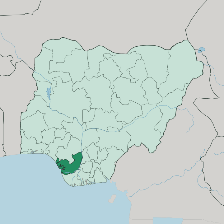
Towns & cities in Delta State
Pick a town or city — each links to where to stay.
Two cities anchor most trips. Asaba, the capital on the River Niger, holds the newer business hotels and sits beside the airport that carries inland visitors. Warri, the oil-industry hub near the Escravos River, keeps the larger stock of rooms and serves anyone bound for the delta creeks.
Beds thin out fast once you leave those two. Pick Asaba for arrivals from the north and the Niger crossing; pick Warri if the coast, the oil fields, or the waterside towns are your reason for coming.
About Delta State
What is Delta State known for?
Delta State takes its name from the Niger Delta, whose western half spreads across it. Oil defines the economy. The creeks around Warri and the Escravos River feed the crude that made this one of Nigeria's core petroleum regions, and pipelines thread the mangroves toward the coast.
Asaba, the capital, sits inland on the River Niger. Travellers know the state instead for the Ethiope River at Abraka, whose clear spring-fed water is a rarity in the delta.
Where is Delta State?
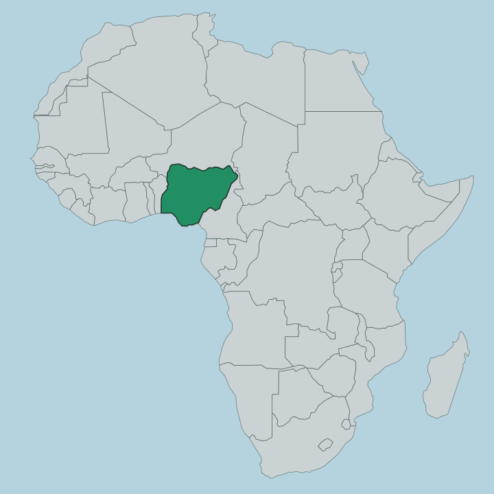
Delta State occupies the western Niger Delta, in the South-South of Nigeria. The River Niger forms its eastern edge, splitting below Aboh into the distributaries that give the whole region its name. In Delta State, water is never far from view.
The Forçados and Escravos rivers carry the Niger's flow south and west through mangrove and swamp toward the sea, and countless smaller creeks braid the low ground between them into islands and channels. The southern rim meets the Atlantic along the Bight of Benin, a stretch of coastline running about 160 kilometres of sandbars and river mouths. Inland the land firms up.
Asaba stands on the Niger in the north-east, on higher ground across the water from Onitsha, while Warri lies south-west in the true delta near the Escravos. Edo State borders the north, Bayelsa the south, and the Niger separates Delta from Anambra and Rivers to the east. The Ethiope River rises from a spring at Umuaja and runs clear past Abraka, a startling contrast to the tea-brown delta water around it. Nowhere here is far from a river.
That braided geography shapes travel, settlement, and the whole rhythm of the state.
What is Delta State like?
No single people fills Delta State. Its map is a mosaic of communities that predate the state line by centuries. The Urhobo, the largest group, hold the central belt around Ughelli and the Ethiope, and the closely related Isoko share the same country to the south.
Along the coast and the western creeks live the Itsekiri, whose old Kingdom of Warri traded with Portuguese and British ships from the delta ports, and the Ijaw, fishermen and boatmen of the mangrove. In the north, above the Niger, the Anioma speak Igbo and look toward Asaba. Each group carries its own festivals, masquerades, and shrine traditions.
That variety is the point. English serves as the common tongue across the state, but a dozen languages fill the markets, and the boat is as ordinary a way to reach a village as the road. Music, wrestling, and river festivals bind the communities more than any one faith or lineage does.
The delta made these cultures, and it still holds them together.
What is the history of Delta State?
Delta State was carved from the old Bendel State in 1991. The line is new. Its story is old, for long before that the Kingdom of Warri and the Anioma towns above the Niger traded palm oil and slaves with European ships, and the coast fell under the British Oil Rivers Protectorate in 1884.
When Nigeria drew the new state, it chose Asaba as capital over the larger and older port of Warri, a decision still argued over. The name looked back to the Niger Delta the state was cut to represent.
What is the climate of Delta State?
Heat and rain define Delta State in every season. The rains dominate. From roughly March to October the delta soaks under heavy tropical downpours, and around Warri near the coast the wet season stretches to some ten months, leaving barely a dry gap.
A short, humid dry spell follows near the turn of the year, when the Harmattan haze can drift down from the north. Rivers swell and low creek towns flood in the heaviest months. Heat and humidity hold steady whatever the season.
How do you get to Delta State?
Air or river brings most visitors. Asaba International Airport handles flights into the capital, while Warri's airport near Osubi serves travellers bound for the oil-industry south of the state. The land route from the east crosses the River Niger by the road bridge from Onitsha into Asaba.
Roads run on. Warri and the creek towns lie deeper in the delta, reached by tarmac to a point and then by boat out to the outer villages where no road goes.
Updated July 2026