Nigeria
Niger State, Nigeria — Towns & Travel Guide


Niger State is Nigeria's largest state by land, a west-central sweep of savanna where the Niger River draws its southern edge.
About Niger State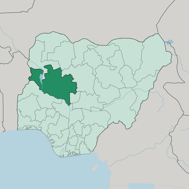
Towns & cities in Niger State
Pick a town or city — each links to where to stay.
Minna is the practical base. As capital and largest city it holds the airport and the hospitals travellers rely on, and roads fan out from it to every corner of the state. Bida in the south suits anyone drawn to Nupe metalwork, where brass casters and glass beaders keep to workshops clustered around the Etsu Nupe's court.
Suleja sits at the eastern corner beside Abuja, handy for arriving through the federal capital and pushing on. Kontagora holds the north. Beds thin out once you leave these four.
Choose Minna for reach, Bida for craft, Suleja for the Abuja gateway, or Kontagora for the market roads toward Kainji.
About Niger State
Niger State runs on water and current.
What is Niger State known for?
Its rivers turn turbines, not just wheels. The Kainji Dam on the Niger River, along with the Shiroro and Zungeru dams, feeds hydroelectric power onto the national grid and earns the state its nickname, the Power State. Minna anchors the centre as capital and busiest city, while Bida in the south keeps the brass and glass workshops of the Nupe kingdom alive.
Wooded savanna covers most of the land between them.
Where is Niger State?
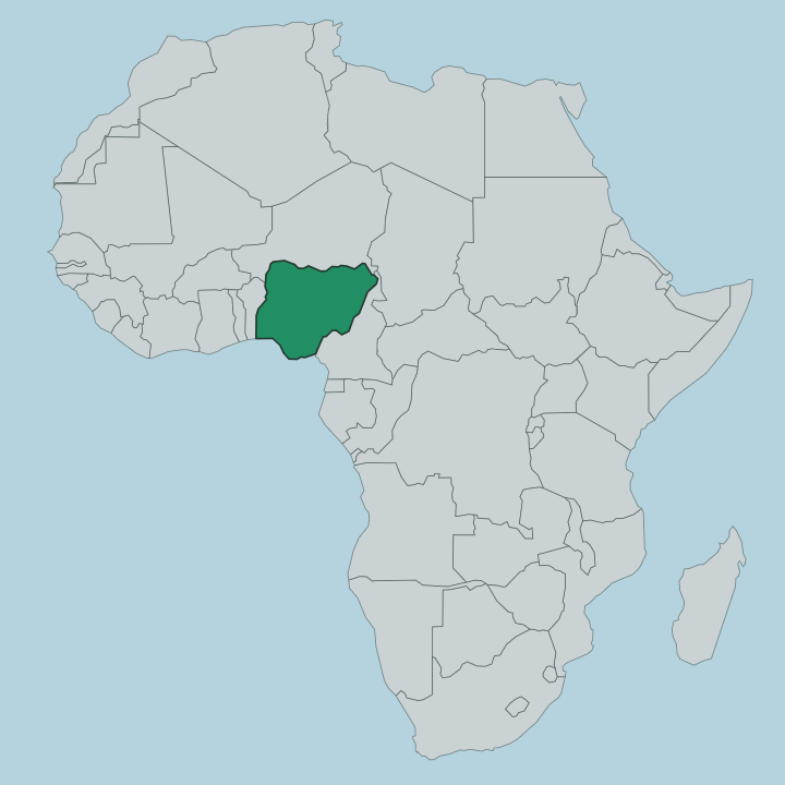
Niger State fills the west-central belt of Nigeria, the biggest of the country's states by area. It reaches from the border with the Republic of Benin in the west across to the Federal Capital Territory around Abuja. The Niger River, the great river that gave both state and country their name, forms the southern boundary.
Off to the north the land rises into open savanna toward Kebbi and Zamfara, while Kaduna lies along the north-east and Kwara to the south. Water shapes the interior more than any ridge. The Kaduna River winds down through the middle in broad floodplains, joined by the Gurara, the Gbako and the Mariga.
Much of the state is wooded savanna. The Niger widens behind the Kainji Dam into Kainji Lake, a reservoir long enough to run more than a hundred kilometres up the valley into the northern hills. Kainji Lake National Park spreads along its western shore, the oldest national park in the country.
Minna stands near the centre, and the smaller towns string out along the rivers. Rivers define this land.
What is Niger State like?
Culture here is a patchwork of peoples the rivers kept apart. The Nupe hold the south, around Bida and the lower Niger, and their kingdom under the Etsu Nupe gives the state its most famous crafts. Bida brass casting reaches back centuries, worked by hand into bowls, figures and beads that sell far past the town.
Glass beading and cloth weaving run alongside it. The Gbagyi, often called Gwari, occupy the eastern districts toward Minna and the federal capital, farmers known for carrying loads on the shoulder rather than the head. Northward the mix shifts again, toward Hausa and Fulani communities on the savanna roads.
Markets tie the whole state together. Nupe is spoken across the south and Gbagyi to the east, with Hausa serving as the common tongue of the markets and the northern towns. Islam is widely followed, threaded through with older local practice.
Festivals mark the farming year and the courts of the traditional rulers. The Etsu Nupe's palace at Bida remains a working seat of authority, not a museum piece. It all makes a state more varied than its single river name suggests.
What is the history of Niger State?
Niger State was carved out in 1976. The old North-Western State was split, and this western half took the name of the river along its southern edge. The ground it covers is far older than that line on a map, for the Nupe kingdom ruled the lower Niger from Bida for centuries before any colonial boundary was drawn.
British Nigeria was even governed for a spell from Zungeru, where the ruins of the colonial station still stand. Kainji Dam, closed in 1968, then remade the northern valley into a lake and gave the young state the power industry it is now known for.
What is the climate of Niger State?
It stays hot. The year turns on the rains, not the thermometer. A long wet season runs from around May into October, heaviest in the late months, when storms sweep across the savanna and swell the Kaduna and the Niger.
The drier stretch from November to April is the easier time to travel, dusty and warm under clear skies. The southern districts near the river catch more rain than the drier northern reaches toward Kontagora.
How do you get to Niger State?
Most travellers reach Niger State overland from Abuja, whose airport sits just across the eastern border near Suleja. From there roads run west to Minna and on toward Bida and Kontagora. Minna has its own airport for internal flights, and a rail line threads through the state on the route north.
Distances are long and the rivers force the roads to follow the crossings. Give yourself time between towns.
Good for
Updated July 2026