Nigeria
Katsina State, Nigeria — Towns & Travel Guide


Katsina State is a Hausa heartland in far northern Nigeria, its savanna running to the Niger border.
About Katsina State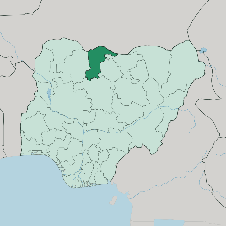
Towns & cities in Katsina State
Pick a town or city — each links to where to stay.
Start in Katsina. The capital is the natural first base, since the emir's palace, the Gobarau Minaret and the old walled city all sit within it and the state's few hotels cluster there. Daura, in the north, is the spiritual home of the Hausa and holds the Kusugu well of the Bayajidda legend, though beds thin out fast beyond the capital.
Funtua guards the southern approach from Kaduna, a cotton and groundnut town more useful as a waypoint than a destination. Base yourself in Katsina; treat Daura and Funtua as day runs from it.
About Katsina State
Katsina State is old Hausa country.
What is Katsina State known for?
Its name comes from the medieval Kingdom of Katsina, one of the seven true Hausa states and once the commercial heart of Hausaland, where camel caravans arrived across the Sahara from Tripoli and Tunis. Horses matter here. The Durbar processions of the Katsina and Daura emirates, staged at the close of Ramadan, put mounted riders in bright regalia before the emir.
Groundnuts and cotton grow across the plains, and the state carries the deepest roots of Hausa scholarship in the country.
Where is Katsina State?
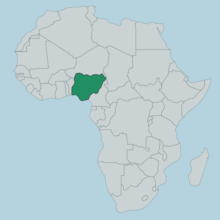
Katsina State sits in the far north-west of Nigeria, a wedge of flat savanna pushing up to the frontier with Niger. Its whole northern edge is that national border. Zamfara State lies to the west, Kano and Jigawa states to the east, and Kaduna State closes it off to the south. The land is open and mostly level, part of the West Sudanian savanna, with low undulating rises through the western and central belt rather than any real hills.
Head north and the grassland thins toward the semi-desert Sahelian fringe. Water shapes it, not relief. The Sokoto River drains the western side, and the Bunsuru and Gada rivers thread the plains, feeding the fields through the short wet months and running low the rest of the year.
The state stretches across roughly 24,000 square kilometres of this country. Towns follow the water and the trade roads: Katsina near the top by the Niger border, Daura out to the north-east, Funtua and Malumfashi down in the wetter south. Sand carried on the harmattan settles over all of it in the dry season.
What is Katsina State like?
Life here runs on Hausa and Fulani rhythms. The overwhelming faith is Islam, and Katsina was for centuries the leading centre of Hausa Islamic learning before that mantle passed west to Sokoto in the nineteenth century. Two emirate courts still frame public life.
The Katsina and Daura emirs preside over their old capitals, and their authority shows most vividly at the Durbar, when hundreds of horsemen ride to salute the emir at the end of Ramadan. The kitchen is unmistakably northern. Tuwo shinkafa with miyan kuka, the thick baobab-leaf soup, is everyday food, and fura da nono, millet balls in soured milk, is the drink herders and townsfolk share alike.
Groundnuts, cotton and grain shape the working year across the plains. Craft runs deep too: leatherwork, weaving and the dyed cloth of the wider Hausa world. Hausa is the everyday tongue.
It is heard in the street, the market and the mosque, and this is devout and conservative country, warm to guests, where the horse remains the proudest emblem of all.
What is the history of Katsina State?
The Kingdom of Katsina rose in the early second millennium as one of the Hausa Bakwai, the seven true Hausa states. Islam took hold in the 1450s under Muhammadu Korau, who raised the Gobarau Minaret, and trans-Saharan trade made the city the largest of the Hausa centres. Then the Fulani jihad ended that line.
Umaru Dallaji took the town in 1806 and became its first emir, and Katsina's emir later submitted to British Northern Nigeria in 1903. The modern state was carved from Kaduna State in 1987.
What is the climate of Katsina State?
The year splits hard in two. Rain falls only from about May to September, when the savanna greens and the Sokoto and Bunsuru rivers fill, before a long dry season locks in from October. March and April are punishing, with afternoons pushing past 40 degrees on the northern plains.
From November the harmattan blows down off the Sahara, dry and dust-laden, hazing the sky and cooling the nights. The far north, sliding toward the Sahel, is the hottest and driest ground of all.
How do you get to Katsina State?
Most arrivals come overland from Kano. Katsina city has its own airfield, the Umaru Musa Yar'Adua Airport, on the north-east edge of town, but service is limited and many travellers instead fly into Kano's larger airport and drive the road up, covering roughly 135 kilometres north-west to the capital. From the south, the highway climbs through Funtua and Malumfashi from Kaduna State.
Katsina sits close to the Niger border. The busy Jibia crossing lies just north-west of the capital.
Updated July 2026