Nigeria
Kogi State, Nigeria — Towns & Travel Guide


Kogi State sits where the Niger meets the Benue in central Nigeria, the country's only state to border ten others.
About Kogi State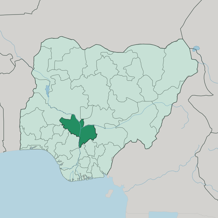
Towns & cities in Kogi State
Pick a town or city — each links to where to stay.
Lokoja is the obvious base. The capital holds most of the state's hotels, strung along the Niger valley below Mount Patti, and it puts the confluence, the Lugard rest house and the road network within easy reach. Okene, in the Ebira highlands to the south-west, is the second town of any size and a stop for anyone heading toward Kabba and the Okun country.
Idah, the Igala seat on the Niger's east bank, is the choice for reaching the river's older history. Base yourself in Lokoja for a first visit; move to Idah or Okene when a particular region is the point.
About Kogi State
Kogi is the Confluence State.
What is Kogi State known for?
Just below its capital, Lokoja, the brown Niger and the green-tinged Benue merge into a single Y-shaped channel and run south toward the sea. Above the town rises Mount Patti. From that hill Flora Shaw is said to have looked down and coined the name Nigeria in 1914, and east of the water spreads the old Igala kingdom around Idah, while west of it sit the Ebira around Okene and the Okun towns near Kabba.
Rivers define the place.
Where is Kogi State?
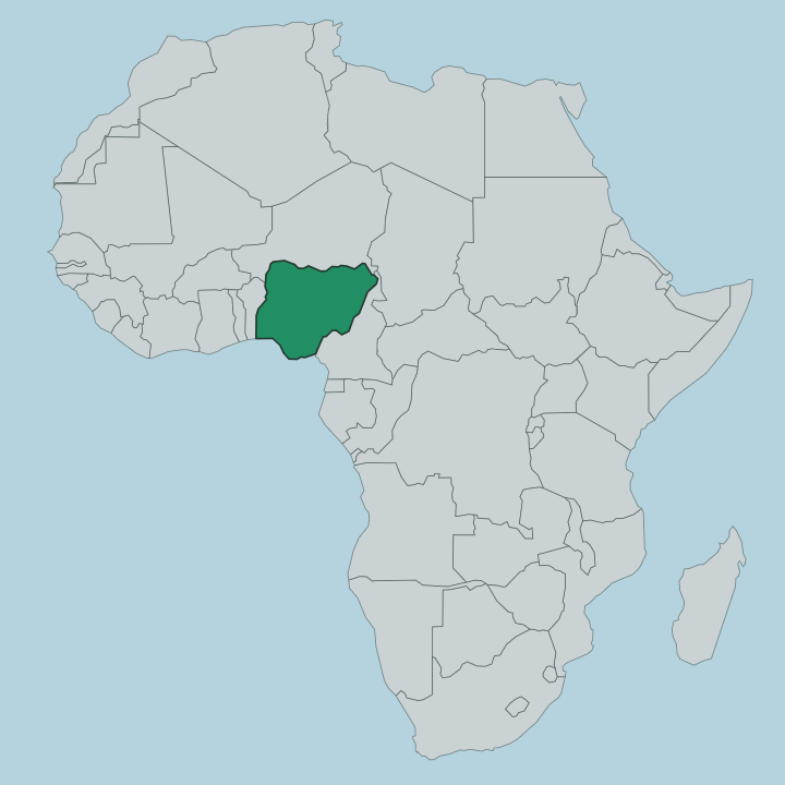
Kogi occupies the middle of Nigeria, in the country's North Central belt. Its defining fact is water. The Niger enters from the north-west and the Benue from the north-east, and the two join just past Lokoja to flow south as one great river toward the delta.
That junction splits the state into distinct halves. The Igala lands spread east of the Niger around Idah, a broad plain of farms and river villages. West of the water the ground climbs into the Ebira highlands around Okene, rougher country of granite hills and inselbergs, with the Okun towns near Kabba beyond them.
Mount Patti stands over Lokoja itself, a flat-topped hill of about 458 metres with the confluence laid out below. No other Nigerian state touches so many neighbours. Kogi borders ten of them, from the Federal Capital Territory in the north to Anambra and Enugu in the south-east, a consequence of sitting at the country's river crossroads.
The land is mostly wooded savanna, cut by the two rivers and their tributaries, and it has drawn traders along the water for centuries.
What is Kogi State like?
Three peoples share Kogi, and the river sorts them. The Igala hold the east bank, ruled for centuries by the Attah from Idah, a kingship whose line reaches back long before the British arrived. Their old capital keeps that authority alive in ceremony and title.
West of the Niger the Ebira dominate around Okene, known across Nigeria for a dense weaving tradition and the woven cloth that carries their name. Further west again the Okun, a Yoruba-speaking people, hold the towns around Kabba, a bridge between the confluence and the wider Yoruba world to the south-west. Smaller groups add to the mix.
The Bassa, Nupe and Oworo live along the rivers, and Lokoja itself, a colonial creation, drew people from all of them into one town. That spread of tongues is unusual even for Nigeria. Igala, Ebira and Okun are distinct languages, not dialects, and a traveller can cross from one into another in an afternoon's drive.
English ties them together as the common language, as it does across the country. Markets, masquerades and river festivals mark the calendar, and the confluence itself remains the image the state holds of itself.
What is the history of Kogi State?
The land is far older than the state. The Igala kingdom ruled the eastern bank from Idah for centuries, and in 1841 a British expedition set up an early trading post at the confluence. Lokoja grew from that post into the first colonial capital of Northern Nigeria under Frederick Lugard, and it was from Mount Patti above the town that the name Nigeria was coined in 1914.
Kogi State itself is recent. It was carved out of Kwara and Benue states in 1991, drawing the Igala, Ebira and Okun homelands together under one government for the first time.
What is the climate of Kogi State?
Kogi runs hot. It has a tropical savanna climate, split into a long rainy season from about April to October and a dry season through the rest of the year. The wet months are heavy, peaking around August, when the Niger and Benue swell and the confluence spreads wide across its banks.
The dry season brings the dusty harmattan wind down from the north and clearer air over Lokoja. Heat is the constant, with the fiercest temperatures arriving in the months just before the rains break.
How do you get to Kogi State?
Most travellers reach Kogi by road. Lokoja sits on the main highway linking Abuja, the national capital to the north, with the cities of the south, so a great deal of Nigeria's north-south traffic passes straight through the state. The nearest major airport is at Abuja, a few hours' drive away, as Kogi has no busy commercial airfield of its own.
The rivers that made the place carry little passenger traffic now. Once inside, roads fan out from Lokoja east to Idah and south-west to Okene and Kabba.
Updated July 2026