Russia
Karachayevo-Cherkesiya, Russia — Towns & Travel Guide


Karachay-Cherkessia is a mountain republic of Russia in the North Caucasus, where the Greater Caucasus rises toward Mount Elbrus.
About Karachayevo-Cherkesiya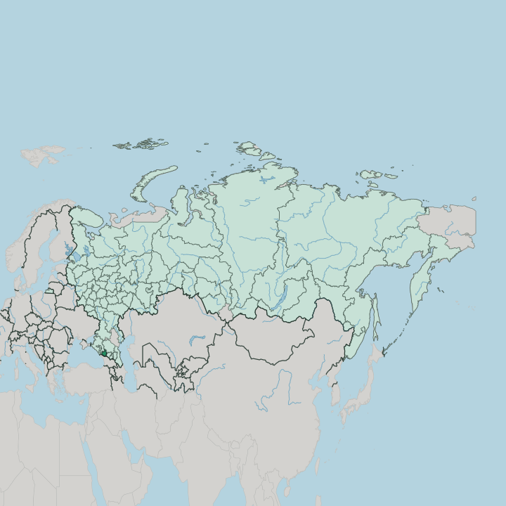
Towns & cities in Karachayevo-Cherkesiya
Pick a town or city — each links to where to stay.
Beds cluster in the valleys. Dombay is the busiest mountain base, with cable-car stages climbing above 3,000 metres in the Teberda valley and the broadest choice of rooms in the whole republic. Arkhyz, over in the Bolshoy Zelenchuk valley, runs quieter and newer, and puts the tenth-century Zelenchuk churches within easy reach.
Teberda sits lower. It is an old cure town where the road enters its nature reserve, milder than Dombay just up the way. Cherkessk, the capital out on the Kuban plain, works mainly as an arrival point, the place you pass through before the drive south into the mountains begins.
Choose Dombay for lifts and snow; choose Arkhyz or Teberda when you want the valleys without the crowds.
About Karachayevo-Cherkesiya
Mountains define this republic.
What is Karachayevo-Cherkesiya known for?
Roughly four-fifths of its land climbs into the Greater Caucasus, and the ski settlements of Dombay, Arkhyz, and Teberda draw skiers and hikers into that high country. Mount Elbrus, the highest peak in the Caucasus at 5,642 metres, stands on the eastern border with Kabardino-Balkaria. The Kuban river gathers its first waters here, on the slopes below Elbrus.
Cherkessk, the capital, sits on the northern plain where the mountains give way to steppe.
Where is Karachayevo-Cherkesiya?
Karachay-Cherkessia lies in the western half of the North Caucasus, in the south of European Russia. Mountains cover most of it. About four-fifths of the republic sits within the Greater Caucasus, and only a narrow strip of the Kuban plain runs flat along the northern edge where the range fades into steppe.
The land tilts from that plain up to the main watershed in the south, and along that crest runs the international border with Georgia. Krasnodar Krai lies to the west, Stavropol Krai to the north-east, and Kabardino-Balkaria to the south-east. The high ground is the story.
Mount Elbrus, the highest peak in the Caucasus at 5,642 metres, stands on the eastern boundary shared with Kabardino-Balkaria, and Dombay-Ulgen rises to 4,046 metres near the Georgian frontier. The Kuban river is born on Elbrus's slopes and runs north through the republic, joined along the way by the Bolshoy Zelenchuk and other mountain streams. Cherkessk, the capital, sits where the Kuban leaves the foothills for the plain.
From there the deep valleys of the Teberda and the Zelenchuk cut south into the highest peaks.
What is Karachayevo-Cherkesiya like?
Two peoples give the republic its name. The Karachays are a Turkic mountain people who settled the eastern highlands, and the Cherkess, or Circassians, belong to the Northwest Caucasian world of the lower valleys and plains. Russians, who arrived with the empire and the Cossack frontier, make up much of the population on the western plains around Cherkessk.
Nogais and Abazins add two more distinct communities to the mix. Five languages hold official status here alongside Russian: Karachay-Balkar, Kabardian, Abaza, and Nogai. That layering shows on the ground.
The Karachays share their language and much of their culture with the Balkars across the border in Kabardino-Balkaria, a bond that the deportations of the Stalin years could not sever. Highland traditions of herding, horsemanship, and hospitality run through Karachay and Cherkess life alike. Islam is the faith of most of the titular peoples.
Yet the oldest churches in Russia stand here too, in the Zelenchuk valley, left from a Christian Alania that flourished a thousand years ago. Few republics pack so many languages and faiths into so little land.
What is the history of Karachayevo-Cherkesiya?
Christian Alania rose in these valleys in the tenth century, and its stone churches near Nizhny Arkhyz still stand as the oldest in Russia. The Mongols swept that kingdom away. Under Soviet rule the region was drawn into a Karachay Autonomous Oblast in 1922, pairing the two titular peoples in one unit.
Then came the wound that still marks Karachay memory: in November 1943 Stalin's government abolished the Karachay homeland and deported the whole Karachay people to Central Asia on a false charge of collaboration. Exile lasted well over a decade. They were allowed home only in the 1950s, and the modern Karachay-Cherkess Republic took its present shape in 1992.
What is the climate of Karachayevo-Cherkesiya?
In Karachay-Cherkessia the weather answers to elevation, moderate on the Kuban plain around Cherkessk but deep in snow up in the Caucasus valleys. On the Kuban plain around Cherkessk the climate is moderate, with short winters and long, humid summers, January averaging near freezing and July around 20 degrees. Climb south into the Greater Caucasus and everything changes: the mountain valleys of Dombay and Teberda hold deep snow through a long winter, which is what makes them ski country.
Summers in the high valleys stay cool and green while the plain below turns warm. Snow, not rain, defines the highland year.
How do you get to Karachayevo-Cherkesiya?
The republic has no airport. Nearly everyone flies into Mineralnye Vody in neighbouring Stavropol Krai, then drives the roughly 200 kilometres south-west to Cherkessk and on into the valleys. From the capital a single main road threads up the Kuban and Teberda gorges to Karachayevsk, Teberda, and Dombay, while another branch climbs the Bolshoy Zelenchuk to Arkhyz.
Rail reaches Cherkessk on a spur from the main North Caucasus line. Beyond that the mountains are the end of the road, and the border with Georgia along the crest has no open crossing.
Good for
Updated July 2026