Russia
Transbaikal Territory, Russia — Towns & Travel Guide


Transbaikal Territory is a vast Russian region east of Lake Baikal, where larch taiga meets Mongolian steppe around the city of Chita.
Find your area →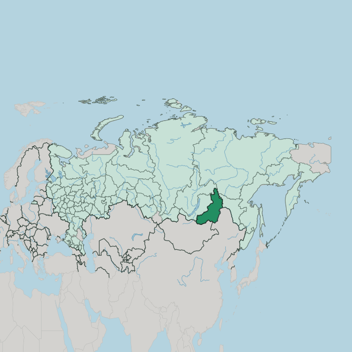
Towns & cities in Transbaikal Territory
Pick a town or city — each links to where to stay.
 Russia
Chita
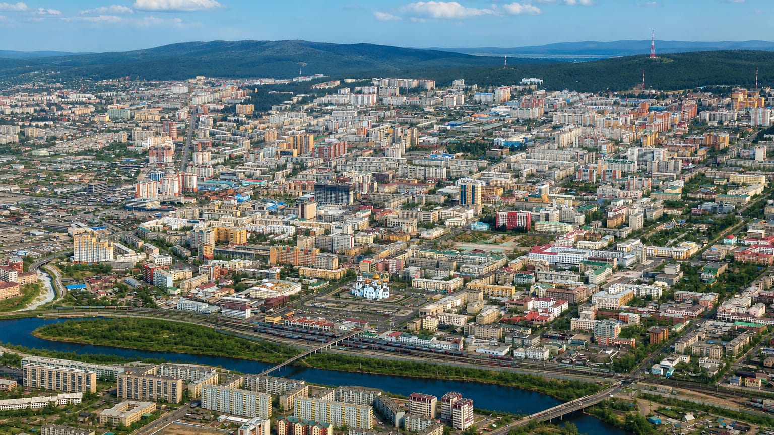
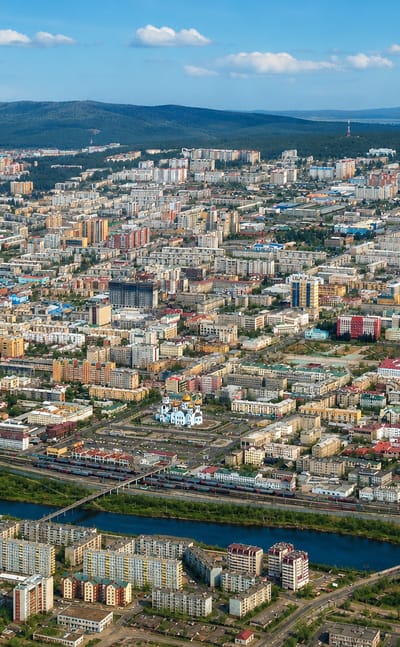
Chita stands on the old land route toward China, the capital of Transbaikal Territory, a Siberian city where a Buddhist datsan, a cathedral, and a…Where to stay →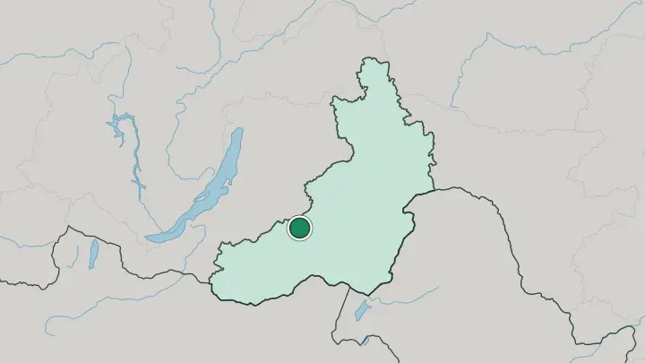
About Transbaikal Territory
What is Transbaikal Territory known for?
This is Transbaikalia, the historical land east of Lake Baikal that Russians long called Dauria. Chita anchors it. The city sits on the Trans-Siberian Railway, and for most travellers the region is a long stop between Irkutsk and the Amur.
Its two faces divide north and south: dark larch taiga cloaks the ranges toward the Yablonovy watershed, while dry grassland rolls down to the borders with Mongolia and China. The Onon, which flows off the southern steppe, is claimed by tradition as the birthplace of Genghis Khan.
Where is Transbaikal Territory?
Transbaikal Territory spreads across southeastern Siberia, east of Lake Baikal in the historical region of Transbaikalia. It is huge. The terrain is a corrugation of medium-height ranges, plateaus, and broad basins rather than open plain, and the Yablonovy Range runs down the middle as the divide between waters bound for the Arctic and waters bound for the Pacific.
Off its eastern slopes the Ingoda gathers, passing Chita on its way to meet the Onon; together they form the Shilka. Rivers define the south. The Shilka joins the Argun on the frontier with China, and the two together give rise to the Amur, one of the great rivers of the Far East.
The borders here are international and long. Mongolia lies to the south and southwest, China to the southeast along the Argun, and inside Russia the region abuts Irkutsk Oblast, Buryatia, the Amur region and the Sakha Republic. This is the land old maps labelled Dauria.
Its northern reaches climb into rugged, near-empty highlands, while the south settles into the dry steppe that carries herds and horsemen toward Mongolia.
What is Transbaikal Territory like?
Two peoples share this ground. The Russians who founded Chita and strung the Cossack forts arrived from the west; the Buryats, a Mongolic people of the steppe, were here long before, herding and practising Tibetan Buddhism. That older world survives most vividly at Alkhanay, the mountain the Buryats hold sacred, where Buddhist shrines and springs draw pilgrims from across the south.
Datsans and prayer flags mark the grassland. The southern steppe of Dauria still carries the memory of Genghis Khan, whose people, by tradition, rose along the upper Onon. The Russian layer is just as tangible.
Chita keeps a quarter of wooden and stone houses from its days as a garrison and mining town, and its story turns on the Decembrists, officers exiled here after the failed revolt against the tsar. They were sent east in chains. Their wives followed them into Siberian exile, and the town they were confined to grew, in time, into the region's cultural capital.
Between the datsans of the steppe and the churches of Chita, the territory reads as a meeting of Slavic and Mongol worlds.
What is the history of Transbaikal Territory?
Russia reached this country in the mid-1600s, when Pyotr Beketov's Cossacks founded Chita in 1653 and pushed forts along the Shilka and the Argun toward China. Silver and exile followed. The mines of Nerchinsk made Transbaikalia a place of hard labour, and after the failed Decembrist revolt of 1825 the tsar sent condemned officers east to Chita.
The modern region is young: Transbaikal Territory was created in 2008 by merging the old Chita Oblast with the Agin-Buryat Autonomous Okrug, uniting Russian and Buryat lands under one administration.
What is the climate of Transbaikal Territory?
The climate is sharply continental, and the swing between seasons is brutal. Winters are long, dry and bitter, held under high pressure that pins clear skies over frozen ground; January runs colder than minus twenty in the southern steppe and far colder again in the northern highlands beyond the Yablonovy Range. Summers turn suddenly warm and bring most of the year's rain.
Sunshine stays generous. Snow cover is thin, so it is the still, hard frost of Dauria, more than the depth of snow, that defines a Transbaikal winter.
How do you get to Transbaikal Territory?
The Trans-Siberian Railway is the classic way in, and Chita is its Transbaikal stop, roughly a day and a half east of Irkutsk by train. Most travellers arrive that way. Chita also has an airport with flights from Moscow and the Russian Far East, cutting the long overland haul across Siberia.
Overland from the south, road crossings link the region to Mongolia and to China across the Argun. Once here, distances are large and buses infrequent, so reaching the steppe reserves or Alkhanay means hired transport off the rail line.
Common questions
What is the best area to stay in Transbaikal Territory?
Chita: arriving by the Trans-Siberian Railway.
Good for
Updated July 2026