Saudi Arabia
Northern Borders Region, Saudi Arabia — Towns & Travel Guide


Saudi Arabia's far-northern desert province, where the old Tapline oil road built the frontier towns of Arar, Rafha and Turaif.
About Northern Borders Region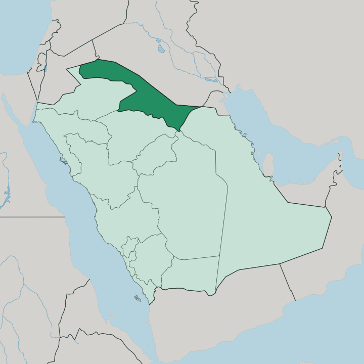
Towns & cities in Northern Borders Region
Pick a town or city — each links to where to stay.
Arar is the obvious base, the provincial capital and the town with the most beds and the Jadidat Arar land port on the Iraqi frontier. Beyond it, choices thin out fast. Rafha sits east toward Iraq, an old Tapline pump town and the first Saudi stop on the pilgrim road down from Kufa.
Turaif lies west near Jordan, wrapped around the phosphate works of Waad Al-Shamal. Pick Arar for the capital; take Rafha or Turaif only if the frontier towns themselves, or the crossings beside them, are your reason for coming this far north.
About Northern Borders Region
The name says it plainly.
What is Northern Borders Region known for?
This is Saudi Arabia's northern frontier, a wedge of gravel-and-sand badia pressed against Iraq to the north and Jordan to the west. Its three main towns owe their existence to a single steel line: the Trans-Arabian Pipeline, the Tapline, which pumped Gulf crude across the desert to the Mediterranean and left Arar, Rafha and Turaif behind it. Beneath the surface lie some of the world's largest phosphate reserves, now worked at the Waad Al-Shamal mining city near Turaif.
Yet most travellers pass through rather than stop, following the ancient hajj road that still carries pilgrims from Iraq south toward Mecca.
Where is Northern Borders Region?
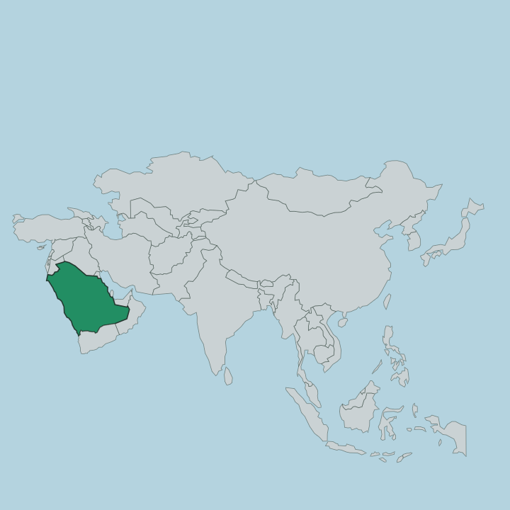
The region fills the top edge of Saudi Arabia. It is a wedge of desert in the far north of the kingdom, sharing its whole outer rim with two foreign neighbours. Iraq lies to the north and north-west; Jordan lies to the west.
Inland, the province gives onto Al-Jouf to the west, Hail and Al-Qassim to the south-west, and the Eastern Province to the south. Most of the ground is flat badia, part of the gravel steppe that Arab geographers call the Al-Widyan, an arm of the wider Syrian Desert that spills across the Iraqi and Jordanian frontiers. No mountains rise here.
No rivers cross it. Shallow wadis run only after rain and vanish again, and the land climbs gently as it approaches the Jordanian border in the west. Sand and gravel plains make up about half the surface.
Arar, the capital, sits toward the Iraqi side in the east of the province, near the Wadi Arar that gives the town its name. Rafha lies further east again, close to Iraq. Turaif holds the far western corner, out toward Jordan.
Between and beyond the three towns the desert is nearly empty, one of the least peopled corners of the whole kingdom, and the horizon stays low and open in every direction.
What is Northern Borders Region like?
Life here is Bedouin at its root. The tribes of the northern badia grazed camels and sheep across these gravel plains long before there were towns, and that pastoral inheritance still shapes the food, the hospitality and the poetry of the province. Arabic is the language, spoken in the dialect of the northern desert.
The settled towns are young. Arar, Rafha and Turaif barely existed before the oil road came through in the middle of the twentieth century, so the region carries little of the old mud-brick architecture found further south. What binds the place instead is movement across it.
Pilgrims from Iraq have crossed this desert toward Mecca for more than a thousand years, and traders and herders have always moved between the wells of the north. Camel herding and camel racing remain a source of local pride. The frontier itself is part of the character, felt in every border town and land port along the northern edge, a province defined as much by who passes through it as by who settles down.
What is the history of Northern Borders Region?
History here runs along two lines drawn across the desert. The first is the Zubaydah Trail, the great Abbasid hajj road that carried pilgrims from Kufa in Iraq down to Mecca, its wells and cisterns still marking the sands south of Rafha. The second is the Tapline.
When the Trans-Arabian Pipeline opened in 1950 it needed pump stations across this empty north, and Arar, Rafha and Turaif grew up around them from little more than desert camps. The province was drawn as a formal administrative unit in the following decades. Two thousand years of caravans, and then a steel pipe, made the map you see now.
What is the climate of Northern Borders Region?
Seasons swing hard here. Unlike the humid Gulf coast, this inland desert has a continental climate, and Turaif in the west is among the coldest places in the whole kingdom. Summers are fierce and dry, with the gravel plains baking under a high sun.
Winters are genuinely cold; night temperatures around Turaif and Arar drop below freezing in January and February, and the higher western ground sometimes takes a dusting of snow. What little rain falls comes in winter and spring, briefly greening the wadis before the badia turns brown again.
How do you get to Northern Borders Region?
Flying is the sensible way in. Arar has the province's main airport, linking the capital to Riyadh and the larger Saudi hubs across the long desert distance. Overland, the region is Saudi Arabia's road door to the north: the Jadidat Arar land port handles crossings to and from Iraq, and Turaif carries traffic west toward Jordan.
Pilgrims from Iraq still enter here by road each hajj season. Once inside the province, a highway strung along the old Tapline route ties Arar, Rafha and Turaif together across the emptiness between them.
Updated July 2026