Syria
Ar-Raqqah Governorate, Syria — Towns & Travel Guide


Ar-Raqqah Governorate spreads across the Euphrates valley of north-central Syria, its plains split by the river and anchored on the city of Raqqa.
Find your area →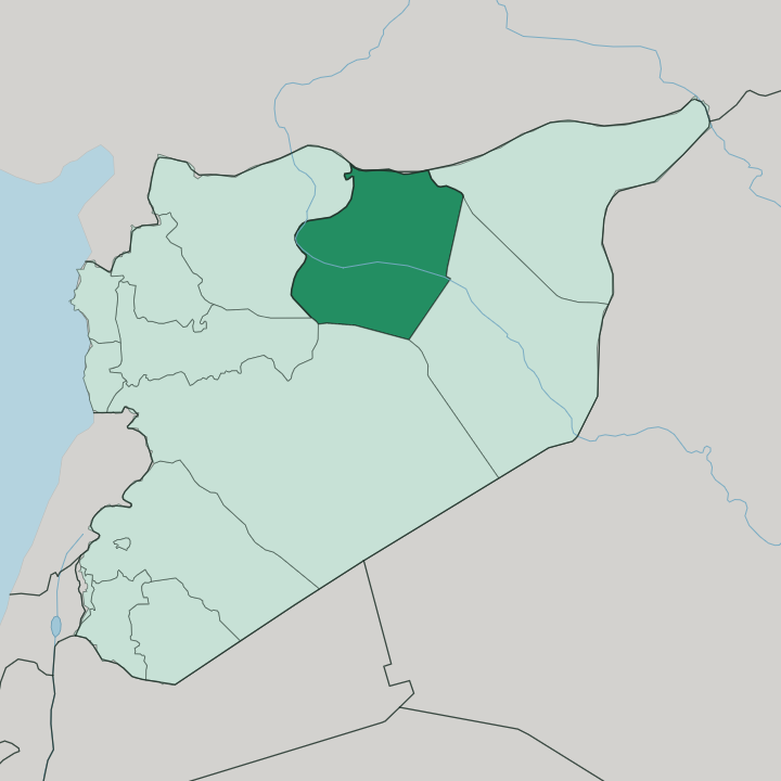
Towns & cities in Ar-Raqqah Governorate
Pick a town or city — each links to where to stay.
 Syria
Syria
Ar Raqqah
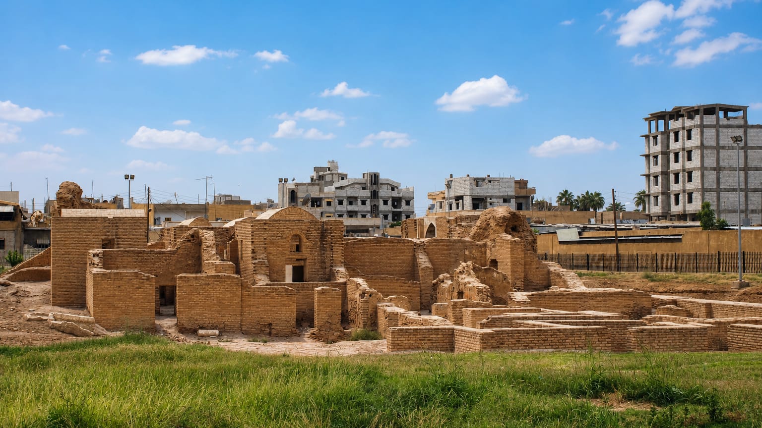
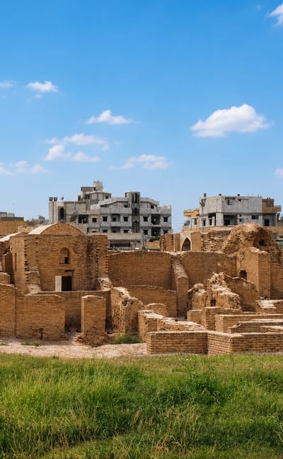
The Euphrates River flows past Ar Raqqah, a city in Syria and once capital of the Abbasid Caliphate, known for Qasr al-Banat and the Raqqa Museum.Where to stay →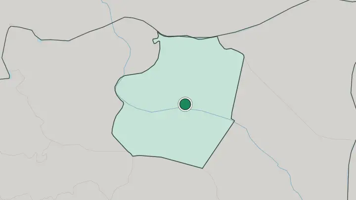
About Ar-Raqqah Governorate
The Euphrates is the whole story here.
What is Ar-Raqqah Governorate known for?
Syria's greatest river cuts west to east across the governorate, and everything on the map follows its banks. The capital, Raqqa, once served for thirteen years as the working seat of Harun al-Rashid's Abbasid Caliphate. Upstream stands the Tabqa Dam.
It is the country's largest, holding back the long reservoir of Lake Assad, and it turned dry steppe into irrigated farmland. Out in the southern desert rise the walls of Resafa, a ruined Byzantine pilgrim city stranded far from any water.
Where is Ar-Raqqah Governorate?
Ar-Raqqah Governorate lies in north-central Syria, a broad wedge of the Euphrates valley set between the desert to the south and the Turkish border to the north. The Euphrates is the spine of it. Syria's largest river runs from west to east across the province, and its floodplain is a green ribbon drawn through flat, low steppe that stretches away brown and open on either side.
Two lesser rivers feed the picture. The Balikh comes down from the karst spring of Ain al-Arous near the border and runs south to meet the Euphrates at Raqqa, the second-largest tributary the great river gathers inside Syria. West of the capital the valley widens into Lake Assad, the long reservoir held back by the Tabqa Dam near the town of Tabqa.
The land rarely rises. Away from the water it settles into dry alluvial plain and gravel steppe, and the average ground stands a few hundred metres above the sea. Aleppo lies well to the west, the nearest of Syria's great cities. The northern rim touches Turkey along a straight political line, where Tell Abyad faces the Turkish town of Akcakale across the frontier.
To the south the steppe thins toward true desert, and it is there, far from the river, that the walls of Resafa still stand on the dry plain. The whole province reads as one thing seen twice: the river, and everything that is not the river.
What is Ar-Raqqah Governorate like?
This is a governorate of the river and the field. Arabic is the everyday language, and the rhythm of life follows the water and the harvest more than any city clock. Cotton is the crop that made the modern province.
Growers took it up along the Euphrates from the late 1940s, and once the Tabqa Dam opened its canals in the 1970s the fields of cotton and grain spread out across freshly irrigated land that had once been dry open steppe. Farming still shapes the place. State farms, tenant plots and the long argument over who gets the river's water run through daily life in a way they do in few other Syrian provinces.
The deep past is never far off. Raqqa keeps the memory of its Abbasid century, when Harun al-Rashid ruled from its walls and left a palace quarter, gates and a mosque behind him. Older still is Resafa in the southern steppe, once the pilgrim city of Sergiopolis, drawing Christians to the shrine of Saint Sergius before the Arabs and later the Mongols emptied it.
Between those poles sits ordinary life. Markets, riverside orchards, and the low mud-brick and concrete towns of the plain carry the culture of the province day to day, tied to the Euphrates that made all of it possible.
What is the history of Ar-Raqqah Governorate?
Raqqa's great age came fast. In 796 the caliph Harun al-Rashid moved his court here and made the city the working seat of the Abbasid Caliphate, an empire that reached from North Africa into Central Asia. He built walls, gates and a palace city north of the town, and dug canals off the Euphrates and the Balikh to water its gardens.
The residence lasted until 809, when the caliph died and the court drifted back toward Baghdad. Older layers survive south of the river at Resafa, the Roman fort and Byzantine pilgrim town of Sergiopolis, which the Mongols left abandoned in the thirteenth century.
What is the climate of Ar-Raqqah Governorate?
Ar-Raqqah is hot, dry and continental. Summers on the Euphrates plain are fierce, with high-summer heat around Raqqa often pushing past forty degrees in the shade. Winters swing the other way to cool nights that can drop near freezing.
Rain is scarce and unreliable, most of it falling between November and April, and the yearly total is thin enough that the land depends on the river rather than the sky. Beyond the irrigated strip the steppe stays parched brown for most of the year.
How do you get to Ar-Raqqah Governorate?
Most journeys reach Ar-Raqqah by road. The capital sits roughly a hundred and sixty kilometres east of Aleppo, and the highway down the Euphrates valley is the main artery in and out. From Raqqa, local roads run west to Tabqa and its dam and north up the Balikh to Tell Abyad on the Turkish border.
There is no working passenger airport of note inside the province. Travel here follows the river and the land route between the towns strung along it.
Common questions
What is the best area to stay in Ar-Raqqah Governorate?
Raqqa: the river city at the heart of the governorate.
Good for
Updated July 2026