Syria
Deir ez-Zor Governorate, Syria — Towns & Travel Guide


Towns & cities in Deir ez-Zor Governorate
Pick a town or city — each links to where to stay.
Deir ez-Zor city is the only practical base. It is the provincial capital and by far the largest town, set on both banks of the Euphrates where the main road bridges the river. The valley strings out in two directions.
Al-Mayadin lies downstream toward the Iraqi border, a market town near the ruins of Mari. Abu Kamal sits further southeast at the frontier itself, the last Syrian stop before Iraq and the nearest town to the site of Dura-Europos. Choose Deir ez-Zor for the museum and the crossings; the smaller Euphrates towns suit you only when you are visiting the ancient sites nearby.
About Deir ez-Zor Governorate
The Euphrates is the whole story here.
What is Deir ez-Zor Governorate known for?
This is the largest governorate of eastern Syria, and the river runs the length of it from the northwest corner down to the Iraqi border, carrying a thin green valley through open desert. Two of the ancient world's great river cities sit on its western bank: Mari, an Amorite capital sacked by Hammurabi, and Dura-Europos, a Hellenistic garrison town later held by Rome. The provincial capital, Deir ez-Zor, spreads along both banks where the M4 road crosses the water.
Beyond the valley lies sand.
Where is Deir ez-Zor Governorate?
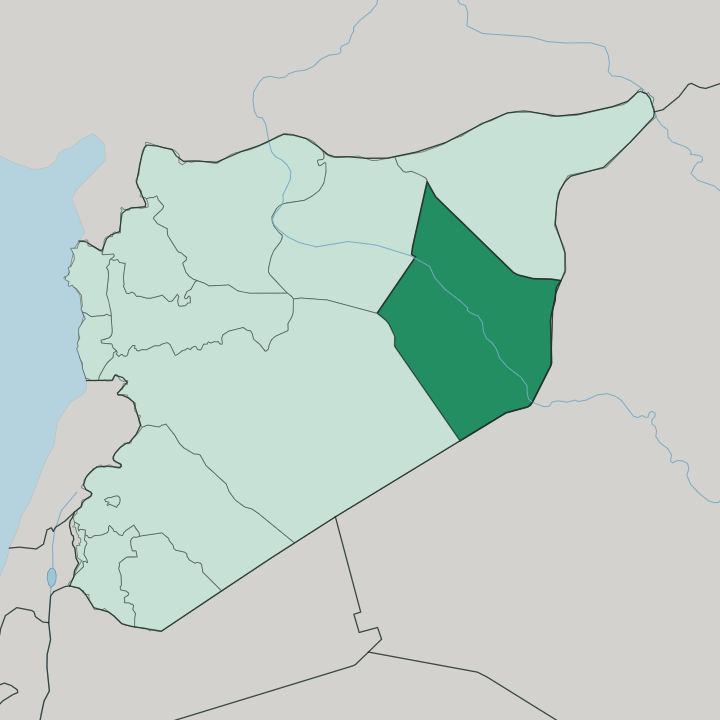
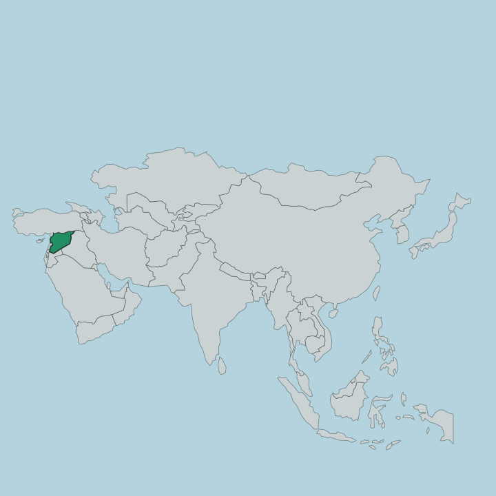
Deir ez-Zor Governorate fills the far east of Syria, sharing a long frontier with Iraq downstream along the river. The Euphrates cuts through it on a slant, running from the northwest corner toward the southeast and splitting the province into two unequal halves. West of the water spreads al-Shamiya, an arm of the Syrian Desert reaching toward Damascus.
East of it lies al-Jazira, the steppe that ties this province to Al-Hasakah to the north. The river rules. Almost everyone lives in the narrow floodplain the Euphrates waters, a thin green ribbon threading through hundreds of kilometres of otherwise empty stone and sand that make up the true badiya of eastern Syria.
The provincial capital, Deir ez-Zor, stands roughly midway along the valley, downstream of the point where the Khabur joins the Euphrates from the north. Al-Mayadin and Abu Kamal follow the river southeast toward the Iraqi line, the last of them almost on the frontier. No coast.
No mountain. Everything the province has, the river gave it, and everything it lacks, the desert kept.
What is Deir ez-Zor Governorate like?
Life along this stretch of the Euphrates is tribal and rural, shaped by the river and the flocks. The 'Uqaydat confederation dominates the valley, and the Baggara hold much of the steppe beside them; loyalty here still runs through the tribe and the extended family more than the town. Farming follows the flood terraces the river leaves behind.
Families grow cotton and wheat on the irrigated land and raise Awassi sheep on the drier margins, a fat-tailed breed suited to the badiya. Arabic is the language of the whole province, spoken in a distinctive Bedouin-inflected valley dialect. The deep past is close to the surface.
This was the eastern edge of the Mesopotamian world, and its earth still holds the archives of Mari, whose palace gave up thousands of cuneiform tablets to excavators at Tell Hariri. Many of those tablets, and finds from Dura-Europos, are gathered in the Deir ez-Zor Museum in the provincial capital. Bread, rice and grilled mutton anchor the table, eaten around a shared platter.
The river gives fish as well. It is a culture of the desert edge, austere and hospitable at once, and the Euphrates is at the centre of all of it.
What is the history of Deir ez-Zor Governorate?
History along the Euphrates here reaches back to the dawn of cities. Mari rose on the river as an Amorite capital and was destroyed by the Babylonian king Hammurabi around the year 1759 BC, its palace archive buried where it fell. Centuries later Dura-Europos guarded the same river route, founded by Alexander's successors and later fortified by Rome as its furthest outpost in Mesopotamia until a Sasanian siege ended it.
The modern town of Deir ez-Zor grew far later, an Ottoman garrison and river crossing that the French Mandate turned into the seat of the province. The river carried every one of them.
What is the climate of Deir ez-Zor Governorate?
This is hot desert country. Summers along the Euphrates are long and unrelenting, with brutal afternoon heat baking the valley and the surrounding badiya of the Syrian Desert for months on end. Winters turn cool and short, and what little rain falls comes then, never enough to green the land beyond the river's own terraces.
Dust and dry winds sweep off the steppe. The Euphrates, not the sky, is what keeps this province alive.
How do you get to Deir ez-Zor Governorate?
Most arrivals come overland from Damascus. The M4 highway runs northeast across the Syrian Desert to Deir ez-Zor, a long haul of several hours by road from the capital through open badiya. Deir ez-Zor Airport handles occasional domestic flights, chiefly the short hop from Damascus, though river-crossing infrastructure has suffered badly in the war years.
Inside the province, the single road along the Euphrates ties Deir ez-Zor to Al-Mayadin and Abu Kamal downstream toward Iraq. There is no railway worth the name.
Updated July 2026