Syria
Damascus Countryside, Syria — Towns & Travel Guide


The countryside wrapped around Damascus, from the Barada's orchards to the Qalamoun peaks and the desert beyond.
About Damascus Countryside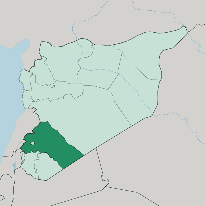
Towns & cities in Damascus Countryside
Pick a town or city — each links to where to stay.
Most travellers base themselves in Damascus and ride out into the countryside for the day. The mountain towns are the exception. Al-Zabadani and neighbouring Bloudan draw people up into the Anti-Lebanon range for cool air when the plain below turns hot.
Douma, the administrative capital, and the wider Ghouta sit close enough to the city to visit on a short loop. Choose the Qalamoun villages of Maaloula and Saidnaya if the draw is Aramaic and the old monasteries; choose the hill resorts if you want the mountain summer that pulls Damascenes out of the valley.
About Damascus Countryside
What is Damascus Countryside known for?
This is the belt of orchards, mountain towns, and open desert that wraps completely around Damascus itself. The Ghouta oasis is the old draw, a green apron of apricot and walnut groves watered by the Barada. Higher up, the Qalamoun range holds Maaloula, one of the last places where Western Neo-Aramaic is still spoken, alongside the ancient pilgrimage monastery at Saidnaya.
Cool resorts like Al-Zabadani perch near the Lebanese border. East of the orchards, the Syrian Desert takes over.
Where is Damascus Countryside?
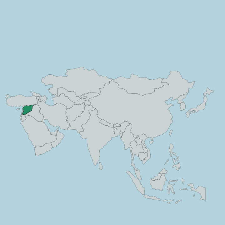
Damascus Countryside fills the southwest of Syria and folds completely around the capital, so that the city of Damascus sits inside it like a hole in a ring. It is one of the largest of the country's governorates. The land is anything but uniform.
In the west it climbs into the Anti-Lebanon Mountains, the long range that carries the border with Lebanon and casts a rain shadow over the plain below. Its northeastern arm, the Qalamoun Mountains, holds the cliff villages of Maaloula, Yabroud and Al-Nabk on the old road toward Homs. To the east the ground falls away into the Syrian Desert, which takes up most of the governorate's surface and thins the map of towns to almost nothing.
Between mountain and desert lies the reason people have always lived here: the Ghouta, a fertile oasis watered by the Barada river. That river rises in the Anti-Lebanon, splits into several branches, and spreads its water across the orchards before the last of it vanishes into the sand. Homs lies to the north and Jordan to the south.
Lebanon presses against the western mountains, and the drier governorates of Quneitra, Daraa and Suwayda border the southwest.
What is Damascus Countryside like?
The countryside carries the older, quieter face of the Damascus region. Life here has always turned on water and stone. In the Ghouta, families have farmed apricot and walnut groves along the Barada's channels for centuries, and Damascus apricots were carried across the Mediterranean and far to the east long before anyone drew a governorate on a map.
The mountain villages keep a different inheritance. Maaloula, Jubb'adin and once Bakhah are the last strongholds of Western Neo-Aramaic, a survival of the tongue spoken here in antiquity, still heard in the streets and in prayer. Christianity runs deep in the Qalamoun.
The Melkite monastery of Mar Sarkis clings to the rock above Maaloula, while the Greek Orthodox convent at Saidnaya draws pilgrims to an icon of the Virgin long held to be miraculous. Arabic is the shared language of the whole region. Yet in a few cliffside villages an older voice persists, and that layering of orchard against desert edge and monastery against mountain is what gives the countryside its character.
What is the history of Damascus Countryside?
The land around Damascus was settled long before the modern province existed. Its story follows the city it encircles. Under the Umayyad and Abbasid caliphates the Ghouta was engineered into a hydraulic garden, its canals dividing the Barada so that orchards could reach far out from the walls.
The cliff monasteries are older still. Tradition traces the convent at Saidnaya to the emperor Justinian I in the sixth century, and the Qalamoun villages have held their monasteries and their Aramaic through every ruler since. Rif Dimashq was later drawn as a governorate to gather all this rural country around the capital under one administration, with Douma as its seat.
What is the climate of Damascus Countryside?
The plain is dry. Rain arriving off the Mediterranean is wrung out by the Anti-Lebanon Mountains before it reaches the interior, leaving the Ghouta and the desert edge hot through a long summer and mild in winter, with what little falls squeezed into the cold months. Higher ground writes its own weather.
Up in the Qalamoun and around Al-Zabadani the summers stay cool and the winters can turn cold enough for snow, which is exactly why the hill resorts fill when the valley below bakes.
How do you get to Damascus Countryside?
The main gateway is here rather than in the city. Damascus International Airport stands out on the plain southeast of Damascus, inside the countryside itself, linked to the capital by the M5 motorway. Most visitors land there and drive in.
From Damascus the mountain and desert towns fan out by road: north to Saidnaya and the Qalamoun, west up into the Anti-Lebanon toward Al-Zabadani, and east out toward the Syrian Desert. Roads climb quickly once you leave the Ghouta.
Good for
Updated July 2026