Syria
Daraa Governorate, Syria — Towns & Travel Guide


Daraa Governorate spreads across the fertile Hauran plain in Syria's far south-west, from the Yarmouk gorge to the Jordanian border.
About Daraa Governorate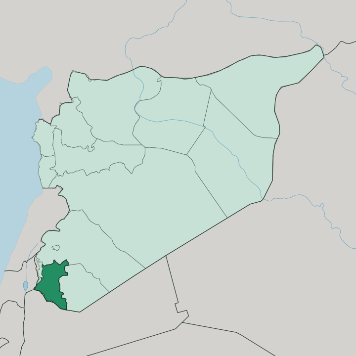
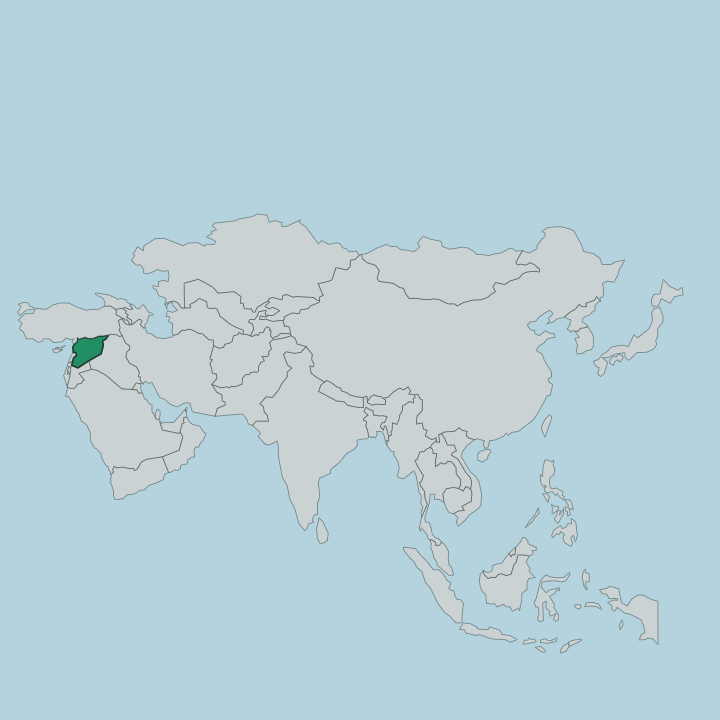
Towns & cities in Daraa Governorate
Pick a town or city — each links to where to stay.
Three towns divide the choices. Daraa city, the capital on the Damascus-Amman highway, is the practical base for anyone crossing to or from Jordan, though its beds are worn and few after long years of war. Bosra, farther east, draws the traveller who comes for the Roman theatre and the black-stone streets around it.
Nawa sits out on the northern Hauran, an agricultural town among the wheat with little for visitors beyond the fields. War thinned the lodging everywhere here. Pick Daraa city for the border and the highway; pick Bosra when the ruins are the reason you came.
About Daraa Governorate
What is Daraa Governorate known for?
Daraa is Syria's southern gateway. The governorate fills the volcanic Hauran plain between Damascus and the Jordanian border, black basalt soil that Rome once farmed for grain to feed the empire. Bosra anchors the south, an old caravan town whose Roman theatre of dark basalt still seats thousands.
The provincial capital, Daraa city, sits on the Damascus-Amman highway where the graffiti of fifteen schoolboys lit the first protests of 2011. Wheat and olives cover the rest.
Where is Daraa Governorate?
Daraa Governorate occupies the far south-west of Syria, a corner of the Hauran plain that the country shares with Jordan. Jordan lies along the whole southern edge. The Yarmouk River runs the western boundary, cutting a deep gorge that separates the province from the Golan Heights and the frontier with Israeli-held ground beyond it. Quneitra Governorate flanks the west above that river.
To the north the land climbs toward Rif Dimashq Governorate and the road to Damascus; to the east it gives way to the older lava fields of Suwayda Governorate. This is basalt country. Ancient volcanoes to the east left the plain floored with dark stone and the dark, stone-rich soil that grows the region's wheat.
The ground is mostly flat and open, broken only by low hills in the north and by the trench of the Yarmouk in the west. Daraa city stands near the Jordanian border, close to the point where the Damascus-Amman highway crosses out of Syria. Bosra rises to its east, and Nawa lies north across the plain toward the Golan.
No mountains wall the province off. Its whole character comes from the flat black tableland of the Hauran, the same fertile shelf of ground that carries the grain fields south into Jordan and west toward the Sea of Galilee basin.
What is Daraa Governorate like?
The Hauran is farming country. Life across Daraa Governorate turns on the wheat and barley harvest and on the olive groves that have rooted in this basalt soil since antiquity, and the rhythm of planting and reaping still orders the calendar of its villages. Society runs along clan and tribal lines, extended families holding whole clusters of villages between them.
Arabic is the everyday tongue, spoken here in the distinctive Hauran dialect of the south. Most people here are Sunni Muslim, though Daraa city held Christian families and churches before the war scattered many of them. Building here is done in the local black basalt, the one stone the plain gives in plenty.
Bosra shows the tradition at its grandest, whole streets and a Roman theatre raised from dark volcanic rock. The same stone builds the ordinary houses of the countryside. Hospitality and the codes of tribal honour weigh heavily in daily dealings, and a stranger passing through a Hauran village is met by customs far older than the modern border with Jordan.
Food leans on what the land yields: wheat bread, olives, oil, and the produce of the summer fields. This is a rural south, not a city one.
What is the history of Daraa Governorate?
The Hauran's history is very old. Daraa city appears as Edrei in the Hebrew Bible and as Adraa in Greco-Roman times, a stop on the caravan and pilgrim roads south. Bosra was a Nabataean town before Rome made it capital of the province of Arabia in 106, and its great basalt theatre dates from that age.
Under the caliphates the whole plain fed Damascus, and Daraa stood on the Hajj route to the holy cities. Its modern fame is grimmer. In March 2011 the arrest and torture of schoolboys who had scrawled anti-government graffiti in Daraa city touched off the protests that spread into the Syrian civil war, and the province became known as the cradle of the uprising.
What is the climate of Daraa Governorate?
The wet season rules here. Daraa has a dry Mediterranean climate, and nearly all of its rain falls in the cool months between autumn and early spring, soaking the Hauran wheat before the heat returns. Summers run hot, long, and rainless.
The plain bakes under an open sky from late spring until the rains come back, and the whole province lives or fails by how much of that winter rain the fields receive. Snow dusts the higher northern ground in a cold year. Dry winters starve the crop.
How do you get to Daraa Governorate?
Daraa is Syria's land door to Jordan. The Damascus-Amman highway runs straight through the governorate and crosses the border just south of Daraa city, so most arrivals come overland by road from the Syrian capital or up from Amman. Damascus lies about ninety kilometres to the north, roughly an hour and a half by the highway.
There is no airport here. Bosra sits a short drive east of the main road, reached by local routes across the plain. War and shifting front lines long made these roads hard and uncertain to travel.
Updated July 2026