Syria
Al-Hasakah Governorate, Syria — Towns & Travel Guide


Al-Hasakah Governorate is Syria's far north-eastern corner, a wheat-and-oil plain where the Khabur River threads a hundred ancient mounds.
About Al-Hasakah Governorate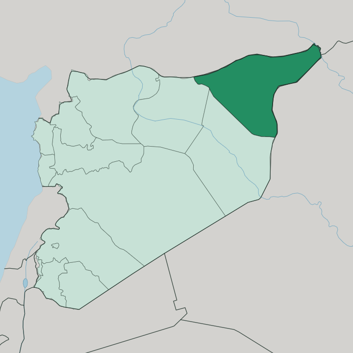
Towns & cities in Al-Hasakah Governorate
Pick a town or city — each links to where to stay.
Beds cluster in two towns. Al-Hasakah, the capital, sits on the Khabur River where the market, offices and through-roads meet, and it makes the practical base. Qamishli is the other choice.
Up on the Turkish border facing Nusaybin, it is the only place in the governorate reached by scheduled flights, long a Christian and Kurdish centre. Ras al-Ayn lies further west along the frontier, a small spring-fed town beside the Tell Halaf mound, where rooms are scarce and casual. You stay in Al-Hasakah for the centre of things; you stay in Qamishli for the border and the flights.
About Al-Hasakah Governorate
This is farmland first.
What is Al-Hasakah Governorate known for?
The governorate grew much of Syria's wheat and cotton, and its fields fed the country from the plains along the Khabur River. Oil sits under the same ground, and before the war roughly half of Syria's crude was pumped here. Then there is the deep past: more than a hundred archaeological mounds dot the Jazira, among them Tell Brak, one of the oldest cities anyone has dug.
Al-Hasakah is the capital and the market town at the centre of it all.
Where is Al-Hasakah Governorate?
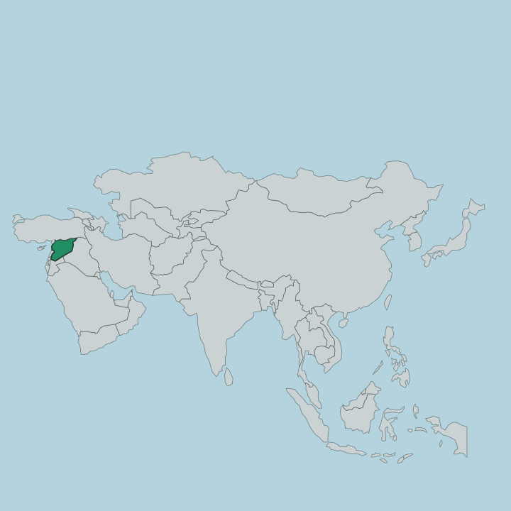
Al-Hasakah Governorate fills the far north-eastern corner of Syria, the wedge of land that pushes out between Turkey and Iraq. Turkey runs along the whole northern edge; Iraq closes off the east. Inside Syria it borders Raqqa Governorate to the west and Deir ez-Zor Governorate to the south.
This is the country's slice of Upper Mesopotamia, the plain the Arabs call the Jazira, the island. The Jazira plain of Al-Hasakah runs flat to the horizon. Alluvial plains and open steppe roll to the horizon, rising only gently, with no mountain to break the sweep.
Water is what makes it live. The Khabur River, a tributary of the Euphrates, curves down out of Turkey and runs west to east through the governorate, gathering smaller streams as it goes and passing the capital at Al-Hasakah on its way south toward the Euphrates. That river fed the earliest farms and the earliest towns, and the mounds of those towns still stand across the plain in their hundreds.
The border with Turkey is a hard line of fence and rail; the Iraqi border sits near the Tigris away to the east. Everything of interest lies within reach of the water.
What is Al-Hasakah Governorate like?
Few Syrian provinces mix as many peoples. Arabs hold the river plains and the south; Kurds form the majority along the northern border; and Assyrian and Armenian Christians, along with Yazidis and smaller communities, have towns and villages of their own. Qamishli shows the blend most clearly.
The town keeps eleven churches, Syriac Orthodox and Assyrian and Chaldean among them, and its Christmas parade runs through streets where Kurdish is the language you hear most. Spring brings Nowruz, the Kurdish new year, with fires lit on the hills and dancing that fills whole days. The Assyrians mark Kha b-Nisan, their own new year, in the same weeks.
Arabic, Kurdish and the Assyrian dialect of Aramaic all sound in the markets, sometimes in a single conversation. This corner has long been a refuge, settled through the last century by families fleeing across the Turkish border, and that history of arrival is written into the map: Qamishli itself was laid out in the 1920s as a town for newcomers. The food is Mesopotamian and hearty, built on the wheat and lamb of the plain.
It is a province that wears its diversity plainly, without fuss.
What is the history of Al-Hasakah Governorate?
Cities began here. The Khabur plain saw some of the world's first towns rise, and Tell Brak was already a large city in the fourth millennium BC, when Akkad, Assyria and the Hurrians shaped the region in turn. At Tell Halaf, near Ras al-Ayn, excavators found the painted pottery that gave a whole Neolithic culture its name and the carved reliefs of the later kingdom of Guzana.
The modern towns are barely a century old by comparison. Al-Hasakah began as a French military post in 1922 and grew into the capital of a province once called al-Jazira.
What is the climate of Al-Hasakah Governorate?
The Jazira runs hot and dry. Summers on the steppe are long and fierce, with afternoons that push well past forty degrees and little shade to soften them. Winters turn cool, and for a few weeks the plain even goes green: what rain the governorate gets falls from December to April, and it is the winter wet that lets the wheat grow without irrigation.
The Khabur River carries the rest of the year's water. It is a semi-arid land, dust in summer and mud in the wet weeks, and the farming here follows the rain rather than any fixed season.
How do you get to Al-Hasakah Governorate?
Qamishli holds the only airport. Syrian carriers fly there from Damascus, Latakia and Beirut, landing in the border town at the northern edge of the governorate. Overland the province sits at the end of long roads: the highway east from Deir ez-Zor and the Euphrates, or the crossings on the Turkish and Iraqi frontiers when those are open.
From the airport at Qamishli it is about eighty kilometres south down to the capital at Al-Hasakah. Distances are wide and the plain is empty between towns.
Updated July 2026