Turkey
Hatay, Turkey — Towns & Travel Guide


Hatay is Turkey's southernmost province, a Mediterranean sliver along the Syrian border where Antakya carries the old name of Antioch.
Find your area →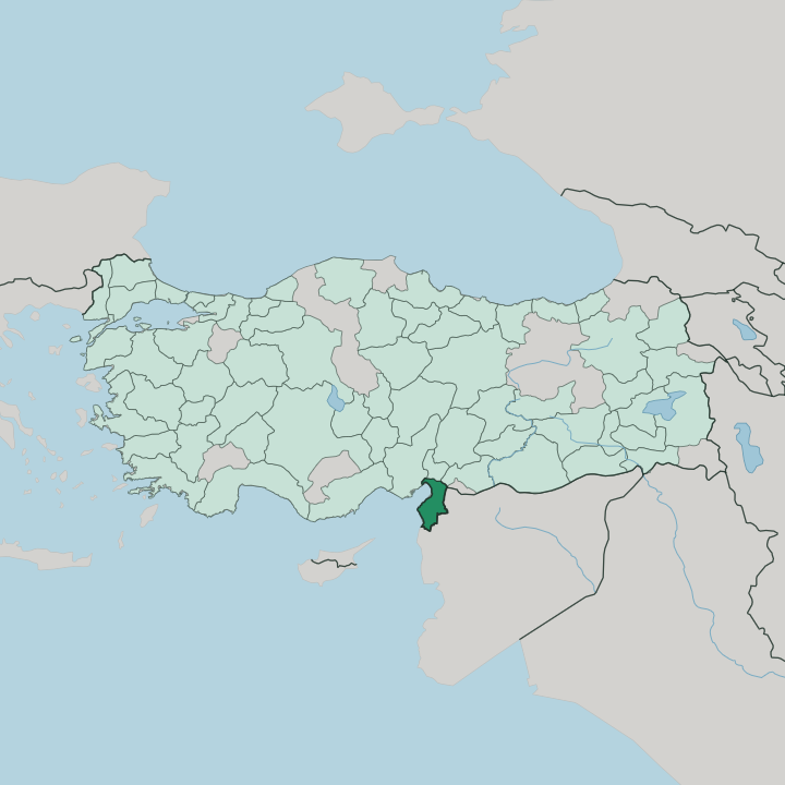


Towns & cities in Hatay
Pick a town or city — each links to where to stay.
 Turkey
Antakya
Antakya sits in a fertile valley on the Orontes River, the capital of Hatay Province in southern Turkey and heir to ancient Antioch.Where to stay →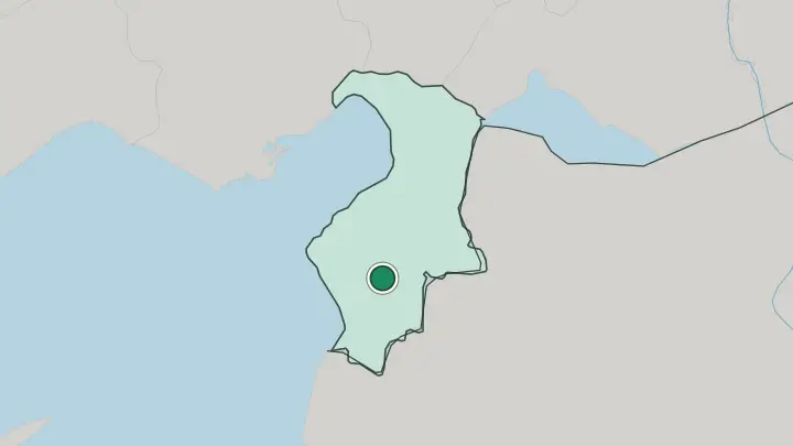
About Hatay
Two names carry Hatay: Antakya and its kitchen.
What is Hatay known for?
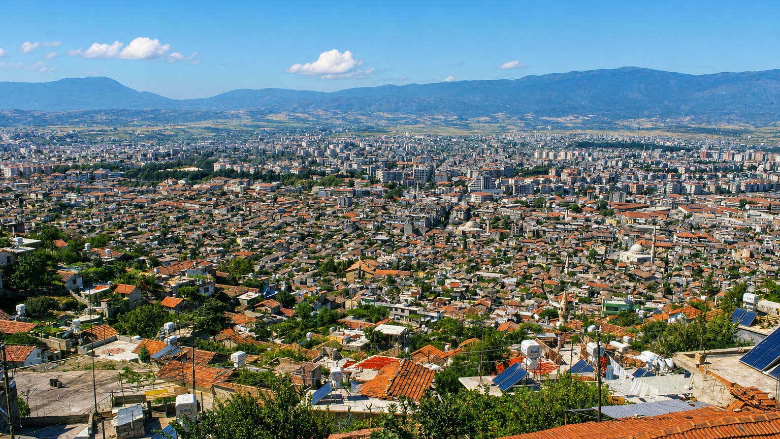
The capital sits on the ground of ancient Antioch, once among the largest cities of the Roman world and the corner of the earth where the followers of Jesus were first called Christians. Food is the other pilgrimage. Antakya carries a UNESCO seat as a City of Gastronomy, and its cooks send out künefe, oruk, and hundreds of spice-heavy plates rooted in Arab and Levantine cooking.
Mosque, church, and synagogue have long stood a short walk apart.
Where is Hatay?
Hatay is the southernmost province of Turkey. It hangs below the rest of the country like a hook, wrapping around the northwestern corner of Syria, with the eastern Mediterranean along its western edge and the Syrian frontier tracing the south and the east. Mountains define most of it.
The Nur Mountains, the Amanos of antiquity, run as a north-south wall along the northwest, dropping steeply to the Gulf of İskenderun, while Mount Keldağ rises to the south above the sea. Between the ranges lies the Amik plain, a wide fertile basin of cotton, wheat, and orchards drained by the Orontes. The river matters here.
Rising far south in Lebanon, the Orontes crosses Syria before curving through Antakya and out to the Mediterranean near Samandağ, the last stretch of a river that runs the wrong way for its region, south to north. Antakya sits well inland, a short drive up the valley from the coast. This is a seam in the earth's crust, the meeting line of the Arabian and Anatolian plates, and the folded ridges and sunken plains of the province record that slow collision.
What is Hatay like?
Hatay wears its mixture openly. Turkish is the common tongue, but Arabic has been spoken in its towns and villages for centuries, and the province's Arab communities, Alawite and Sunni alike, sit beside Turks, Armenians, and a long Christian presence. The kitchen is the clearest expression of all this.
Antakya cooking leans on olive oil, tahini, pomegranate, and hot pepper, and its signature künefe, threads of pastry over molten cheese soaked in syrup, has earned a protected name across Europe. Bread comes hot from wood ovens. Faith sits close together here, nowhere more plainly than at the Habib-i Neccar mosque in Antakya, one of the oldest in Anatolia and a place honoured by Muslims and Christians both.
That habit of living side by side runs deep.
What is the history of Hatay?
Few provinces carry a longer memory. Antioch was founded around 300 BC by a general of Alexander the Great, grew into one of the capitals of the Roman east, and became a cradle of early Christianity before earthquakes and conquest wore it down. Then came the long Ottoman centuries, when this was the sanjak of Alexandretta.
After the First World War it passed to French-mandate Syria, won autonomy in 1921, and in 1938 was proclaimed a separate republic, the Hatay State. That state lasted barely a year. A contested referendum in 1939 folded Hatay into Turkey as its southernmost province, a transfer that Syria has never accepted.
What is the climate of Hatay?
Hatay has a Mediterranean climate. Summers run long, hot, and dry, tempered on the coast by sea breezes off the gulf, while the winters stay mild and carry almost all of the year's rain. The rain falls in downpours.
Most of it arrives between late autumn and early spring, heaviest around the turn of the year, and the Nur Mountains wring more of it from the sea air than the plains below ever see. The warmth suits the land. Olive groves, citrus orchards, and vineyards spread across the valleys, and frost and snow reach only the higher ridges.
How do you get to Hatay?
Most travellers reach Hatay by air or road from the north. Hatay Airport, on the plain between Antakya and İskenderun, links the province to the big Turkish hubs, and a coastal highway threads down from Adana past the port cities of the gulf. The sea is the province's other door. İskenderun is one of the busiest ports on the Turkish Mediterranean, working cargo more than passengers, and mountain roads climb east over the Amanos toward Gaziantep and the wider southeast.
The Syrian border runs close. Crossings into Syria lie a short way south of Antakya and Reyhanlı, a reminder of how far this corner of Turkey reaches into the Levant.
Common questions
What is the best area to stay in Hatay?
Antakya: a first base for the old Antioch.
Good for
Updated July 2026