Vietnam
Quang Ngai, Vietnam — Towns & Travel Guide


Quảng Ngãi is a coastal province in central Vietnam, where the Trà Khúc River reaches the sea opposite the volcanic island of Lý Sơn.
About Quang Ngai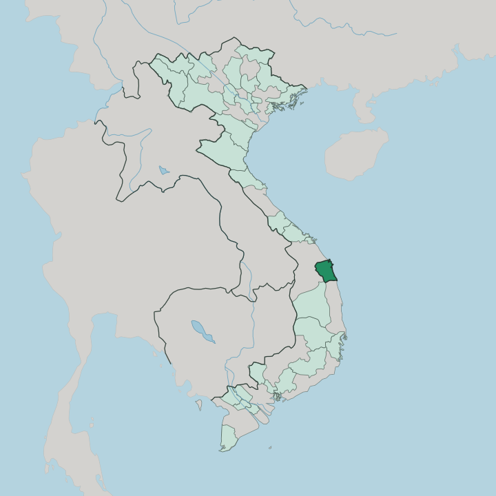


Towns & cities in Quang Ngai
Pick a town or city — each links to where to stay.
Most trips base in Quảng Ngãi City, the main city on the south bank of the Trà Khúc, where the hotels and the bus and rail links cluster. The coast splits the rest. North of the river, guesthouses gather near Sa Kỳ Port, the harbour where the boat to Lý Sơn casts off.
Down south, Sa Huỳnh lines simple rooms along its salt pans and beach. On the island, Lý Sơn keeps homestays and a couple of small resorts among the garlic plots. Start in the city.
About Quang Ngai
Two names carry the province.
What is Quang Ngai known for?
Lý Sơn is a volcanic island ringed by reefs and terraced garlic fields, reached by speedboat from the mainland and prized for the crop that earned it the label Kingdom of Garlic. On the southern coast, Sa Huỳnh gave its name to the Iron Age Sa Huỳnh culture, whose jar burials were first unearthed among its salt pans and dunes. Just north of the city, the Sơn Mỹ memorial marks the village where the My Lai massacre took place in 1968.
History and coastline pull in different directions here.
Where is Quang Ngai?
Quảng Ngãi lies on Vietnam's south-central coast, its long edge open to the South China Sea. The land tilts from west to east. Behind the shore, spurs of the Annamite Range climb inland, and the highest peaks rise in the far west along the edge of the Central Highlands.
Between the mountains and the water sits a broad alluvial plain, the rice bowl where most towns and villages stand. Three rivers drain that plain. The Trà Khúc is the largest, running about 135 km down from the Kon Tum highlands and passing Quảng Ngãi City before it empties into the sea.
Smaller streams frame it, the Trà Bồng across the north and the Vệ through the south. The coastline runs 129 km, unusually straight through the centre and south, with rocky capes breaking it north of the city. Offshore, the volcanic island of Lý Sơn stands about 30 km out, built of old craters and basalt cliffs.
Its fields grow the garlic and onions the island is known for. To the north lies Đà Nẵng, while the land climbs west into forested hills and river gorges. Water shapes the province more than any border.
What is Quang Ngai like?
Quảng Ngãi is Vietnamese country at heart, its coastal plain settled by Kinh farmers and fishers. The uplands tell another story. In the western valleys, the Hrê and Co peoples keep their own languages, stilt houses and bronze gongs, long separated from the plain by the Trường Lũy rampart.
Older layers run beneath all of it. The Sa Huỳnh culture worked this coast in the Iron Age, and the Cham of Champa held it for centuries before the Vietnamese came south. Fewer Cham brick towers survive here than along the coast to the north, yet Cham wells and place names still dot the plain.
The kitchen is the easiest way in. Don, a tiny river clam pulled from the Trà Khúc and the Vệ, simmers into the broth locals treat as a hangover cure and a point of pride. Cơm gà turns rice gold with turmeric and chicken stock.
Cá bống sông Trà, a small goby braised in the pan, comes straight from the river that runs past the city. Sugarcane built the province's sweet tooth, pressed into kẹo gương, a brittle mirror candy of caramel and peanuts sold in golden sheets. Garlic from Lý Sơn seasons the rest.
What is the history of Quang Ngai?
The land changed hands more than once. For centuries it belonged to Champa, until Đại Việt pushed south and annexed it in 1471. To hold the new frontier against the Hrê of the hills, the Nguyễn dynasty raised the Trường Lũy in 1819, a rampart of stone and earth running more than 100 km, the longest monument in Southeast Asia.
War left the darkest mark. In 1968, American troops killed hundreds of villagers at Sơn Mỹ, the atrocity known abroad as the My Lai massacre.
What is the climate of Quang Ngai?
Quảng Ngãi runs on a tropical monsoon rhythm. Heat holds all year, heaviest before the rains break. The long dry stretch runs from around February into August, when the coast bakes and the Trà Khúc shrinks to sandbars.
Then the weather turns. From September into December the rains arrive in force, with October and November the wettest, and the typhoons that batter central Vietnam blow in off the South China Sea.
How do you get to Quang Ngai?
Reaching Quảng Ngãi means coming down the coast. The North-South railway threads the province, and the Reunification Express calls at Quảng Ngãi station on its run between Hà Nội and Hồ Chí Minh City. National Route 1 carries the buses alongside it.
Flying takes a change. The nearest runway is Chu Lai Airport up the coast, with domestic hops to Hà Nội and Hồ Chí Minh City, while Đà Nẵng handles the international flights a couple of hours north. Boats to Lý Sơn leave from Sa Kỳ Port.
Good for
Updated July 2026