Democratic Republic of the Congo
Haut-Lomani, Democratic Republic of the Congo — Towns & Travel Guide


Haut-Lomani is a savanna region of southeastern Democratic Republic of the Congo, cut by the Lomami River and centred on Kamina.
About Haut-Lomani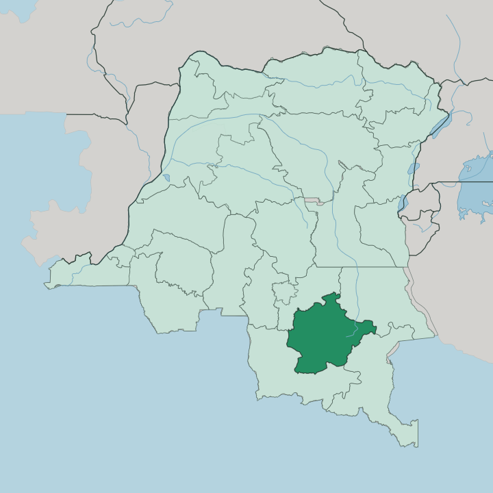


Towns & cities in Haut-Lomani
Pick a town or city — each links to where to stay.
Kamina is the natural base. The plateau town is where the region's three rail lines meet and the airports sit, and beds are few enough that the town itself becomes the reason to stop rather than any resort. Bukama lies east, a small port on the Lualaba River where the navigable upper Congo starts and boats load for the run downstream toward the flooded country around Lake Upemba.
Options are thin. Choose Kamina if you arrive by rail or air; choose Bukama when the river and the Upemba wetlands are the point of the trip.
About Haut-Lomani
What is Haut-Lomani known for?
Haut-Lomani is known for the Lomami River that gives it its name. The waterway rises here in the south, near Kamina and the divide between the Congo and Zambezi basins, before running north toward the great forest. Two things anchor the region for a traveller: the rail town of Kamina and the flooded plains of the Upemba Depression to the east, where the Lualaba River spreads into Lake Upemba inside Upemba National Park.
The Luba people fill the villages between. This is old Katanga country.
Where is Haut-Lomani?
Haut-Lomani sits in southeastern Democratic Republic of the Congo, high on the plateau that once formed the northern half of Katanga. It is savanna country. Broad grasslands roll between belts of gallery forest that trace the streams, and the land climbs toward the divide separating the waters of the Congo from those of the Zambezi.
The region takes its name from the Lomami River, which rises in the south near Kamina and flows north for hundreds of kilometres to join the Congo far downstream. Along the eastern flank runs a second and larger river, the Lualaba, the name the upper Congo carries above its falls. Where the Lualaba slows it floods into a chain of shallow lakes and papyrus swamps, the Upemba Depression, and the broadest of these is Lake Upemba.
Much of that wetland lies inside Upemba National Park on the Kibara Plateau. Kamina stands on high ground in the west of the region, a little over a thousand metres up. Around it spread the five territories of Bukama, Kabongo, Kaniama, Malemba-Nkulu and Kamina itself.
The rivers set the pattern of settlement more than any road does.
What is Haut-Lomani like?
This is Luba country, and that heritage sits at the centre of daily life. The Luba people fill the villages of the plateau, and their language belongs to the wider family of tongues spoken across old Katanga. Their past here is a deep one.
The marshy grasslands of the Upemba Depression, on the region's eastern side, cradled one of Central Africa's great precolonial states. The Kingdom of Luba grew out of those wetlands, its early rulers governing from a capital at Mwibele that lay in what is now this region, and by the eighteenth century its influence reached far across the southern savanna through trade and tribute rather than conquest. Fishing camps still work the flooded margins of the Upemba lakes as they did then.
Cassava, maize and freshwater fish carry the everyday table. Markets gather at the rail halts and river ports. Swahili moves as the language of trade across this corner of the Congo, alongside the Luba speech of the villages, and French serves as the official tongue in Kamina and the territory seats.
Between the towns, the rhythm is agricultural and riverine, tied to the seasons of rain and flood.
What is the history of Haut-Lomani?
The Kingdom of Luba rose from the Upemba Depression in the heart of this region, and its rulers governed the savanna long before any colonial power arrived. It flourished for generations. That kingdom broke apart in the late nineteenth century, and the land passed under the Congo Free State and then Belgian rule, becoming the northern reach of the vast Katanga.
Kamina turned into a railway junction under the Belgians, who later built a large air base beside it. When the old Katanga was broken up, this district carried on as the region around the Lomami and the Lualaba.
What is the climate of Haut-Lomani?
Haut-Lomani runs on a tropical savanna climate of two clear seasons. Rain falls heavily through the warmer months and then all but stops, leaving a long dry stretch when the grasslands brown and the Upemba wetlands shrink back. The plateau height around Kamina tempers the heat, so nights on the high ground can turn cool once the rains have gone.
The wet season is what fills the Lualaba and floods the lakes east of Bukama. Dust marks the dry.
How do you get to Haut-Lomani?
Most travellers reach Haut-Lomani through Kamina, the region's rail and air junction. Three lines of the Congolese railway meet at the town, running north toward Kindu, west, and south-east toward Lubumbashi, so the train is the historic way in from the rest of Katanga. The town keeps its own airport.
A civil field sits beside the old military airfield, and roads across the plateau stay rough and slow, so in the wet season the rivers matter as much as any track. From Bukama, boats work the Lualaba downstream into the Upemba country.
Good for
Updated July 2026