Democratic Republic of the Congo
South Kivu Province, Democratic Republic of the Congo — Towns & Travel Guide


South Kivu is a mountainous province of eastern DR Congo, wrapped around the southern shore of Lake Kivu.
About South Kivu Province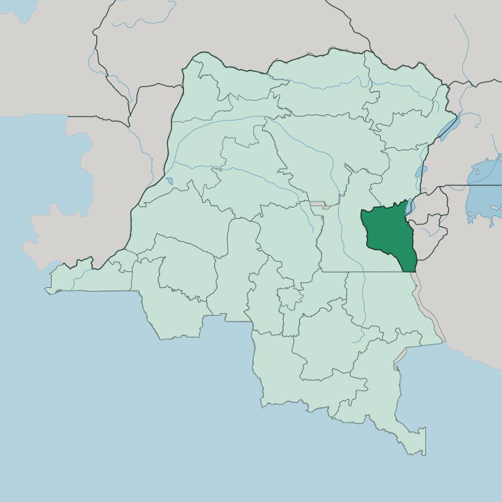


Towns & cities in South Kivu Province
Pick a town or city — each links to where to stay.
Bukavu is the obvious base, spread across the hilly peninsulas at the southern tip of Lake Kivu and the departure point for gorilla tracking in Kahuzi-Biéga. Most beds cluster there. Uvira lies south on the Ruzizi Plain at the head of Lake Tanganyika, a lakeside town facing Burundi across the water.
Idjwi offers something quieter, a rural island in the middle of Lake Kivu reached only by boat. Choose Bukavu if you want the park and the lake within easy reach; choose Uvira or Idjwi when you want the far shore of the province and don't mind sparse rooms.
About South Kivu Province
Gorillas and green ridges.
What is South Kivu Province known for?
South Kivu is best known for Kahuzi-Biéga National Park, the montane forest west of Bukavu that shelters the eastern lowland gorilla and takes its name from two dormant volcanoes, Mount Kahuzi and Biéga. The province holds the southern half of Lake Kivu and the point near Bukavu where the Ruzizi River pours out of the lake toward Lake Tanganyika. Idjwi, a long inland island, sits in the lake itself.
Where is South Kivu Province?
South Kivu occupies the far east of the Democratic Republic of the Congo, in the Albertine Rift, the western branch of the great trench that splits this part of Africa. The land is defined by that rift. Steep escarpments climb from the water, and the Mitumba Mountains form the western shoulder of the Kivu basin.
Mount Kahuzi, an extinct volcano rising to 3,308 metres, stands as the highest point of the province. The eastern edge is all lake and river. Lake Kivu washes the province's north-east, the Ruzizi River runs down its border, and Lake Tanganyika closes off the south-east, and across that string of water lie Rwanda, Burundi and Tanzania.
Inland the country falls away west into forest. Bukavu holds the south-western corner where the Ruzizi leaves Lake Kivu, and Uvira sits far south on the Ruzizi Plain at the head of Lake Tanganyika. North Kivu adjoins the province to the north, Maniema to the west, and Tanganyika to the south.
Rain-fed rivers such as the Luka and the Lugulu drain the lowland toward the Congo basin. It is high, wet, and steep almost everywhere.
What is South Kivu Province like?
The province is a patchwork of peoples. The Shi, also called the Bashi, are the largest group, farming the terraced highlands of the Bushi country around Bukavu, Kabare and Walungu. Their old chiefdoms still shape the land.
South of them, the Fuliru and the Vira hold the Ruzizi Plain around Uvira, the Bembe live on the southern plateaus above Lake Tanganyika, and the Lega, or Barega, occupy the deep forests of Mwenga and Shabunda to the west. Congo Swahili is the everyday tongue that ties these communities together, spoken alongside French and each people's own language. Daily life turns on the land and the lake.
Farmers work coffee and cassava on the volcanic slopes, fishermen cast for sardine-like ndagala on Lake Kivu, and market days pull villagers down from the hills into Bukavu. It is a young, rural society. The province has lived through decades of conflict since the Congo wars of the 1990s, and that hardship sits alongside a deep attachment to home ground, to clan, and to the ridgelines people have farmed for generations.
What is the history of South Kivu Province?
South Kivu was carved out in 1969, when the old Kivu Province of eastern Congo was split and Bukavu became the seat of its own administration. The land had long been settled by the Shi kingdoms of the highlands. From the late 1990s the province became a front line: the First and Second Congo wars drew fighting across the Ruzizi border from Rwanda and Burundi, and the eastern hills have seen armed groups come and go ever since.
Through it all, one thing held. Kahuzi-Biéga, protected as a national park from 1970, kept its forest and its gorillas.
What is the climate of South Kivu Province?
Height tames the tropics here. South Kivu sits near the equator, but Bukavu and the Lake Kivu shore stand well over a kilometre and a half above the sea, so days stay warm and nights turn genuinely cool. The pattern is tropical savanna, split into a long wet season and a shorter dry spell rather than hot and cold halves of the year.
Rain is heavy on the Mitumba slopes and lighter down on the Ruzizi Plain around Uvira, where the low, sheltered valley runs hotter than the highlands above it.
How do you get to South Kivu Province?
Bukavu is the way in. Kavumu Airport sits about 25 kilometres north of the city and handles the domestic flights that link South Kivu to the rest of the country. Many travellers instead arrive by boat, taking the passenger ferry down Lake Kivu from Goma to Bukavu, a crossing of roughly three hours along the lake.
The Rwandan border at Bukavu is the other common door, since the city touches the frontier where the Ruzizi River leaves the lake. Roads inland to Uvira and the forest territories are rough and slow.
Good for
Updated July 2026