Democratic Republic of the Congo
East Kasai, Democratic Republic of the Congo — Towns & Travel Guide


East Kasai is a diamond-rich province in south-central Democratic Republic of the Congo, centred on the mining city of Mbuji-Mayi.
About East Kasai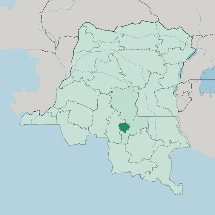


Towns & cities in East Kasai
Pick a town or city — each links to where to stay.
Mbuji-Mayi is the only base. The provincial capital holds nearly all of the province's beds, its market, its airport and its diamond trade, sprawling along the Mbuji-Mayi River in the centre of East Kasai. Beyond it the territories of Tshilenge, Katanda, Miabi, Lupatapata and Kabeya-Kamwanga are rural farming country with almost no formal lodging.
Stay in the capital and travel out by road. Choose it if you are here for the mines, the Luba heartland, or onward transit rather than sightseeing.
About East Kasai
Diamonds define East Kasai.
What is East Kasai known for?
The gravels around Mbuji-Mayi hold one of the densest concentrations of industrial diamonds anywhere, and mining has drawn people here since alluvial stones were first found along the Mbuji-Mayi River. The province is the heartland of the Luba people, whose Tshiluba language carries across the wider Kasaï region. Its short, turbulent past as the breakaway mining state of South Kasai still marks its politics.
Most who come are traders, not tourists.
Where is East Kasai?
East Kasai sits in the south-central interior of the Democratic Republic of the Congo, one of the three provinces carved in 2015 from the older and much larger Kasaï-Oriental. It is landlocked and far from any coast. Sankuru province wraps its northern edge, Lomami lies to the east, and Kasaï-Central adjoins it to the west, deep within the Congo Basin.
Mbuji-Mayi, the capital, stands near the middle of the province where the Mbuji and Mayi rivers meet. The land is a rolling plateau of savanna grassland threaded with gallery forest along the watercourses, part of the broad tableland that separates the Sankuru and Kasai river systems. Streams here drain north toward the Sankuru River, a major tributary that feeds the Kasai River and, through it, the Congo.
Red lateritic soils and diamond-bearing gravels lie beneath much of the surface, which is why the mines sit where they do. The province is compact by Congolese standards. Roads are poor and often impassable in the rains, so the rivers and the airport at Mbuji-Mayi carry much of the long-distance traffic.
Distance, not any border, is what isolates it.
What is East Kasai like?
This is Luba country. The province is the demographic and cultural core of the Luba people of Kasai, and Tshiluba is heard in the markets, the churches and the mining camps far more than French. That shared language and identity is what drew Luba families here from across the Congo through the twentieth century, concentrating a whole people around Mbuji-Mayi.
Faith runs strong. Catholic and Protestant congregations sit alongside a dense fabric of independent churches, and Sunday fills the city. Daily life turns on the diamond trade and on farming the savanna around it.
Cassava, maize and groundnuts come in from the territories of Tshilenge and Miabi, while the informal diggers and buyers of the diamond pits give Mbuji-Mayi its restless, money-driven character. Luba craft traditions in wood and beadwork belong to one of Central Africa's old kingdoms, whose art is held in museums well beyond the Congo. Music and street commerce fill the evenings.
It is a hard-working, self-reliant place, proud of a distinct Luba identity that its people carried through war and secession and never set down.
What is the history of East Kasai?
Diamonds made this place. Alluvial stones were found along the Mbuji-Mayi River in 1918, and the colonial company Forminière turned the settlement of Bakwanga into a mining town almost overnight. At independence in 1960 the Luba leader Albert Kalonji declared the diamond region the breakaway mining state of South Kasai, with Bakwanga as its capital, before the secession was crushed by 1962.
The town was later renamed Mbuji-Mayi after its river. The modern province dates only from 2015, when the huge former Kasaï-Oriental was split into three.
What is the climate of East Kasai?
East Kasai has a tropical savanna climate, hot through the year and split into two clear seasons. The long rains run from about October to May, when heavy afternoon storms break over the plateau and turn the red-earth roads to mud. Then it dries out.
A cooler, dusty spell follows through the middle of the year, from June to September. Temperatures around Mbuji-Mayi stay warm. The wet months, not the calendar, set the rhythm of travel and mining here.
How do you get to East Kasai?
Reaching East Kasai means catching a plane. Mbuji-Mayi Airport handles domestic services only, and the main link is the roughly two-hour flight from Kinshasa, the national capital far away to the west across the Congo Basin. No international flight lands here.
There is no through railway from the coast either, so the plane does the work that the roads cannot. Overland routes from Kinshasa or the Kasai River ports run long and rough, impassable in parts during the rains. From Mbuji-Mayi, battered tracks fan out to Tshilenge, Katanda and the other territories.
Updated July 2026