Democratic Republic of the Congo
Kwilu, Democratic Republic of the Congo — Towns & Travel Guide


Kwilu is a province of western Democratic Republic of the Congo, named for the river that crosses it and centred on the palm-oil city of Kikwit.
About Kwilu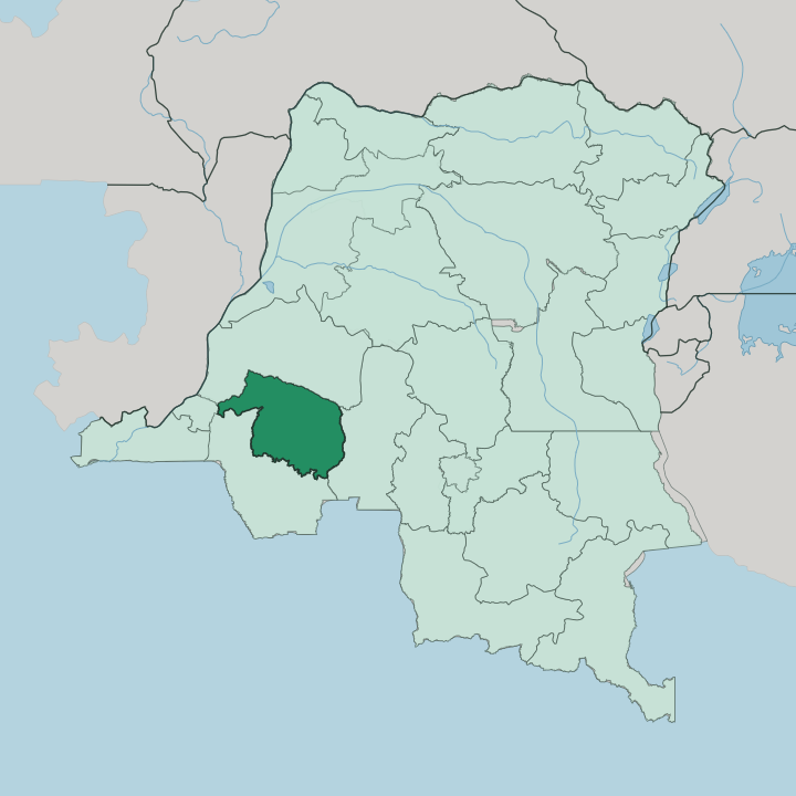


Towns & cities in Kwilu
Pick a town or city — each links to where to stay.
Kikwit is the practical base for Kwilu, the largest city and the terminus of the paved road from Kinshasa. Kikwit is where the rooms gather. It stands on the left bank of the Kwilu River, at the last point river craft can reach before the rapids, and its markets run on palm oil and cassava brought in from the surrounding territories.
Bandundu, the provincial capital, sits downstream where the Kwilu joins the Kwango, a quieter river town of administration rather than trade. The interior villages of Gungu and Idiofa have little formal lodging and are reached over dirt roads from the Kikwit hub. Base yourself in Kikwit for a first look at the province.
About Kwilu
One river shapes it all.
What is Kwilu known for?
The Kwilu gives the province its name, flowing down from the southeast and out to the northwest through plains and low rolling hills of savanna and thin gallery forest along the banks. Kikwit sits on its left bank at the furthest point boats can reach, the largest city and the old capital of the palm-oil country. The Pende villages of Gungu and Idiofa carry a mask tradition known across Central Africa.
Bandundu is the provincial capital.
Where is Kwilu?
Kwilu lies in the west of the Democratic Republic of the Congo, one of the provinces carved from the old Bandundu when the country was redrawn. It is inland country. No coast touches it.
Kinshasa, the national capital, sits on its western side, and the road to it runs out over savanna and farmland. Kasaï lies to the east, Kwango to the south along the river of that name, and Mai-Ndombe to the north. The Kwilu River is the axis of the whole province, entering from the southeast and running out to the northwest, and its valley carries most of the towns strung along the bank.
The land itself is plateau and plain. Broad grassland stretches between low rolling hills, cut by watercourses and threaded with strips of gallery forest along the rivers. The Kwilu gathers the interior streams as it goes, taking in the Kwenge below Kikwit before it joins the Kwango near Bandundu; from there the combined water flows on into the wide Kasaï, and by that river reaches the Congo itself.
Rivers do the work that roads cannot in much of the province. That drainage, more than any border, ties the territories of Kwilu together.
What is Kwilu like?
Kwilu is Pende country above all, and the Bapende gave Central Africa some of its most striking masks. The mbuya masks of the western Pende, carved around Gungu and Idiofa, take on human roles for the dances: the chief, the diviner, the widow, the man in a trance. Each has its own face.
They appear at initiations and at the enthronement of a chief, worn by dancers who move through a whole cast of village characters. Carvers hold real standing in that society, ranked near the nobles and given the first share of the harvest. Other peoples share the province too, among them the Bayanzi and the Basuku, so the mask tradition is one thread among several rather than the only one.
Daily life turns on the land and the river. Cassava is the staple, pounded into the flour that feeds most of the province, and palm oil has long been the cash crop that made Kikwit a trading town. French is the official language of administration, while Kikongo ya leta, the trade Kikongo also called Kituba, is what people speak across the markets and villages.
Music, church and market carry much of public life. The result is a culture rooted in farming and craft rather than in any city.
What is the history of Kwilu?
Kwilu first became a province in 1962, in the turbulent years after Congolese independence. One uprising defines the era. From 1963, Pierre Mulele, a former minister in Patrice Lumumba's government who had trained abroad, raised a Maoist-inspired revolt among Pende and Mbunda recruits around Gungu and Idiofa.
Government forces had largely broken it by 1965, and hunger and disease closed the chapter. The province was later folded into Bandundu as a district, then restored as Kwilu again in the 2015 redrawing of the country's provinces.
What is the climate of Kwilu?
Kwilu has a tropical savanna climate. The year splits into a wet and a dry half. The long rains fall from October into May, when downpours build over the plateau and the Kwilu River runs high.
A drier stretch follows from June to September, when the skies clear and the rivers drop. Warmth holds steady across Kwilu all year. Roads that are passable in the dry months turn to mud when the rains return, which shapes when travel across the interior is easy.
How do you get to Kwilu?
Most travellers reach Kwilu overland from Kinshasa. National Road 1 runs southeast from the capital to Kikwit, the paved artery that ties the province to the rest of the country, and buses cover it in a long day. The road ends its useful reach for visitors at Kikwit, on the Kwilu River.
Kikwit Airport handles the occasional domestic and charter flight, but scheduled service is thin and unreliable. Bandundu, downstream at the Kwango confluence, is also reached by river and road. Beyond the main towns, dirt tracks and the rivers themselves carry the traffic into the interior.
Updated July 2026