Democratic Republic of the Congo
Province du Haut-Katanga, Democratic Republic of the Congo — Towns & Travel Guide


Haut-Katanga is the southernmost province of the Democratic Republic of the Congo, the copper-and-cobalt heartland centred on Lubumbashi.
About Province du Haut-Katanga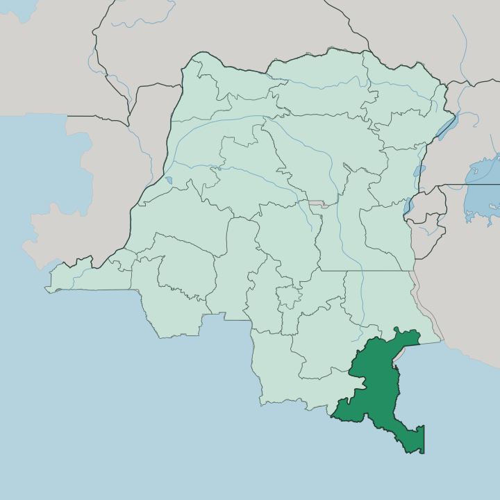


Towns & cities in Province du Haut-Katanga
Pick a town or city — each links to where to stay.
Lubumbashi is where nearly every trip to Haut-Katanga begins and ends. The provincial capital holds the airport, the consulates and the bulk of the hotels, so most visitors base themselves there. Likasi, the second industrial town, sits up the rail line toward the copper mines and suits travellers with business at Kambove or the smelters.
For the plateau country and Lofoi Falls, Kundelungu National Park lies northeast, reached as a trip out from the city rather than a place to bed down. Beds thin fast beyond Lubumbashi. Choose the capital for comfort and connections; choose Likasi only when the mining belt is the reason you came.
About Province du Haut-Katanga
Haut-Katanga runs on metal.
What is Province du Haut-Katanga known for?
The province sits at the northern end of the Central African Copperbelt, and its red earth holds some of the richest copper and cobalt deposits on the planet. Lubumbashi anchors the whole thing, the second-largest city in the Democratic Republic of the Congo and the mining capital of the south. Smelters, headframes and haul roads define the working landscape around Likasi and Kasumbalesa.
Away from the pits, the Katanga Plateau rolls out in savanna and miombo woodland toward Kundelungu National Park.
Where is Province du Haut-Katanga?
Haut-Katanga fills the far south-eastern corner of the Democratic Republic of the Congo, pressed against the frontier with Zambia. The province took its present shape in 2015, carved from the old province of Katanga along with Lualaba, Haut-Lomami and Tanganyika. Most of it rides high on the Katanga Plateau, an elevated tableland of open savanna and miombo woodland that keeps the air cooler than the Congo lowlands to the north.
Lubumbashi stands near the southern edge, close to Zambia. The land is not flat. Northeast of the capital the ground climbs again onto the Kundelungu Plateau, a grassy highland cut by deep valleys and gallery forest inside Kundelungu National Park.
There the Lofoi Falls drop in a single unbroken thread of some 340 m, one of the tallest waterfalls in Central Africa, fed by a tributary of the Lufira River. The Lufira itself was dammed near Likasi to power the smelters of the copper zone. Rivers here work for the mines as much as they shape the land.
This is high, mineral-rich country, and the plateau underfoot is exactly what makes the copper worth digging.
What is Province du Haut-Katanga like?
Life in Haut-Katanga has been shaped by the mine for well over a century. Copper here is old. Smiths on the Katanga Plateau were casting standardised copper ingots for long-distance trade by the tenth century, generations before Europeans arrived.
That deep metalworking heritage still colours local identity. French is the official language, but the streets of Lubumbashi run on Kiswahili, the working lingua franca that ties the province to the wider Swahili world of eastern Africa. Migration to the mines layered in other tongues.
Kiluba, Kisanga, Bemba and Chokwe all reached the city with workers drawn from the countryside and from across the Zambian border. The result is a frontier culture, industrial and outward-looking at once, quite unlike the river-focused Congo further north. It is a mining society first, and the rest grew up around the smelters.
What is the history of Province du Haut-Katanga?
Copper made this province, and it made it fast. Lubumbashi was founded in 1910 as Élisabethville, a colonial mining town built to feed the smelters. The Belgian firm Union Minière du Haut-Katanga controlled the copper trade across the region until its assets were nationalised in the 1960s to form the state company Gécamines.
In 1966 the city took its present name from the nearby Lubumbashi River, shedding the colonial title. Katanga briefly declared independence after 1960 before being reabsorbed. Mining never stopped.
What is the climate of Province du Haut-Katanga?
Haut-Katanga sits high enough to escape the worst of the equatorial heat. The Katanga Plateau lifts Lubumbashi well above the Congo lowlands to the north, softening the tropical climate into something noticeably milder. The year splits cleanly into two seasons.
A long dry season runs roughly from May through September, cool and clear on the plateau, and it is the stretch when the roads to Kundelungu National Park stay passable. Rains return in force from November. The south of the province leans humid tropical while the north grades into open savanna.
How do you get to Province du Haut-Katanga?
Haut-Katanga is reached, for the most part, by air. Lubumbashi International Airport, the old Luano field on the edge of the city, is the main door into Haut-Katanga and handles the province's international and domestic traffic. Most travellers fly in.
Overland, the busiest route is the road and rail crossing at Kasumbalesa, southeast of Lubumbashi on the Zambian frontier, where copper trucks queue for the ports of southern Africa. Rail lines run from Lubumbashi toward both the Atlantic and Indian ocean coasts, though service is slow and limited. Distances inside the province are long and the roads rough.
Most visitors arrive through the capital and fan out from there.
Updated July 2026