Democratic Republic of the Congo
Tanganika, Democratic Republic of the Congo — Towns & Travel Guide


Tanganika stretches along the western shore of Lake Tanganyika in the east of the Democratic Republic of the Congo, its capital the lake port of Kalemie.
About Tanganika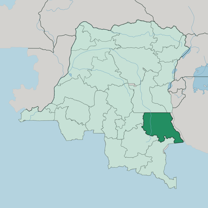


Towns & cities in Tanganika
Pick a town or city — each links to where to stay.
Kalemie is the base. It holds the province's port, its airport and nearly all of what passes for lodging, strung along the western shore of Lake Tanganyika at the point where the Lukuga River drains out of the lake and turns west. Moba, further south down the same shore, is the other lake port and a second way in from the water.
Beds thin out fast beyond those two towns. Choose Kalemie if you want the lake, the port traffic and a room at the end of a long day inland.
About Tanganika
The lake defines it.
What is Tanganika known for?
Tanganika takes its name and its eastern edge from Lake Tanganyika, the second-deepest freshwater lake on Earth, and the whole province leans toward that water. Kalemie sits on the western shore as the capital and busiest port, the place where boats set out across the lake toward Tanzania, Burundi and Zambia. Inland, the ground turns to mining country: Manono built its name on tin and coltan drawn from the pegmatites around the town.
Six territories make up the province, from Moba in the south to Kongolo on the Lualaba in the north.
Where is Tanganika?
Tanganika occupies the north-eastern corner of what used to be Katanga, in the east of the Democratic Republic of the Congo. Lake Tanganyika runs the length of its eastern side. That lake is the province's defining border and its window onto the wider region, and across the water lie Tanzania, Burundi and Zambia rather than any Congolese neighbour.
The land itself is broad. At about 134,940 square kilometres it is one of the largest of the country's provinces, and it fills the ground between the lake in the east and the upper reaches of the Congo river system in the west. Water ties the province together.
Kalemie stands on the western shore where the Lukuga River flows out of Lake Tanganyika, carrying its overflow west to the Lualaba, the great headstream that becomes the Congo. Kongolo and Kabalo sit inland on that river network, north and west of the capital. To the south, Moba holds the shore further down the lake.
Haut-Lomami and Haut-Katanga, the other pieces of the old Katanga, border Tanganika to the west and south.
What is Tanganika like?
Swahili is the language of the street here. Along the lake shore Kingwana, the Congolese dialect of Swahili, carries the market and the port far more than French, the country's official tongue. The province is a meeting ground of peoples: Tabwa and Bembe near the lake, Luba-Katanga and Hemba across the interior, and traders drawn from further east into Kalemie.
That lakeside mix has been shaped for generations by traffic across the water, since the same shore that opens onto Tanzania and Burundi opens onto their goods, their boats and their languages. Life bends toward the lake and the river. Fishing crews work Lake Tanganyika out of Kalemie and Moba, and dried fish moves inland along the old rail line and the Lualaba.
The interior tells a different story, one of mining towns like Manono where tin and coltan set the rhythm of work. Two worlds share one province. One faces the water and the ports beyond it, the other digs into the ground of the old Katanga heartland.
What is the history of Tanganika?
Kalemie began as a fort. On 30 December 1891 the Belgian officer Alphonse Jacques raised an anti-slavery post on the lake shore and called it Albertville, a name it kept until Zairianisation turned it into Kalemie in 1971. The province around it is far younger than its capital.
Tanganika was carved out in 2015, when the old Katanga province was split into four and the former Tanganyika district was raised to a province with Kalemie as its seat. Its borders trace the short-lived Nord-Katanga province that existed in the first years after independence, between 1962 and 1966.
What is the climate of Tanganika?
The climate is hot and tropical. Tanganika runs on a wet season and a dry one rather than four, and Kalemie holds close to 24 degrees the year round with rain in the region of a metre falling mostly across the turn of the year. Lake Tanganyika steadies the shore.
Its towns stay milder than the drier ground inland. The dry stretch around midyear, when the rains ease and the tracks inland firm up, is the easier time to travel.
How do you get to Tanganika?
Kalemie is the way in. The capital has the province's airport, its main port, and the terminus of the railway that runs west through Kabalo toward Kamina and Lubumbashi, though the line has fallen into poor repair. The lake is the other road: ferries and boats cross Lake Tanganyika between Kalemie and the ports of Kigoma in Tanzania, Bujumbura in Burundi and Mpulungu in Zambia.
Reaching the interior towns of Manono, Kongolo and Nyunzu means slow going by rough track or by the degraded rail line. Most arrivals come by air or across the water.
Good for
Updated July 2026