Democratic Republic of the Congo
Province de l’Équateur, Democratic Republic of the Congo — Towns & Travel Guide


Province de l'Équateur is a rainforest region of the Democratic Republic of the Congo, straddling the Equator on the Congo River.
About Province de l’Équateur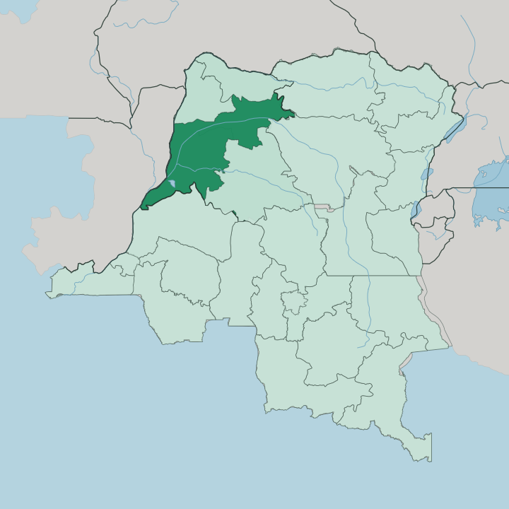


Towns & cities in Province de l’Équateur
Pick a town or city — each links to where to stay.
Mbandaka is the one practical base. The provincial capital lines the east bank of the Congo River just below the mouth of the Ruki, and it holds what few guest rooms the whole province can offer to a visitor. Beyond it the territories run to forest and river villages reached only by boat or small plane.
Stay in Mbandaka if you want the equator crossing, the old river port, and the Eala Botanical Garden a short way upriver. Bikoro and Lukolela lie south along the Congo. They are staging posts for the forest, not towns with beds.
About Province de l’Équateur
What is Province de l’Équateur known for?
The Equator gives the province its name and cuts across it just south of Mbandaka. This is deep Congo Basin country. Its capital, Mbandaka, sits where the Ruki River empties into the Congo River, a river port strung along the water rather than a city of streets.
Rainforest fills almost everything between the towns, and the Mongo people hold the land inside the great curve of the Congo. Travellers come for the river itself, and for the forest that presses against both its banks.
Where is Province de l’Équateur?
Province de l'Équateur lies in the north-west of the Democratic Republic of the Congo, in the heart of the Congo Basin. The Equator runs straight through it. That line crosses just south of the provincial capital, Mbandaka, which is exactly how the whole region came by its name and its identity.
Forest covers most of it. The province spreads across about 103,902 square kilometres of low plain, flat land drained almost entirely toward one river. The Congo River defines the western edge and carries nearly all the traffic that moves through here.
Mbandaka stands on the east bank of the Congo, just below the point where the Ruki River flows in from the east. The Ruki is a blackwater river, its water stained dark as strong tea by the rotting leaves of the flooded forest, and it ranks among the darkest rivers measured anywhere on Earth. Around these channels spreads the Cuvette Centrale, the vast swamp-forest basin at the middle of the Congo watershed.
Seven territories fan out from the capital, among them Bikoro and Basankusu and Bolomba. Roads barely reach them. The river and its tributaries do the work a road network would do elsewhere.
What is Province de l’Équateur like?
The province is Mongo country above all. The Mongo people are the largest ethnic group in the Democratic Republic of the Congo, and they hold the equatorial forest inside the northern bend of the Congo River, with the Batwa, Ngombe, and Babangi among their neighbours. Life here follows the water.
Villages line the riverbanks and the forest clearings, and the pirogue does the work that a car does elsewhere. French is the official language, but the tongue you actually hear along the wharves and in the markets of Mbandaka is Lingala, the trade language that spread up and down the Congo with the river boats. Mbandaka's Catholic cathedral carries inscriptions in the Mongo language, a mark of how deep the older speech still runs beneath the river creole.
Culture here is not built in galleries. It moves on the water, in the fishing camps and the forest settlements, and in a river port that has watched traders come and go since Stanley's day.
What is the history of Province de l’Équateur?
The story starts at the river. Henry Morton Stanley founded the capital in 1883 and called it Équateurville, for the Equator he believed ran through it. The Belgians renamed the town Coquilhatville in 1886, and it kept that name until 1966, when independent Congo restored a local name and called it Mbandaka.
The wider province traces to an Équateur district raised to provincial rank in 1917 under Belgian rule. That older, much larger province was split apart on 11 July 2015, and the present Province de l'Équateur is the piece that kept Mbandaka and the name.
What is the climate of Province de l’Équateur?
The province sits on the Equator, so it stays hot and wet the year round, with temperatures that barely shift from one month to the next and heavy rain feeding the forest through most of the calendar. The wettest spells fall around the turn of autumn. This is pure rainforest weather.
Humid air hangs over near-daily downpours, and no true dry season ever arrives to break the pattern. The Ruki River and its flooded forests owe their dark water to exactly this rain, which soaks the leaf litter and leaches it into the streams.
How do you get to Province de l’Équateur?
Two ways in, and both are slow. Most travellers fly, taking the roughly one-hour hop from Kinshasa to Mbandaka Airport, since roads into the Congo Basin are few and often impassable. The older route is the river itself: a barge down the Congo River between Kinshasa and Mbandaka runs four to seven days, sharing the deck with traders, goats, and cargo.
Once you reach the capital, the territories beyond it are reached only by boat up the Ruki River and the smaller channels, or by light aircraft to the forest airstrips.
Updated July 2026