Democratic Republic of the Congo
Sankuru, Democratic Republic of the Congo — Towns & Travel Guide


Sankuru is a rainforest province of central Democratic Republic of the Congo, named for the great river that curves through it.
About Sankuru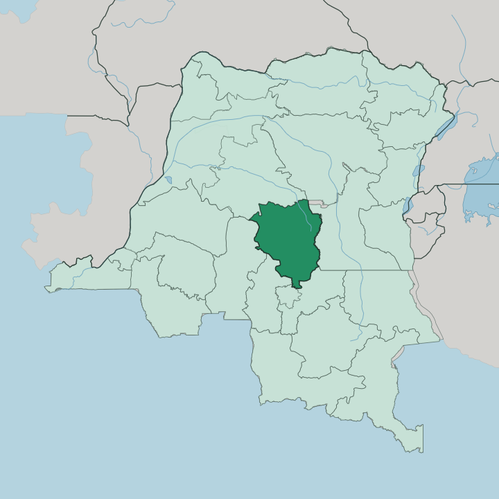


Towns & cities in Sankuru
Pick a town or city — each links to where to stay.
Two towns anchor a trip. Lusambo, the provincial capital, sits above the confluence of the Sankuru and the Lubi and makes the natural base for the river and the administrative south. Lodja, larger and further north, is the commercial centre and the base for the Tetela country and the forest edge around it.
Choose Lusambo for the capital and the riverfront; choose Lodja when the forest interior, its airstrip and the reserve to the north are the reason you came.
About Sankuru
Sankuru is forest country.
What is Sankuru known for?
It carries the name of the Sankuru River, the longest tributary of the Kasai and the water that threads the whole province. Equatorial rainforest covers the north, thinning southeast into a mosaic of savanna and woodland where most towns sit. Lusambo is the capital, a river town above the meeting of the Sankuru and the Lubi, while Lodja to the north is the larger place and the heartland of the Tetela people.
Bonobo, okapi and forest elephant live in its interior, part of why the Sankuru Nature Reserve was drawn across the forest here.
Where is Sankuru?
Sankuru lies in central Democratic Republic of the Congo, deep inside the Congo Basin and far from any coast. It is river country before it is anything else. The Sankuru River, longest tributary of the Kasai, sweeps north and then west across the province and gives it both its name and its main axis of movement.
Three more rivers frame the land around it: the Lomami along the eastern side, the Lubefu through the middle, and the Lukenie rising in the north near Katako-Kombe. Lusambo, the capital, stands in the south above the point where the Sankuru meets the Lubi. The land itself changes as you cross it.
Forest gives way to grass. Dense equatorial rainforest blankets the north, part of the vast forest block of the Congo Basin, and it thins southeastward into a patchwork of savanna, woodland and bush where the towns and farms cluster. Between the forest and the grassland run valleys, low ridges and the wide channels of the rivers that make the interior hard to cross by road.
Much of that northern forest falls inside the Sankuru Nature Reserve, laid out to protect the Sankuru and Lokenye basins. It is one of the largest continuous stretches of protected great-ape habitat anywhere. The rivers, not the roads, still tie the province together.
What is Sankuru like?
Sankuru is Tetela country at heart. The Tetela people are the dominant community across the province, and their language carries almost everywhere here, spoken alongside the Baluba, Basongye and other groups of the wider Kasai. French is the official language of administration, with Tshiluba and Kiswahili serving as the national tongues used between communities.
Daily life turns on the land. Farming families work the clearings between the forest and the savanna, raising rice and cassava alongside banana, pineapple and coffee, and the river carries what they trade. The province has given the country some of its best-known names.
Patrice Lumumba, first prime minister of independent Congo, was born a Tetela near Katako-Kombe, and Sankuru still claims him as its own. That inheritance runs through the province's sense of itself. Musicians and public figures from these towns carried Tetela names into the national culture, and the villages keep the older weight of custom, drumming and oral tradition.
This is not a place of monuments and museums. Its culture lives in the language, the river trade and the memory of the people the forest towns have sent out into the country.
What is the history of Sankuru?
Sankuru began as a colonial district of the old Kasai, with Lusambo its administrative seat on the river. It stood briefly as its own province between 1962 and 1966, then was folded back into Kasaï-Oriental and governed as a district for almost fifty years. The 2015 reorganisation of the country broke that larger province into three and revived Sankuru as one of the twenty-one provinces of the Democratic Republic of the Congo, with Lusambo raised again to capital.
The name has outlasted every rearrangement.
What is the climate of Sankuru?
Heat and humidity hold over Sankuru through every season. The north sits under a true equatorial climate of near-constant rain, softening toward a humid tropical pattern across the centre and south. Days stay warm and even through the year, and the forest holds the humidity in.
A drier spell runs from about May into August, when the rains ease across the savanna south; the wetter months return from September and hold through April. The Sankuru River rides this rhythm.
How do you get to Sankuru?
Reaching Sankuru means flying or floating. Roads across the province are poor and often impassable in the rains, so most travellers arrive by light aircraft, with the airstrip at Lodja the main way into the forested north. The rivers do the rest of the work.
The Sankuru and its tributaries have carried people and goods through this country for generations, and boats still link the river towns where no road does. Lusambo, the capital, sits on that water in the south.
Updated July 2026