Colombia
Departamento de La Guajira, Colombia — Towns & Travel Guide


La Guajira is Colombia's desert peninsula, the Wayuu homeland reaching to Punta Gallinas, the northernmost point of mainland South America.
About Departamento de La Guajira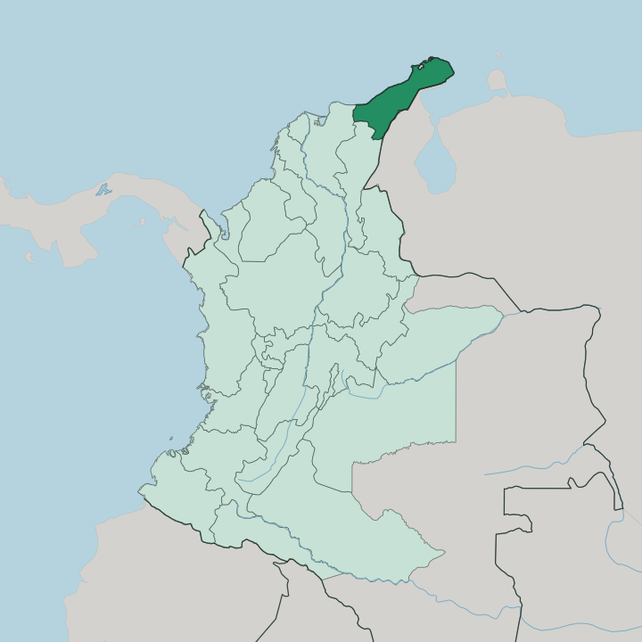
Towns & cities in Departamento de La Guajira
Pick a town or city — each links to where to stay.
Riohacha is the practical base. The capital sits on the Caribbean at the mouth of the Ranchería River, and its seafront is where the long tours into the desert begin. Cabo de la Vela comes next, a Wayuu fishing settlement on a bare headland where you sleep in a chinchorro hammock and the trade winds pull kitesurfers across the bay.
Punta Gallinas is the far end. Only a scatter of family rancherías host visitors out by the Taroa dunes, so book a bed ahead. Choose Riohacha for comfort and connections; go on to the headlands when you want the emptier reach of the peninsula.
About Departamento de La Guajira
La Guajira is a desert.
What is Departamento de La Guajira known for?
It fills the far north-eastern corner of Colombia, the arid Guajira Peninsula that pushes out into the Caribbean toward Venezuela. The Wayuu, Colombia's largest Indigenous group, are the majority here, and their woven mochila bags travel far past the department. Riohacha sits on the coast where the Ranchería River meets the sea.
Beyond it the sand runs on to Punta Gallinas, where the mainland of South America finally stops.
Where is Departamento de La Guajira?
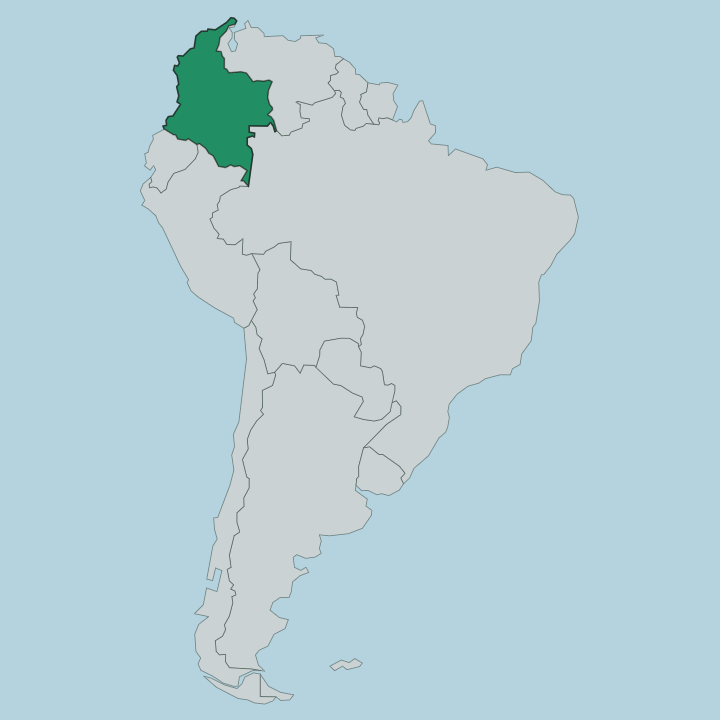
La Guajira is the north-eastern tip of Colombia, the wedge of land that ends the country's Caribbean coast against the border with Venezuela. It is dry. Most of the department lies on the Guajira Peninsula, and the plains that fill its north are true desert, the Guajira-Barranquilla xeric scrub that runs on toward the sea.
That dryness has a single cause: the Sierra Nevada de Santa Marta, an isolated coastal massif rising in the south-west, catches the rain and leaves the peninsula in its shadow. Off those mountains the Ranchería River flows down, bending north and east until it reaches the Caribbean at Riohacha, the one large river the region has. The far north narrows to a point.
Punta Gallinas, out beyond Uribia, is the northernmost place on the mainland of South America, and the wind-piled Taroa dunes spill straight into the sea nearby. Inland toward Venezuela the Serranía del Perijá marks the eastern border, and in the desert's heart the low Serranía de Macuira rises as a green oasis of cloud forest amid the sand. Between them the salt flats of Manaure and the trade town of Maicao sit on the flat, sun-struck ground.
Everything here answers to two forces, the mountains that hold back the rain and the sea that rings the rest.
What is Departamento de La Guajira like?
This is Wayuu country before it is anything else. The Wayuu are Colombia's largest Indigenous people, and across most of the department their language, dress, and clan law shape daily life more than the national grain does. Wayuunaiki is spoken alongside Spanish, and many people in the desert reach for it first.
The weaving is famous. Women knot the crocheted mochila bag in bright bands of colour, and the craft is one of the country's best-known handicrafts, sold from Riohacha to shops far beyond the peninsula. Life is organised by the ranchería, the small family settlement of goats and cactus fences scattered across the scrub rather than gathered into towns.
Uribia calls itself the Indigenous capital of Colombia, and its calendar turns on the Wayuu culture festival. Vallenato, the accordion music of the Caribbean lowlands, is said to have taken shape on the roads between Riohacha and the valleys inland. The result is a corner of Colombia that feels distinct.
It keeps its own tongue, its own descent through the mother's line, and its own long memory of holding the desert against outsiders.
What is the history of Departamento de La Guajira?
Europeans reached the peninsula early. Cabo de la Vela was one of the first points on the South American mainland the Spanish sighted, and by 1535 they had planted a settlement on the coast that grew into Riohacha, drawn by the pearl banks offshore. The Wayuu never truly submitted.
Armed and mounted, they rose against Spanish rule and lived for centuries by trade and contraband that Bogotá could not police, keeping the desert their own. La Guajira became a department of Colombia in its modern form in 1965, and the open-pit coal of Cerrejón later turned the dry interior into one of the country's great export mines.
What is the climate of Departamento de La Guajira?
La Guajira is hot and dry the year round. The Sierra Nevada de Santa Marta wrings the moisture from the air before it reaches the plains, so the northern peninsula sees little rain and the sun is fierce. Steady trade winds off the Caribbean cross the desert and rarely let up, which is what draws the kitesurfers to Cabo de la Vela.
What rain there is falls mostly in a short burst late in the year. Come in the dry months. The tracks into the Alta Guajira harden then, and Punta Gallinas stays within reach.
How do you get to Departamento de La Guajira?
Most travellers come in through Riohacha. The capital has the department's airport and the bus routes down the Caribbean coast from Santa Marta, and it is where the desert tours are arranged. Getting further north takes work.
Beyond Uribia the paved road gives out, and reaching Cabo de la Vela or Punta Gallinas means high-clearance jeeps over sand tracks and, at the very end, a boat, with a Wayuu guide who knows the way. Maicao, on the eastern edge, is the main crossing to and from Venezuela.
Good for
Updated July 2026