Colombia
Departamento de Nariño, Colombia — Towns & Travel Guide


Nariño is Colombia's south-western corner, where the Andes drop from Pasto and the Galeras volcano to the Pacific shore at Tumaco.
About Departamento de Nariño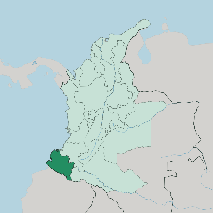
Towns & cities in Departamento de Nariño
Pick a town or city — each links to where to stay.
Pasto is the natural first base, capital of Nariño and the high town under the Galeras volcano where most journeys through the south begin. From there the choices split by altitude. Ipiales sits two hours south by the Guáitara gorge, the overnight stop for the Las Lajas basilica and the road into Ecuador.
Tumaco lies far west on the Pacific. It is warm and low, the place the highlands finally run out. Choose Pasto for the mountains and the carnival; drop to Ipiales for the shrine, or all the way to the coast when you want the warm ocean and the beaches.
About Departamento de Nariño
What is Departamento de Nariño known for?
Nariño is the department travellers reach on the way south to Ecuador. Its draws are stacked by altitude. Pasto, the capital, sits high under the cone of the Galeras volcano, one of the most active in all of Colombia.
Two hours south at Ipiales, the neo-Gothic basilica of Las Lajas hangs on stone piers across the gorge of the Guáitara River, and pilgrims come for it year-round. West of there the land falls away to the Pacific and the port of Tumaco. In early January the capital fills for the Carnaval de Negros y Blancos, the region's signature festival.
Where is Departamento de Nariño?
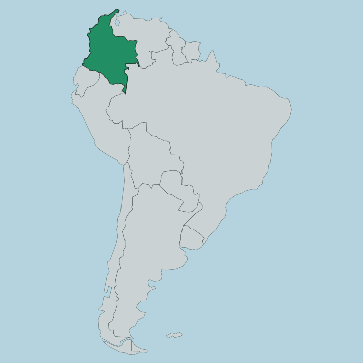
Nariño fills the far south-western corner of Colombia, wedged against Ecuador to the south and the Pacific Ocean to the west. The land climbs. Off the coast lie mangrove estuaries and the port of Tumaco, and behind them the ground rises through humid forest into the Andes, which run the length of the department from the Pacific plain to the eastern heights.
Near the Ecuadorean frontier the ranges knot together at the Nudo de los Pastos, the tangle of high plateau where Colombia's Andes properly begin. The departmental capital, Pasto, stands high on the eastern side under the still-active cone of the Galeras volcano. Two altiplanos carry most of the people: the plateau around Pasto, and the Túquerres-Ipiales plateau to the south, separated from it by the deep trench of the Guáitara River.
That gorge is where the basilica of Las Lajas spans the water below Ipiales. The Guáitara feeds the Patía, the longest river of the whole Colombian Pacific coast, which cuts west through the mountains and empties into the ocean north of Tumaco. Along the eastern edge the Colombian Massif rises, the great water-tower of the country where the Patía and other major rivers take their source.
From cold páramo to hot coast, the whole department is a single slope down to the sea.
What is Departamento de Nariño like?
Nariño's culture is layered like its land, and the layers rarely mix quietly. In the highlands the older strands are indigenous, the inheritance of the Pastos and Quillacingas who worked these plateaus and honoured the moon and the harvest long before the Spanish arrived. On the Pacific lowlands around Tumaco the culture is Afro-Colombian, built on marimba music, fishing, and the rhythms of the estuary towns.
Between the two runs the Andean, Catholic, Spanish-founded life of Pasto and the mountain villages. Nothing shows that fusion better than the Carnaval de Negros y Blancos. Held in Pasto over the first days of January, it turns the streets over to giant papier-mâché floats and two symbolic days: one when revellers daub each other with black paint, the next with white talc, a ritual of equality that UNESCO lists as intangible heritage of humanity.
Pasto is also a craft city. Its workshops are known for barniz de Pasto, a lacquerwork that coats carved wood in colour drawn from a highland resin, a technique carried down since colonial times. Spanish is the everyday language across the department.
The result is a place that feels distinctly its own, closer in temper to the highland Andes of Ecuador than to the Caribbean north of Colombia.
What is the history of Departamento de Nariño?
Before the Spanish, these highlands belonged to the Pastos and Quillacingas, farming peoples of the southern plateaus. Pasto was founded as a colonial town in 1537, and for centuries the district was loyal, conservative country on the edge of the Spanish empire. The department itself is young.
It was carved out and given its present shape in 1904, named for Antonio Nariño, the Bogotá patriot and translator of the rights of man whose name Colombia gives to the region. The old frontier with Ecuador still marks its southern line.
What is the climate of Departamento de Nariño?
In Nariño, elevation decides the climate. Pasto and the high plateaus stay cool and often grey the year round, sitting more than two thousand metres up under the Galeras volcano, while the mornings can be sharp and the páramo above is cold. Drop toward the Pacific and it flips completely: Tumaco and the coastal plain are hot, wet, and heavy with rain off the ocean.
There is no real summer or winter, only dry spells and wet ones, and the rain comes to the lowlands far more than to the heights.
How do you get to Departamento de Nariño?
Air is the quick way in. Most visitors fly into Pasto's airport at Chachagüí, laid out on a flat mesa in the hills north of the capital, with links to Bogotá, Cali and Medellín. Overland, the Pan-American Highway is the spine: it runs down from Popayán in the north to Pasto, then on to Ipiales and the Ecuador border crossing at Rumichaca.
A long paved road drops west from Pasto to the Pacific port of Tumaco. Buses do the rest. From the capital they fan out to Ipiales for the Las Lajas basilica and down to the coast.
Good for
Updated July 2026