Colombia
Departamento de Santander, Colombia — Towns & Travel Guide


Santander climbs the Colombian Andes from the Magdalena River, a department of canyon country, colonial towns and the city of Bucaramanga.
About Departamento de Santander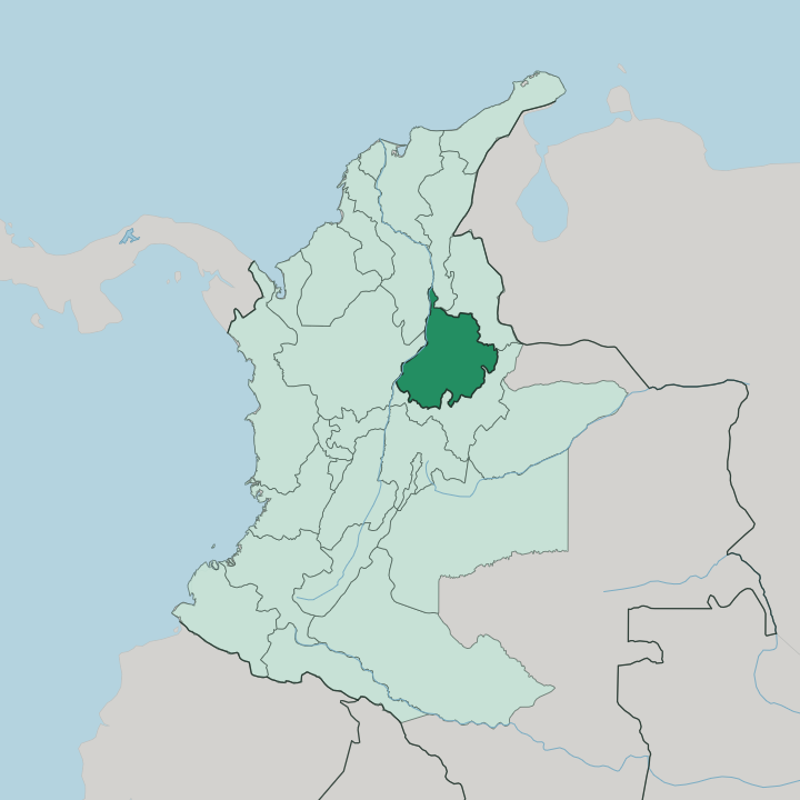
Towns & cities in Departamento de Santander
Pick a town or city — each links to where to stay.
Two bases split most trips through Santander. Bucaramanga sits in the north, the capital and largest city, an easy landing point with a steady spring-like warmth and the department's widest choice of rooms. San Gil is the other.
That riverside town on the Fonce is the launchpad for rafting, caving and paragliding, and travellers chasing the Chicamocha Canyon and the outdoors settle there. Barichara, a short hop from San Gil, trades adrenaline for quiet colonial lanes. Pick Bucaramanga for city comforts; pick San Gil when the canyon and the rivers are why you came.
About Departamento de Santander
Adventure and altitude define Santander.
What is Departamento de Santander known for?
The department rises off the Magdalena River onto the western slope of the Cordillera Oriental, and its centrepiece is the Chicamocha Canyon, a gorge cut by the Chicamocha River that ranks among the deepest on the planet. Bucaramanga anchors the north as capital. To the south, San Gil draws rafters and paragliders while Barichara keeps its colonial stone streets.
This is Colombia's home of adventure sport.
Where is Departamento de Santander?
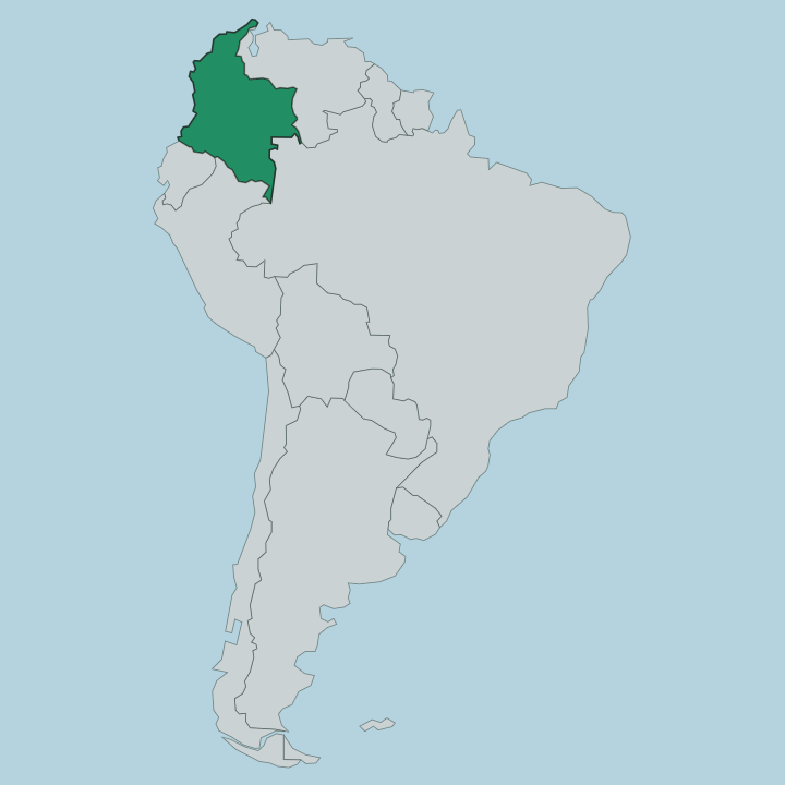
Santander occupies the north-centre of Colombia, on the western flank of the Cordillera Oriental in the Andes. The land tilts hard from edge to edge. Along the western boundary the Magdalena River runs low and hot through the valley floor, dropping under a hundred metres, while the central and eastern ground climbs past three thousand metres into cool mountain air.
That range in a single department is the whole story of its geography. The Chicamocha River saws through the middle of it, and over a long course it has opened the Chicamocha Canyon, a gorge that plunges roughly two thousand metres from rim to river. Bucaramanga stands in the north on a plateau above the Río de Oro.
To the south the smaller Fonce River gathers at San Gil before joining the wider drainage. Boyacá borders Santander to the south, and the Magdalena Valley separates it from Antioquia to the west. Slopes shape almost everything here.
Roads switchback, towns perch on ridges and terraces, and flat ground is the exception rather than the rule across this stretch of the Colombian Andes.
What is Departamento de Santander like?
Santanderean culture carries a reputation for bluntness and grit, a temper locals trace to the mountain frontier and the independence fights fought on it. Food tells much of the story. The hormiga culona, a fat leaf-cutter ant harvested in the spring rains, is toasted and eaten as a delicacy that reaches back to the Guane people who worked these hills long before the Spanish arrived.
Fritanga rules the weekend table around Girón, a groaning platter of fried pork and sausage piled over plantain and yuca that families share for hours. Barichara draws artisans and stonemasons who keep its ochre streets in period order. Spanish is the everyday language, spoken with a directness Colombians recognise on the first sentence.
Craft runs deep in the south. Wool and fique fibre are still worked into blankets and bags in the small towns of the Guanentá country. The Guane legacy survives in place names, weaving and the ant harvest itself.
Music, markets and church plazas hold the social life together, from the parks of Bucaramanga to the colonial squares further south. Identity here is stubborn, regional and proud.
What is the history of Departamento de Santander?
Rebellion runs through Santander's past. In 1781 the town of Socorro rose against Spanish taxes in the Comunero Revolution, an uprising that spread across New Granada and earned the town its name as a cradle of American liberty. The Guane people had farmed these slopes for centuries before that, until Spanish settlement pushed them aside.
The federal State of Santander was drawn together in 1857 from the old provinces of Socorro and Pamplona, becoming a department under the constitution of 1886. Its independence-era temper still colours the region.
What is the climate of Departamento de Santander?
Santander's weather follows its elevation. Bucaramanga sits high enough to hold a steady spring-like warmth all year, one reason it wears the nickname City of Parks so easily. Season barely matters.
Drop toward the Magdalena River and the valley turns hot and humid; climb into the Cordillera Oriental and the air cools sharply toward the páramo. Rain arrives in two wetter spells rather than one long season, and the Chicamocha Canyon stays dry and sun-baked at its floor while the ridges above catch the cloud.
How do you get to Departamento de Santander?
Most travellers fly into Bucaramanga. Palonegro International Airport sits on a plateau a few kilometres west of the city, linking Santander to Bogotá, Medellín and the coast by short domestic hops. From the terminal a winding descent drops into the capital below.
Long-distance buses climb up from the Magdalena River valley and down from Boyacá to the south, and the main highway threads riders straight over the Chicamocha Canyon on its way to San Gil and Barichara. Mountain roads make every overland leg slower than the map suggests.
Good for
Updated July 2026