Colombia
Departamento de Cundinamarca, Colombia — Towns & Travel Guide


Cundinamarca wraps the Eastern Cordillera around Bogotá, from the cold savanna down to the warm Magdalena valley.
Find your area →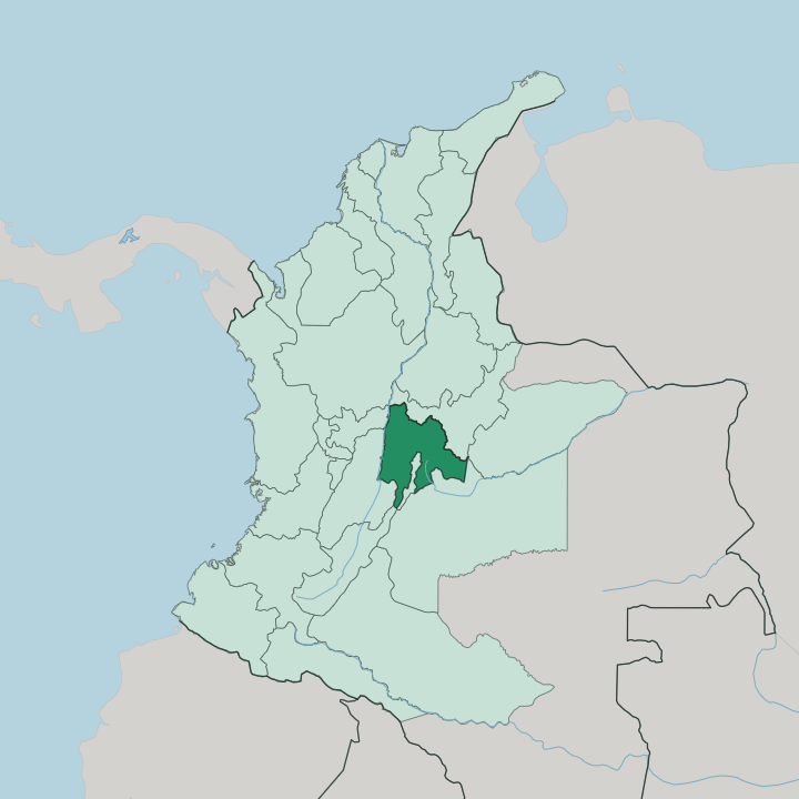
Towns & cities in Departamento de Cundinamarca
Pick a town or city — each links to where to stay.
Bogotá is the practical base. The airport, the buses and the main roads out all begin there, and the day-trips fold back to it each night. From the cold savanna, Zipaquirá makes the northern stop for the Salt Cathedral and the mine galleries beneath the town.
Girardot is the other pull. Drop off the plateau toward it and the warm valley of the Magdalena River delivers the hot-country weekend Bogotanos have kept for generations. Base in Bogotá for museums and flights; go up to Zipaquirá for salt and savanna, or down to Girardot for the heat.
About Departamento de Cundinamarca
The Salt Cathedral is the signature draw.
What is Departamento de Cundinamarca known for?
Miners carved it into the old workings under Zipaquirá, where the Muisca traded rock salt long before the Spanish ever reached the plateau. Bogotá sits inside the department yet governs itself. Most trips out of the capital run into Cundinamarca within the hour.
Lake Guatavita lies here too, the still green crater the El Dorado legend grew from. Weekenders escape south. They drop off the cold plateau toward Girardot for heat by the Magdalena River, an easy world away from the capital's grey.
Where is Departamento de Cundinamarca?
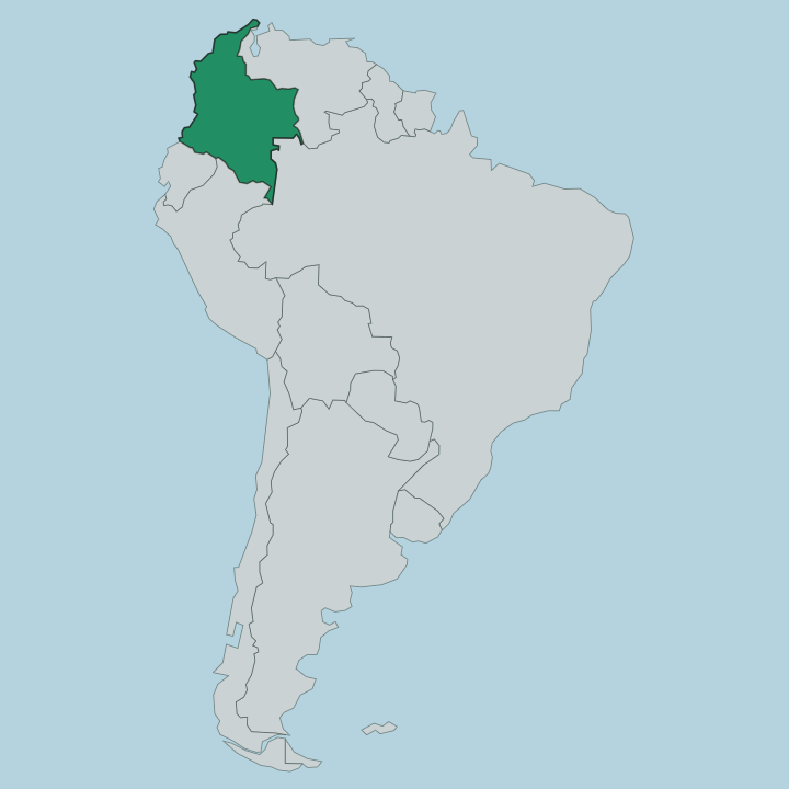
Cundinamarca fills the centre of Colombia, draped across the Cordillera Oriental, the widest branch of the Colombian Andes. Bogotá stands in the middle of it. The city rides a high plateau called the Bogotá savanna, the flattest and best-known reach of the Altiplano Cundiboyacense, cold and level at well over two kilometres of elevation.
West of that plateau the land breaks downward in long ridges and switchback roads toward the Magdalena River, which forms the department's western edge as it runs north through the country's core. Boyacá lies to the north, Tolima across the river to the south-west, and the vast eastern plains fall away toward the Orinoco basin beyond the mountains. That vertical spread is the whole point of the place.
From the páramo grasslands on the highest ridges down to the warm valley floor around Girardot, the land drops through every Andean climate belt in the span of a short drive. The savanna towns sit in the cold zone near the capital. The hot country waits below.
Rivers off the Cordillera Oriental gather westward and feed the Magdalena, and the roads follow them down. Little in Cundinamarca is truly flat except the old lakebed of the savanna itself.
What is Departamento de Cundinamarca like?
This was Muisca country long before it was Spanish. The people the invaders called the Chibcha held the savanna and its uplands, ruled from settlements the conquistadors later built their own towns over. Their memory is everywhere in Cundinamarca.
It surfaces in the salt the Muisca cut from the ground at Zipaquirá, in the placenames that keep their sounds, and in Lake Guatavita, the crater lake where the gilded-chief rite gave Europe the El Dorado dream. Spanish is the language now, spoken across the department as it is across Colombia. The culture that grew on the plateau leans toward the highland Andes rather than the Caribbean coast.
Cold-climate crops, cattle on the savanna pasture, and market towns spaced along the old roads set the rhythm. Bogotá anchors all of it. The capital holds the great museums and concert halls, yet much of the character lives outside it.
It lives in the salt town of Zipaquirá and the flower fields around Fusagasugá as much as in any gallery. Down in the warm valley the mood shifts entirely, toward river towns, weekend heat, and a slower pace than the cold capital keeps. One department, many altitudes, one long inheritance.
What is the history of Departamento de Cundinamarca?
The name is older than the department. Cundinamarca comes from the Chibcha tongue of the Muisca, read by later writers as the condor's nest, and it was fixed to the region long after the Spanish overran the Muisca chiefdoms of the plateau. The modern department took its present form in 1857, carved out as Colombia settled the map of its interior.
Bogotá, the seat the Spanish founded on Muisca ground, became its capital and the country's alike. Salt, savanna and the road down to the Magdalena River shaped the rest.
What is the climate of Departamento de Cundinamarca?
Altitude sets the weather here, not the calendar. On the Bogotá savanna the air stays cool and damp the year through, with grey mornings, quick afternoon rain, and nights that turn genuinely cold on the high plateau of the Altiplano Cundiboyacense. Climb higher onto the páramo ridges of the Cordillera Oriental and it grows colder and wetter still.
Drop toward the Magdalena River around Girardot and the belt flips to steady tropical heat. One department holds both.
How do you get to Departamento de Cundinamarca?
Almost everyone comes through Bogotá first. The capital holds the region's international airport, and its bus terminals send out the roads that thread up and down the Cordillera Oriental to the rest of the department. Zipaquirá sits a short run north across the savanna, reachable by road or by the old tourist train.
Girardot lies a longer haul south-west, dropping off the plateau toward the Magdalena River. From the capital, road is how you reach the rest.
Common questions
What is the best area to stay in Departamento de Cundinamarca?
Bogotá: the airport and every road out of Cundinamarca.
Good for
Updated July 2026