Colombia
Departamento de Sucre, Colombia — Towns & Travel Guide


Sucre is a Caribbean department of Colombia, its coast on the Gulf of Morrosquillo and its interior a mix of savanna and low hills.
About Departamento de Sucre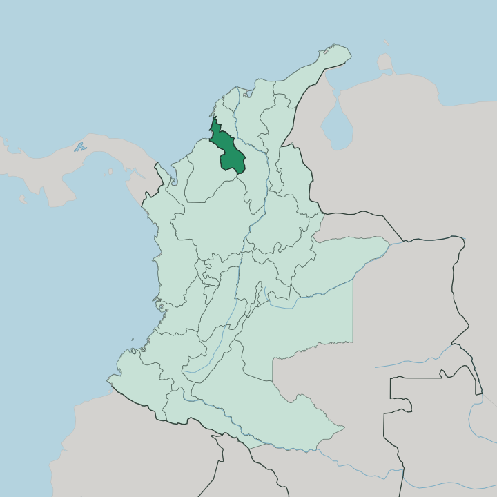
Towns & cities in Departamento de Sucre
Pick a town or city — each links to where to stay.
Most travellers base themselves on the coast. Tolú is the busier of the two beach towns on the Gulf of Morrosquillo, with boats out to the Islas de San Bernardo, while Coveñas sits quieter down the same gulf. Sincelejo, back from the water in the Montes de María foothills, is the practical base for arrivals and for the Corralejas.
The southern San Jorge wetlands are thin on beds and hard to reach. Choose the gulf for the sea, Sincelejo for the capital and the festival.
About Departamento de Sucre
Sucre is beach country and cattle country at once.
What is Departamento de Sucre known for?
Its short Caribbean shore runs along the Gulf of Morrosquillo, where Tolú and Coveñas draw most of the visitors and boats leave for the Islas de San Bernardo. Inland, the flat Sabanas savanna and the low ridges of the Montes de María rise behind Sincelejo, the capital and largest city. The name most travellers hear first is Corralejas, the raucous January bull festival that fills Sincelejo each year.
Where is Departamento de Sucre?
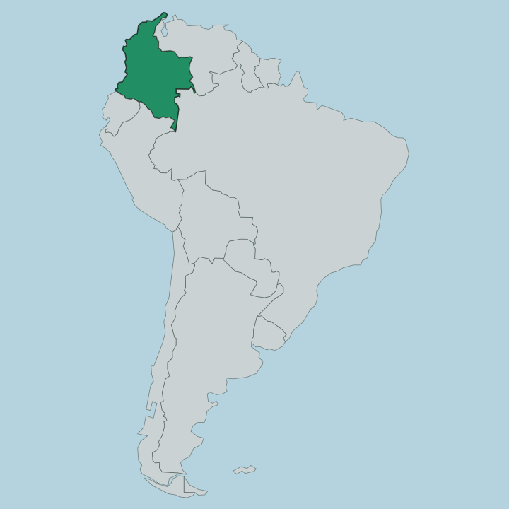
Sucre sits in the Caribbean lowlands of northern Colombia. It is one of the smaller departments. Córdoba lies to the west, Bolívar wraps around it to the east, and the Caribbean Sea forms the short north-western edge along the Gulf of Morrosquillo. Almost the whole department is flat.
Its land is coastal plain, broken only by the low ridges of the Montes de María in the north-east, behind the capital at Sincelejo. Geographers split Sucre into five parts, and each has its own feel. Along the Morrosquillo coast lie the beaches and the ports of Tolú and Coveñas.
The open cattle savanna of the Sabanas, dotted with the market towns of Corozal and Sampués, fills the flat centre of the department. The Montes de María are the hill country. To the south, the San Jorge river and the wetlands of La Mojana flood a low, water-logged basin that drains toward the Cauca and the Magdalena.
Rivers rule the south the way the sea rules the coast. Between them lies the dry savanna that gives the middle of the department its character.
What is Departamento de Sucre like?
Sucre wears its Caribbean coast culture openly. Its identity was shaped by three peoples: the Zenú, who farmed and engineered this land long before the Spanish; Afro-Colombian communities descended from the enslaved; and settlers of Spanish stock alongside the Syrian-Lebanese traders who later reached the savanna towns. That mix shows up on the plate.
Mote de queso, a soured cheese-and-yam soup, and sancocho de gallina are savanna staples, and cassava turns up beside roast meat at every table. Music carries the region. The gaita flutes and drums of the Caribbean lowlands sound through the fandango parades, and hammocks woven in Morroa hang in doorways across the Montes de María.
The loudest expression of all is Corralejas. Each January, Sincelejo throws open a ring of makeshift wooden stands and holds days of bull-running, dancing and fandango that draw crowds from across the department. It is chaotic, old, and unmistakably local.
Craft and cattle underpin the quieter days. The savanna livestock trade built the market towns, and the artisan workshops of Morroa and Sampués keep older skills alive.
What is the history of Departamento de Sucre?
The Zenú came first. On the flood-prone basin of the San Jorge river they built one of the great engineering works of pre-Columbian America, a vast net of canals that drained and irrigated the wetlands and controlled the seasonal floods across the plain for centuries. Spanish colonisation folded the land into the province of Cartagena, and for generations it was governed from Bolívar as its southern savanna.
Sucre became a department in its own right only late, carved out and formally created by law in 1966 with Sincelejo as its capital.
What is the climate of Departamento de Sucre?
Sucre is hot all year. Sitting in the Caribbean lowlands, it holds a warm tropical climate with little swing in temperature between one month and the next, days that hover around the high twenties whatever the season. The real calendar is rain, not heat.
A dry stretch from December into April brings the clearest skies and the peak beach season on the Gulf of Morrosquillo, while the middle of the year turns wet, and the San Jorge basin and the Mojana wetlands to the south flood as the rivers rise. Pack for the sun.
How do you get to Departamento de Sucre?
Most visitors fly into Las Brujas, the small airport at Corozal a short drive from Sincelejo, which runs daily flights to Bogotá and Medellín. Many others come overland. Sucre sits on the main Caribbean coast route, and buses reach Sincelejo from Cartagena to the north and Montería to the west, as well as from Bogotá and Medellín.
From the capital it is a short hop down to the beach towns of Tolú and Coveñas on the gulf. Boats from Tolú carry travellers on to the Islas de San Bernardo.
Good for
Updated July 2026