Colombia
Departamento del Putumayo, Colombia — Towns & Travel Guide


Putumayo is where the Colombian Andes fall away into the Amazon, a frontier department of rivers, cloud forest and yagé country.
About Departamento del Putumayo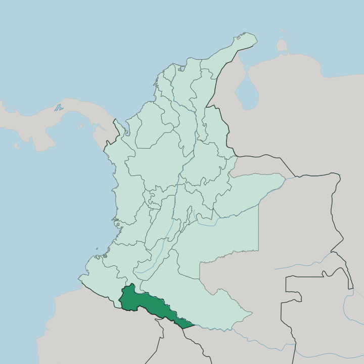
Towns & cities in Departamento del Putumayo
Pick a town or city — each links to where to stay.
Mocoa is the practical first base. The capital sits in the Andean foothills, within reach of the Fin del Mundo waterfall and the fast rivers of the Caquetá basin, and it holds most of the department's beds. West and uphill, the Sibundoy Valley is a cool highland bowl at the source of the Putumayo River, where the Kamëntšá and Inga keep their ceremonial traditions.
Downstream to the south lies Puerto Asís, the largest town and a working river port on the edge of the lowland forest. Choose Mocoa for waterfalls, the Sibundoy Valley for highland culture, and Puerto Asís when you want the river and the deep Amazon.
About Departamento del Putumayo
What is Departamento del Putumayo known for?
Putumayo is Colombia's threshold to the Amazon. The land drops here. In its west the Andes climb steeply toward Nariño and Cauca, and then the ground unfolds eastward into the flat, rain-fed forest that gives the department its warm character.
The Putumayo River, which lends the department its name, runs down to the Amazon along the frontier with Ecuador and Peru. Mocoa, the capital, sits in the foothills; Puerto Asís, the busiest town, works the riverbank downstream. Indigenous ceremony and jungle waterfalls draw the travellers who make it this far south.
Where is Departamento del Putumayo?
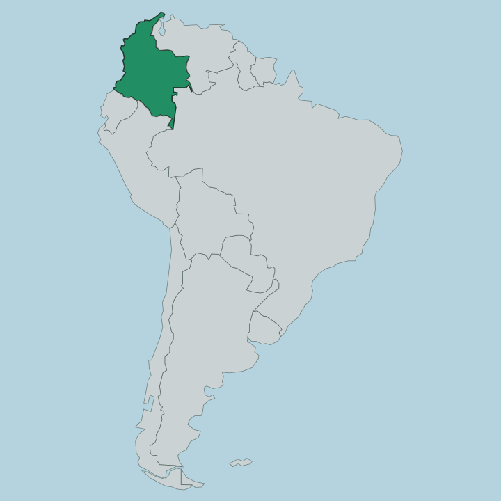
Putumayo lies in the far south-west of Colombia, pressed against the borders of Ecuador and Peru. It is a hinge of a place. In the west the Andes rise abruptly to ridgelines near three thousand metres, along the seam it shares with Nariño and Cauca.
From those heights the land tips eastward and downward, shedding altitude until it flattens into the warm, forested lowlands of the Amazon that fill most of the department. This is the Andean-Amazonian piedmont, the exact belt where the mountains dissolve into rainforest. Two great rivers frame it.
The Caquetá River runs along the north-east, a tributary that reaches the Amazon far downstream in Brazil, where it takes the name Japurá. The Putumayo River rises in the Andes above the Sibundoy Valley and traces much of the southern frontier with Ecuador and Peru before it too feeds the Amazon. Mocoa, the capital, sits in the foothills within the Caquetá basin.
Puerto Asís lies south of it on the bank of the Putumayo, deeper into the lowlands. Rivers, not roads, are the old highways here, and the forest closes in beyond the last cleared pasture.
What is Departamento del Putumayo like?
Putumayo carries one of the densest concentrations of yagé-using peoples anywhere in the Amazon. The Kamëntšá of the Sibundoy Valley speak a language isolate tied to no other tongue on earth, and their taitas keep botanical gardens of medicine plants tended across generations. Beside them the Inga speak Inga Kichwa, a northern branch of the old Quechua that the Inca once carried this far.
Siona and Cofán communities hold their own ceremonial lines further into the lowlands. Yagé binds them. That plant medicine, the bitter vine brew known elsewhere as ayahuasca, is the department's living signature, and pilgrims come from across Colombia and abroad to sit with its healers.
Mestizo and Afro-Colombian settlers layer over the Indigenous base, most of them drawn in by rubber, oil and river trade over the last century. Spanish is the everyday language, alongside the surviving Indigenous tongues. The culture here reads as forest culture, worked out along rivers and under canopy rather than in plazas.
What is the history of Departamento del Putumayo?
Putumayo became a full department of Colombia only in 1991, when a new constitution raised what had long been a remote intendency into a self-governing region. Its story is older and harder than that date suggests. Around the Putumayo River in the late nineteenth and early twentieth centuries came the rubber boom, and with it one of the Amazon's cruellest chapters, as rubber barons enslaved and decimated the Kamëntšá, Siona, Cofán and other peoples.
Oil and settlement followed. The forest frontier drew in migrants and left the department scarred and contested through much of the last century.
What is the climate of Departamento del Putumayo?
Climate here follows the drop from the Andes. The Sibundoy Valley and the high western rim stay cool and misty, hovering around the mid-teens in the cloud forest at the head of the Putumayo River. Descend east toward Mocoa and Puerto Asís and the air turns hot and wet, a true equatorial lowland where the mean sits in the mid-twenties and rain falls heavily through the whole year.
There is no dry season worth the name in the lowlands. Wet.
How do you get to Departamento del Putumayo?
Most travellers fly. SATENA runs small aircraft from Bogotá to Villagarzón and Puerto Asís, the quickest way over the Andes and into the department. The overland alternative climbs from Pasto in Nariño and then drops through the mountains to Mocoa on a steep, switchbacking road that takes most of a day.
From Mocoa a bus carries on south to Puerto Asís, where the river takes over and boats push into the lowland reaches of the Putumayo River. Come by plane if you can.
Good for
Updated July 2026