Algeria
Wilaya de Jijel, Algeria — Towns & Travel Guide


Jijel Province lines Algeria's Mediterranean coast, where the Babors mountains drop into the sea along the cliff-cut Corniche Jijelienne.
About Wilaya de Jijel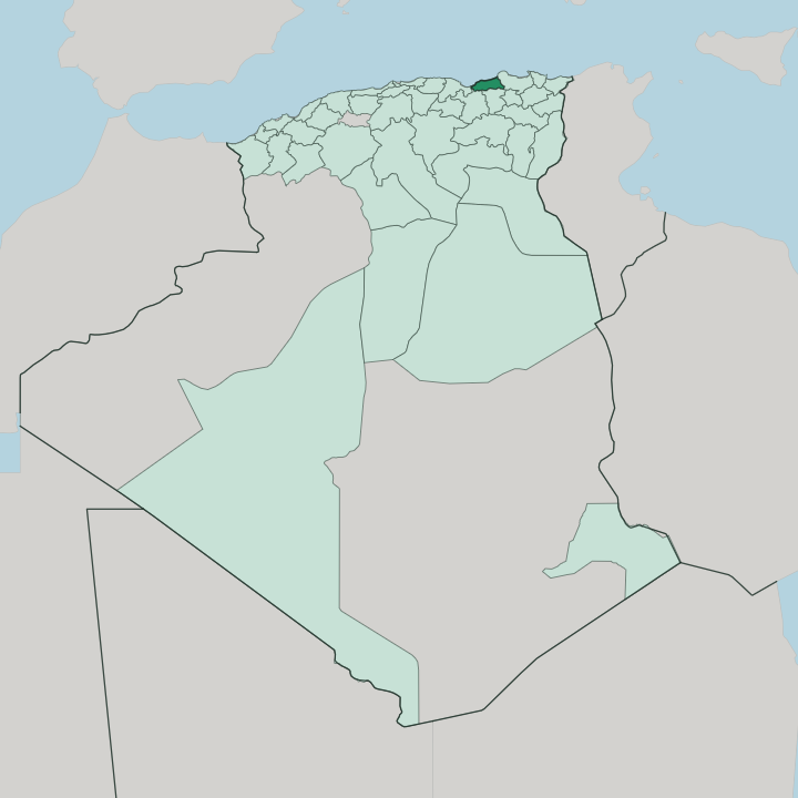


Towns & cities in Wilaya de Jijel
Pick a town or city — each links to where to stay.
Most trips start in Jijel. The provincial capital sits on the old harbour of Igilgili and makes the obvious base for the Corniche Jijelienne, whose coves and beaches run west toward Ziama Mansouriah. Taher, east along the shore, carries the industry, Ferhat Abbas Airport and the deep-water port of Djen Djen.
Inland, the mountains take over. For cork forests and Barbary macaques, Taza National Park backs the coast west of the city.
About Wilaya de Jijel
The coast does the talking here.
What is Wilaya de Jijel known for?
Along the Corniche Jijelienne the Babors mountains break off in capes, cliffs and hidden coves, and fine-sand beaches string the bays between them for swimmers and summer crowds from across Algeria. Taza National Park guards the largest cork oak forest in Algeria and a troop of Barbary macaques. Underground, the Grotte Merveilleuse burrows beneath Ziama Mansouriah into limestone chambers kept cool through the year.
Where is Wilaya de Jijel?
Jijel Province hugs Algeria's Mediterranean coast. It fills a stretch of north-eastern Algeria between the Babors mountains and the sea, its shoreline running for 120 kilometres of capes, cliffs and pocket beaches. Béjaïa lies to the west and Skikda to the east. The inland provinces of Sétif, Mila and Constantine climb away to the south.
The Mediterranean Sea closes the north. Behind the shore, the forested heights of the Babors climb well over a thousand metres, and the mountain frequently falls straight to the water. That collision of rock and sea is the Corniche Jijelienne, the cliff-hung road running west of the provincial capital.
Flat ground is scarce. West of the city, the cork oak forests of Taza National Park spill down cliffs more than a thousand metres high toward the shoreline. The narrow coastal plain widens only around the city of Jijel and again inland toward the town of El Milia, where the ground finally eases back from the mountains.
The whole province belongs to Little Kabylia, the Petite Kabylie of the Babors, Berber country of cork oak forest, deep gorges and hillside villages above the sea.
What is Wilaya de Jijel like?
Two tongues share the province. The city of Jijel and its shoreline speak Jijel Arabic, an old pre-Hilalian dialect unlike the Arabic of most of Algeria, while the Babors highlands behind them speak Kabyle, the Berber language of Little Kabylia. Both belong to one mountain world.
Villages of the Kabyle interior keep the customary assemblies, the cork and olive harvests and the tight clan life of the Babors. The interior is old Kutama land, the Berber confederation that once carried the Fatimids to power out of these mountains. Craft runs to pottery, basketry and silver, sold in the weekly markets of the mountain towns.
The coast lives differently. Fishing ports, cork depots and beach cafés set the rhythm of the shoreline towns, from Jijel itself west to Ziama Mansouriah. Its food leans on the sea and the grove: grilled fish along the shore, olive oil and couscous up in the hills.
Summer upends all of it. Through the hot months, families from Constantine, Sétif and the interior cities pour down to the beaches of the Corniche Jijelienne, and the shore fills with visitors.
What is the history of Wilaya de Jijel?
The story of Jijel starts as Igilgili. Phoenician traders founded the port, and under the emperor Augustus Rome raised it to the rank of a colony, a working harbour on the Mediterranean Sea. Vandals, Byzantines, Umayyads, Genoese and Ottomans all held it in turn.
The corsair Hayreddin Barbarossa seized the town in the sixteenth century and pulled it into the Ottoman world. France later ruled it as Djidjelli.
What is the climate of Wilaya de Jijel?
Jijel has one of the wettest climates in Algeria. Winters run cool and rainy as storms off the Mediterranean Sea pile against the Babors and drop their rain on the coast. By summer the Jijel coast bakes dry and hot.
That heavy winter rainfall feeds the cork oak and gall oak forests of Taza National Park, the greenest on the Algerian coast. The sea keeps the shore mild.
How do you get to Wilaya de Jijel?
Most travellers arrive through Taher. Jijel Ferhat Abbas Airport sits there, just east of the capital, with domestic flights linking the province to Algiers and the rest of Algeria. The deep-water port of Djen Djen handles the freight nearby.
By road, the coastal highway threads the Corniche Jijelienne west to Béjaïa and climbs inland to Constantine and Sétif. The mountains make every approach slow.
Good for
Updated July 2026