Algeria
Wilaya de tiaret kabas, Algeria — Towns & Travel Guide


Tiaret Province rolls across Algeria's High Plateaus, the steppe that cradled the Rustamid capital of Tahert and the Jedars tombs near Frenda.
About Wilaya de tiaret kabas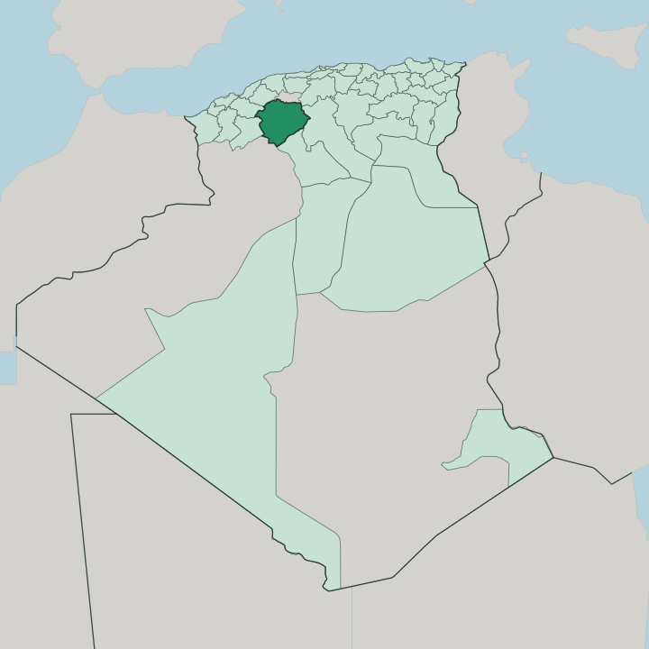


Towns & cities in Wilaya de tiaret kabas
Pick a town or city — each links to where to stay.
Tiaret, the wilaya's capital, holds nearly all the hotel beds and makes the obvious base. From there the province opens outward. Frenda sits a short drive south-west, the nearest town to the Jedars mausoleums, while Sougueur anchors the grain country to the south and Ksar Chellala holds the province's eastern edge.
Rooms thin out fast beyond the capital, so day trips run best from Tiaret itself. Choose the city if you want the stud farm, the museum and the Tahert ruins within easy reach.
About Wilaya de tiaret kabas
What is Wilaya de tiaret kabas known for?
Horses made this province's name. The National Stud Farm of Chaouchaoua, founded in 1874 on the edge of Tiaret, has bred Barb and Arab-Barb mounts across the High Plateaus for generations, and the surrounding wilaya is counted among the Maghreb's great breeding grounds. History carries as much weight.
Tahert, the Rustamid capital, once ruled the central Maghreb from these steppes, and thirteen pyramid-topped Jedars still stand on the hills above Frenda. Grain and grazing fill the rest.
Where is Wilaya de tiaret kabas?
Tiaret Province lies in the interior of northwestern Algeria, well back from the sea. Its ground is the High Plateaus. This is the wide belt of dry, tawny steppe that runs between two mountain walls, the Tell Atlas rising along the north and the Saharan Atlas closing the country off to the south, and the whole wilaya sits on that upland shelf around a thousand metres up.
The capital, Tiaret, stands at the southern foot of the Ouarsenis, on the slopes of Mount Guezoul. Algiers lies roughly two hundred and fifty kilometres to the north-east, and the Mediterranean coast about a hundred and fifty kilometres beyond the mountains. South and east of the capital the land opens into the Sersou, a broad grain plain worked since antiquity. Water is scarce and prized.
The Oued Mina rises near Frenda and drains north toward the Chelif, Algeria's longest river, while smaller wadis fill only after the winter rains. Seven provinces ring the wilaya. Relizane and Mascara border it to the west, Tissemsilt to the north, Saïda to the south-west, and the Saharan provinces of El Bayadh, Laghouat and Djelfa reach away to the south and east.
Ridges and djebels corrugate the plateau between Tiaret, Sougueur and Ksar Chellala.
What is Wilaya de tiaret kabas like?
The horse sits at the centre of local identity. Bred on the plateau since the days of the cavalry, the Barb and its Arab-Barb cross are paraded in the fantasia, the thundering charge of robed riders who fire muskets in unison at full gallop. The stud farm at Chaouchaoua keeps the old bloodlines going.
Away from the saddle, this is pastoral, grain-growing country, and daily life follows the flocks and the harvest across the steppe. Wool off those flocks is spun into carpets and the heavy woollen burnous. Its people are Arab and Amazigh, and both Arabic and Tamazight are heard across the wilaya.
Berber roots run especially deep. The Jedars raised by Amazigh kings, and the memory of Tahert as a seat of Ibadi scholarship, both belong to that older layer. The name itself is said to come from the Berber word for lioness, a nod to the Barbary lions that once hunted these hills.
Weekly souks in Tiaret, Frenda and Sougueur still draw the countryside in to trade sheep, wool and grain. Lamb over couscous is the plateau's staple.
What is the history of Wilaya de tiaret kabas?
Long before Islam, Amazigh chieftains raised the Jedars on the hills near Frenda, pyramid-tombs linked to the Romano-Berber kingdom that held the Ouarsenis in late antiquity. Its great age came next. From 776 the imam Abd al-Rahman ibn Rustam ruled a Rustamid state out of Tahert, an Ibadi theocracy whose libraries and caravans made it a power across the central Maghreb until Fatimid armies sacked the city in 909.
The town below grew around a French redoubt of 1845. The modern wilaya dates from a two-step redrawing: created in 1974, then pared back in 1984 when Tissemsilt was carved from its northern reaches.
What is the climate of Wilaya de tiaret kabas?
On Tiaret's High Plateaus, elevation dictates the climate. Up on the High Plateaus the climate turns semi-arid and continental, far harsher than the mild coast beyond the Tell Atlas. Summers are hot and parched, with dust blowing over the Sersou and the hottest afternoons down on the steppe touching forty degrees.
Winters bite the other way. Hard frost is normal on the higher ground around Tiaret and Frenda, and snow falls there most years. What rain comes falls mostly in winter and spring, and drought shadows the grain farmers of the plateau.
How do you get to Wilaya de tiaret kabas?
Most travellers reach the wilaya overland. The drive down from Algiers runs roughly two hundred and seventy kilometres south-west, climbing from the coast onto the plateau, and buses grind in daily from Oran, Relizane and Algiers. Bou Chekif, the province's own airport, sits a few kilometres east of Tiaret and handles the occasional domestic flight.
Up on the steppe, one main road threads the towns together, linking Tiaret with Frenda, Sougueur and Ksar Chellala.
Good for
Updated July 2026