Algeria
Wilaya de Tipaza, Algeria — Towns & Travel Guide


Wilaya de Tipaza runs along Algeria's coast just west of Algiers, taking in Roman Tipasa, Mount Chenoua and the fertile Mitidja plain.
About Wilaya de Tipaza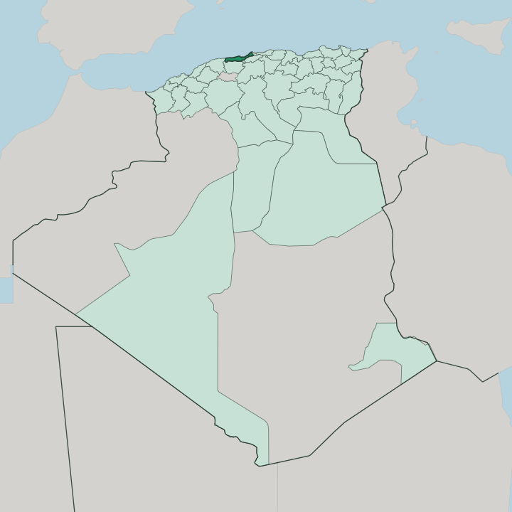


Towns & cities in Wilaya de Tipaza
Pick a town or city — each links to where to stay.
Most visitors base themselves in Tipaza town, steps from the seaside archaeological park and the fishing harbour beneath Mount Chenoua. The beaches lie west. Chenoua Plage and the coves below the mountain draw summer crowds out from Algiers, while Cherchell further along the coast trades sand for Roman streets and a museum of classical marbles.
Koléa sits inland on the Sahel hills above the Mitidja plain, an Ottoman town well back from the water. Pick the town for the ruins, the Chenoua shore for a swim.
About Wilaya de Tipaza
Roman ruins define the province.
What is Wilaya de Tipaza known for?
The ancient port of Tipasa spreads along the shore in a seaside archaeological park, its forum, baths and Christian basilicas earning a place on the UNESCO World Heritage list in 1982. Just inland stands the Royal Mausoleum of Mauretania, the circular stone tomb of King Juba II and Queen Cleopatra Selene II. Mount Chenoua rises straight from the sea to the west.
West again lies Cherchell, the Roman Caesarea, whose museum holds some of North Africa's finest classical sculpture.
Where is Wilaya de Tipaza?
Wilaya de Tipaza holds a strip of the central Algerian coast, immediately west of the capital at Algiers. The Mediterranean forms its whole northern edge. The province stretches from the Mazafran River in the east, which drains the Mitidja plain and marks the border with Algiers, west to the wooded hills around Damous.
Fouka guards the eastern shore, the stretch nearest to Algiers. Behind the shore the land climbs fast. The Sahel hills wall the coast off from the broad Mitidja plain that opens inland to the south-east, so the whole province tilts between mountain and sea.
Mount Chenoua is the defining landform. The forested massif drops straight into the water just west of Tipaza town, sheltering a run of coves and small fishing ports. Cherchell and Gouraya carry the coast on westward toward Damous, past headlands, low cliffs and short river mouths.
Inland the Mitidja is the most fertile plain in Algeria, planted with vineyards, citrus groves and market gardens fed by the Mazafran and its tributaries. Koléa and Hadjout sit on the plain's western rim. Mountain, plain and shore pack into one narrow band.
What is Wilaya de Tipaza like?
The province wears its past in layers. Phoenician traders, Roman colonists, Byzantine garrisons, Ottoman corsairs and French settlers each left a mark along this coast, and the ruins of one often sit beside the buildings of the next. Arabic is the everyday language.
In the villages on Mount Chenoua, though, people still speak Chenoua, a Berber tongue of the Amazigh Chenoua who have farmed and fished the massif for centuries. French lingers from the colonial years, useful in the market and the café. Cherchell keeps the deepest trace, its museum of Roman and Greek marbles among the best on the African continent.
Life here bends toward the sea. Weekend crowds come out from Algiers for the beaches below the Chenoua, for grilled fish at Tipaza's harbour and for a walk through the seaside ruins at dusk. The plain behind supplies the table: table grapes, wine and oranges, plus early vegetables off the Mitidja.
Albert Camus knew this shore well, and set an essay among the wild absinthe and warm stone of the Roman site, where a stele still carries his line about glory. Ancient and ordinary sit side by side.
What is the history of Wilaya de Tipaza?
Tipasa began as a Phoenician trading post on the shore. Rome took it in the first century, and the emperor Claudius raised the port to a colony inside Mauretania Caesariensis, the Roman province whose capital Caesarea is now Cherchell. On a hill inland, King Juba II and Queen Cleopatra Selene II were laid in the great circular tomb now called the Royal Mausoleum of Mauretania.
Christianity came early, leaving basilicas above the sea. Vandals sacked the town around 430, and after Byzantine and Arab centuries it was refounded in 1857. The province itself dates only from 1984.
What is the climate of Wilaya de Tipaza?
The coast has a Mediterranean climate, hot and dry through the long summer, mild and wet in winter. The sea steadies it. Rain falls mostly between autumn and early spring, greening the Mitidja and the slopes of Mount Chenoua, while July and August stay rainless and bright.
Sea breezes off the water take the edge off the summer heat along the shore. Spring and autumn are the kindest seasons for the ruins, when the light is soft and the crowds from Algiers thin out.
How do you get to Wilaya de Tipaza?
Tipaza province has no airfield of its own. Nearly everyone arrives through Algiers, whose Houari Boumediene Airport lies east of the capital, then drives west along the coast or the motorway that skirts the Mitidja. Tipaza town sits about an hour from the city by road.
Buses and shared taxis run the coast route out to Cherchell, Gouraya and Damous in the west. The old shore road links the beaches and the ruins the whole way along.
Good for
Updated July 2026