Estonia
Ida-Virumaa, Estonia — Towns & Travel Guide


Ida-Virumaa is Estonia's north-eastern corner, where the Narva River draws the border with Russia and oil shale built the towns.
Find your area →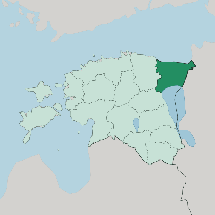
Towns & cities in Ida-Virumaa
Pick a town or city — each links to where to stay.
 Estonia
Narva
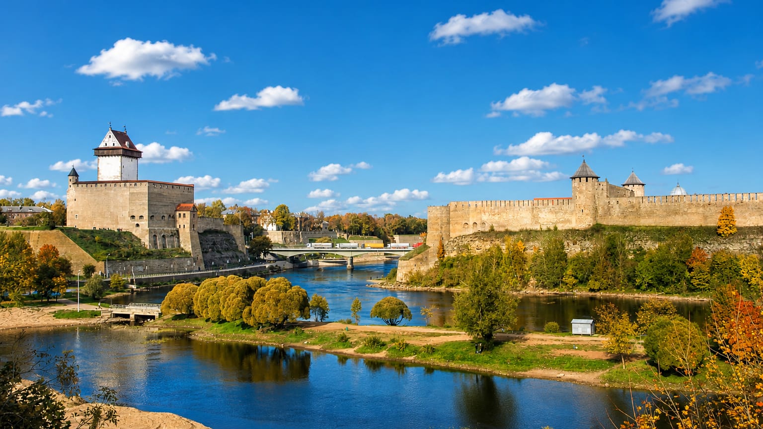
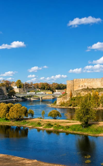
Hermann Castle rises above the Narva river, the easternmost city in Estonia, set in Ida-Virumaa on the west bank of the border stream.Where to stay →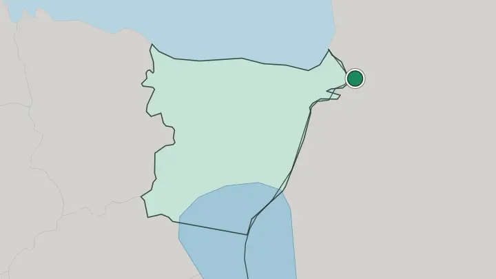
About Ida-Virumaa
Two things define this county.
What is Ida-Virumaa known for?
The first is the Narva River, which forms the whole eastern border with Russia and carries the medieval castle at Narva staring across the water at the Russian fortress of Ivangorod. The second is oil shale, the brown rock mined here for more than a century to fuel Estonia's power stations and pile up the grey ash hills above Kohtla-Järve and Kiviõli. Along the northern edge runs the Gulf of Finland, with the long sand beach at Narva-Jõesuu and the limestone cliffs of the Baltic Klint.
It is the one county where most people speak Russian at home.
Where is Ida-Virumaa?
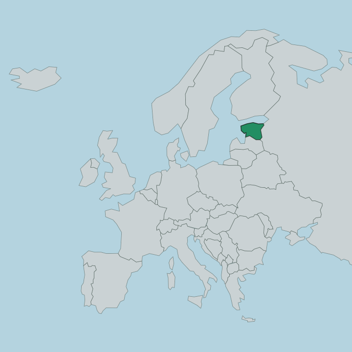
Ida-Virumaa fills the north-eastern tip of Estonia, the last county before Russia. Its whole eastern edge is a river. The Narva flows north for roughly 77 kilometres out of Lake Peipus, the huge lake shared with Russia in the south, and empties into the Gulf of Finland at the top of the county.
That river is the international border. On one bank stands the Estonian town of Narva; on the other, the Russian town of Ivangorod, their two old fortresses within sight of each other across the current. The northern boundary is the sea.
Along the Gulf of Finland the land breaks off in the Baltic Klint, a limestone escarpment whose cliffs at Ontika climb to some 54 metres, the highest in the country. Valaste, the tallest waterfall in Estonia, drops over that same ledge. Inland the surface is low and flat, underlain by the oil shale that made the county's fortune, and pocked by the mines and quarries that dug it out.
Lääne-Viru County lies to the west and Jõgeva County to the south-west. Jõhvi, near the middle, is the administrative seat, while Narva anchors the far eastern corner on the river. Few Estonian counties pack so much border and so much industry into one stretch of coast.
What is Ida-Virumaa like?
This is the most Russian-speaking part of Estonia. It is the only county where Russians make up the majority, and in Narva, Sillamäe and Kohtla-Järve that share climbs far higher, so the street signs are Estonian but the talk in the shop is usually Russian. Much of that population arrived in the Soviet decades to work the oil shale mines and the chemical plants, and the towns they built have a heavy Soviet-era feel, laid out to a plan, unlike anywhere else in the country.
Industry shaped the whole character here. Kohtla-Järve grew up around shale processing and still smells of it; the ash hills above Kiviõli are so large that one has been turned into a ski and sledging slope. Sillamäe was a closed nuclear-materials town under the Soviet Union, and its centre is a rare, near-intact piece of Stalinist planning.
The Estonian, Russian and older Baltic-German layers all sit on top of one another here. Narva was flattened in the Second World War and rebuilt, yet its castle survived, and the border it guards still runs live along the river. Visitors come for exactly that mixture: the mining heritage, the Soviet townscapes, and a frontier you can stand on and look across.
What is the history of Ida-Virumaa?
The story turns on the river. A border stronghold rose at Narva under Danish rule in the mid-13th century, first mentioned in writing in 1256, and grew into a Hansa trading town holding Lübeck rights. When Moscow built the fortress of Ivangorod on the opposite bank in 1492, the two castles froze the frontier in stone.
Swedes, then the Russian Empire, then the Soviet Union held the county in turn, and it was Soviet geologists who turned its buried oil shale into an industry that drew workers from across the union. Narva was largely destroyed in 1944 and rebuilt, and when Estonia regained independence the old river once again became an international border.
What is the climate of Ida-Virumaa?
The cold sinks its teeth into Ida-Virumaa, where Estonia's mild coast gives way to a harder continental winter inland. Inland, the county sits where Estonia's mild coastal weather gives way to something more continental, so the cold sets in hard and snow lies for weeks. The Gulf of Finland can freeze along the northern shore, and the beach at Narva-Jõesuu that fills with bathers in July stands silent and iced over in January.
Summers are short, green and comfortable. They stay warm enough that the old spa towns still draw people to the sand. Rain falls through the year rather than in any one season.
How do you get to Ida-Virumaa?
Most travellers come from Tallinn. The main road and the railway both run east along the northern coast from the capital, through Jõhvi, and on to Narva at the very end of the line against the Russian border. Trains and buses make that run daily, and the county is easy to reach without a car.
Coming from the Russian side means crossing the Narva River at the border bridge, when that crossing is open. Once inside, a car helps for the coast and the mining sites, since the beaches, cliffs and ash hills lie scattered between the towns.
Common questions
What is the best area to stay in Ida-Virumaa?
Narva: the medieval castle and the Russian border.
Good for
Updated July 2026