Estonia
Jõgevamaa, Estonia — Towns & Travel Guide


Jõgevamaa is an eastern Estonian county of drumlin ridges, bogs and old lakeside fishing towns along the shore of Lake Peipus.
About Jõgevamaa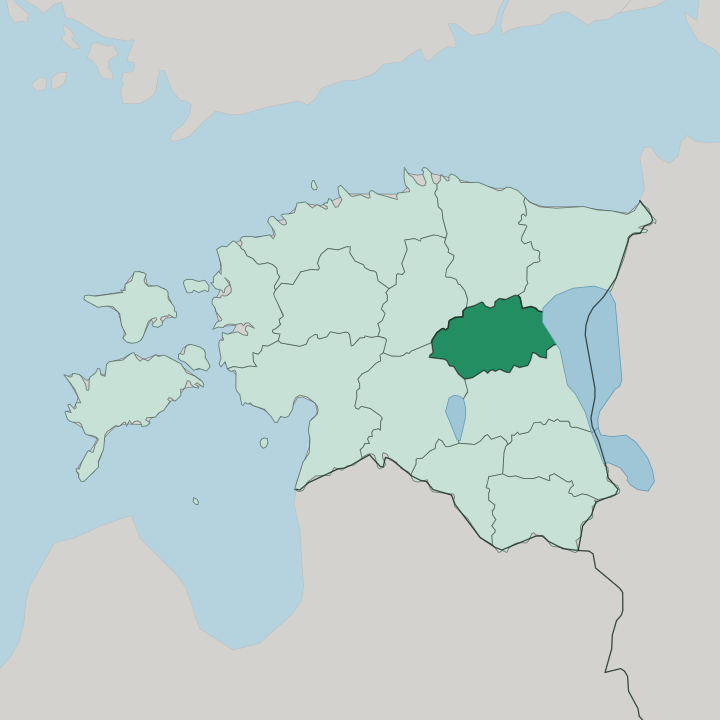
Towns & cities in Jõgevamaa
Pick a town or city — each links to where to stay.
Beds cluster in the three towns. Each frames a different side of the county, from the railway seat in the middle to the castle in the west and the fishing shore in the east. Jõgeva, the administrative seat astride the Tallinn-Tartu railway, is the practical base for reaching the drumlin lakes and the interior reserves.
Põltsamaa suits a stay built around its castle ruins and fruit-wine cellars. Mustvee puts you on the Lake Peipus shore, among the Old Believer prayer houses. Pick your side.
Choose Jõgeva for rail links, Põltsamaa for the castle and wine, or Mustvee when you want to wake beside the lake.
About Jõgevamaa
Glaciers wrote this landscape.
What is Jõgevamaa known for?
The Vooremaa drumlin field, a run of long parallel ridges left by the ice, gives the county its signature terrain of whaleback hills separated by lakes and reed-fringed hollows. Its eastern edge meets Lake Peipus, where Mustvee and the smaller fishing villages carry the traditions of Russian Old Believers who settled the shore. Põltsamaa, in the west, keeps the ruins of a medieval castle and a name for fruit wine.
Much of the interior is quiet farmland, bog and forest, protected in the Endla and Alam-Pedja reserves.
Where is Jõgevamaa?
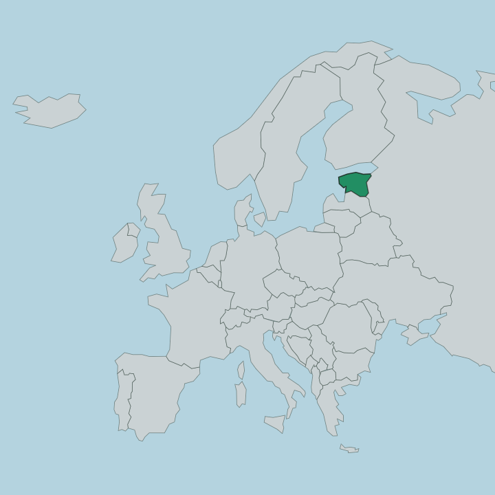
Jõgevamaa lies in eastern Estonia, midway between the capital at Tallinn and the university city of Tartu, and its whole eastern flank rests against Lake Peipus. The county borders Ida-Viru and Lääne-Viru to the north, Järva to the north-west, Viljandi to the south-west and Tartu to the south. Water and ice shaped nearly all of it.
The defining landform is the Vooremaa drumlin field, a belt of long ice-moulded ridges running north-east to south-west, each ridge a couple of kilometres to more than a dozen long and separated from its neighbours by lakes and marshy troughs. Farmland covers the drumlin tops. Between and beyond them spread some of Estonia's largest raised bogs and wet forests, held in the Endla reserve in the west and the Alam-Pedja reserve along the Pedja River in the south.
That river drains much of the county's low interior toward the Baltic river system. The eastern edge is different country again: a flat, sandy lake plain dropping to the reed beds and beaches of Lake Peipus, one of the largest lakes in Europe and the border with Russia. The land nowhere rises high.
It is a place of gentle ridges, standing water and slow rivers rather than hills or coast.
What is Jõgevamaa like?
Two very different cultures share this ground. Along Lake Peipus live the Russian Old Believers, who fled religious persecution eastward and settled the sandy lakeshore in the eighteenth century; their unpainted prayer houses, onion gardens and smoked-fish stalls still mark the villages around Mustvee. Inland the county is thoroughly Estonian farm country, its identity bound up with the national epic.
The Vooremaa ridges, boulders and lakes gather more Kalevipoeg legend than almost anywhere else in the land. Folklore explains this whole landscape as the work of that giant. The moraines are said to be earth he shifted, the sling-stones boulders he threw, and at the Kääpa River, where the hero is meant to have died, his sword lies waiting in the water.
That story-map turned ordinary bogs and hills into named, remembered places. Farming, fishing and quiet village life set the everyday rhythm. Museums at the manor houses, the wine cellars of Põltsamaa and the Old Believer congregations keep the county's memory close to its land.
The common language is Estonian, though Russian is still heard plainly along the lake.
What is the history of Jõgevamaa?
The county itself is young. Jõgevamaa was drawn in 1990 from parts of the older Viljandi and Tartu counties, but the settlements within it reach back much further. Põltsamaa grew around a castle the Livonian Order raised on the river in the thirteenth century, and the manor there later gave Estonia one of its earliest presses and, by tradition, its first fruit wine.
Jõgeva itself was recorded as a manor in 1599, then made by the railway that reached it in the 1870s and turned a small station into the market town and county seat it became. The Old Believer villages along Lake Peipus date from the eighteenth century, when refugees from Russia settled the shore.
What is the climate of Jõgevamaa?
The cold cuts sharp in Jõgevamaa. Sitting inland in eastern Estonia, away from the moderating sea, Jõgevamaa runs colder and more continental than the Baltic coast, and Jõgeva has logged some of the lowest temperatures ever measured in the country. Snow lies for weeks and Lake Peipus can freeze hard enough to walk and drive across, as it did during the medieval battle fought on its ice.
Summers are short, mild and green, the warm season when the bogs and drumlin lakes are at their best. Rain and cloud spread through the year rather than falling in one season.
How do you get to Jõgevamaa?
Most travellers come by land. Jõgevamaa sits on the main Tallinn-Tartu axis, and the railway between the two cities stops at Jõgeva, making the train the simplest way in from either end. The nearest airport is at Tartu, a short run south, with Tallinn's larger airport about two hours away by road or rail.
Drivers reach the county easily along the highways linking Tallinn, Tartu and the Lake Peipus shore. Once here, a car helps for the drumlin lakes, the reserves and the lakeside villages that the trains do not serve.
Good for
Updated July 2026