Egypt
Muḩāfaz̧at Maţrūḩ, Egypt — Towns & Travel Guide


Muḩāfaz̧at Maţrūḩ is Egypt's north-western corner, a strip of turquoise Mediterranean coast backed by the vast Western Desert.
About Muḩāfaz̧at Maţrūḩ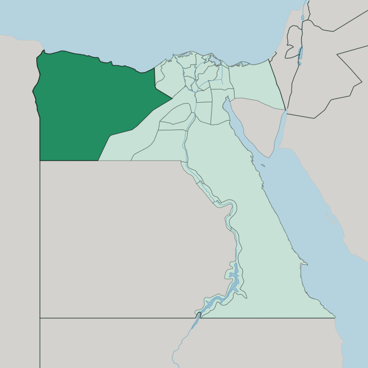
Towns & cities in Muḩāfaz̧at Maţrūḩ
Pick a town or city — each links to where to stay.
Marsa Matruh is the obvious base. It is the capital and by far the largest town, with the beaches strung along its bay and the coast road running west toward Agiba, and it fills with Egyptian holidaymakers through the summer months. The eastern shore around El Alamein and El Dabaa is where the newer beach resorts cluster, on the open Mediterranean between there and Alexandria.
Siwa Oasis is where the rest go, five hours south into the desert, a world apart with its mud-brick lodges and hot springs. Choose Marsa Matruh for the classic bay beaches; choose Siwa for the oasis and its Amazigh village. Sidi Barrani and Sallum, out west toward the Libyan border, are transit stops rather than places to linger.
About Muḩāfaz̧at Maţrūḩ
What is Muḩāfaz̧at Maţrūḩ known for?
Two things define this governorate: white-sand beaches and open desert. Marsa Matruh anchors the coast, its bay ringed by pale sand and clear shallow water, with Agiba and Cleopatra beaches cut into the cliffs west of town. Inland the land empties into the Western Desert, dropping into the Qattara Depression and stretching south to the palm groves of the Siwa Oasis.
El Alamein, near the eastern edge, gave its name to the decisive desert battles of the Second World War. Sea, then sand.
Where is Muḩāfaz̧at Maţrūḩ?
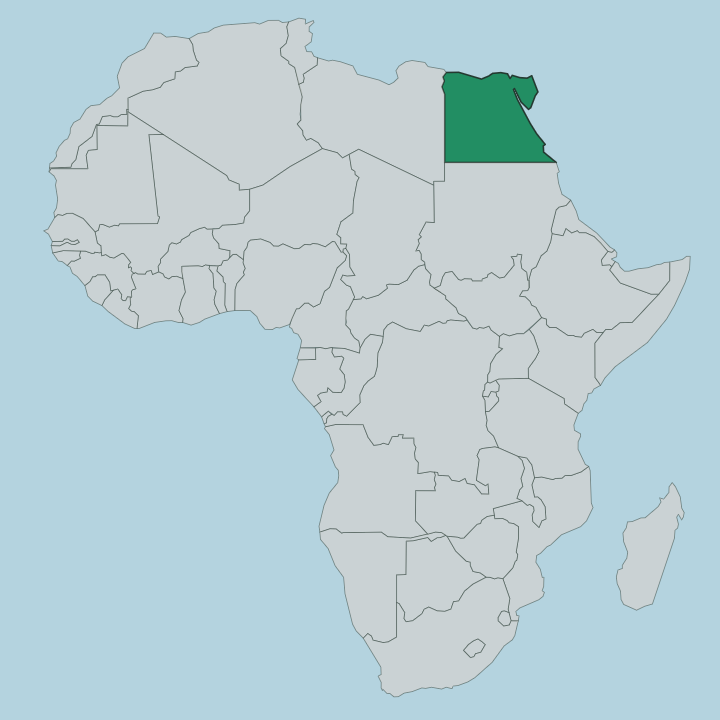
Muḩāfaz̧at Maţrūḩ fills the north-western corner of Egypt, one of the largest governorates in the country by area. Its northern edge is the Mediterranean Sea. Its western edge is the border with Libya, which the coast road reaches at the town of Sallum before climbing the escarpment beyond.
Almost everything that matters to a traveller sits on that narrow coastal band. Marsa Matruh lies roughly midway along it, with Sidi Barrani and Sallum to the west and El Dabaa and El Alamein to the east toward Alexandria and the Nile Delta. South of the coast the governorate becomes the Western Desert, and the scale changes completely.
The Qattara Depression sinks below the level of the sea, one of the lowest points on the whole continent, its floor a crust of salt marsh and sand. Further south again lies the Great Sand Sea, a field of dunes running across the Libyan frontier. The one break in that emptiness is the Siwa Oasis, a long green depression of springs and date palms far inland.
Coast and desert are the two halves of the place. The drive between them crosses a great deal of nothing.
What is Muḩāfaz̧at Maţrūḩ like?
The coast and the desert here carry two different cultures. Along the shore the population is largely Bedouin, descended from tribes who grazed this margin of the Sahara for generations, and Arabic is the everyday language of Marsa Matruh and the coastal towns. Fishing, herding and, in summer, tourism set the rhythm of the bay.
It is a quieter, more conservative stretch of Egypt than the Nile cities. Siwa is another matter entirely. The Siwan people are Amazigh, or Berber, and speak Siwi rather than Arabic, a language and a way of life the oasis kept through centuries of isolation from the rest of the country.
Their old town rises in tiers of mud-brick and salt around the ruins of the Shali fortress. Dates and olives are the wealth of the springs, pressed and packed and sent north. The Oracle of Amun once stood here, and pilgrims crossed the desert to consult it long before the modern road did.
One governorate holds both worlds, and they feel a thousand years apart.
What is the history of Muḩāfaz̧at Maţrūḩ?
Marsa Matruh began as Paraetonium, a Greek harbour that Alexander the Great is said to have used on his march to the Oracle of Amun at Siwa in 331 BC. Under the Ptolemies it was the westernmost city of their kingdom, and the Romans made it a grain port shipping wheat across the Mediterranean to feed the empire. Then the coast slept for centuries.
It woke violently in the Second World War, when the Western Desert became a battlefield: El Alamein, near the eastern boundary, was where the Allied line finally held and turned Rommel back short of Alexandria. The war left cemeteries, cave shelters and, in the sand, mines that are still being cleared.
What is the climate of Muḩāfaz̧at Maţrūḩ?
Two climates meet here. The coast has a hot, dry summer softened by the Mediterranean, warm rather than scorching on the shore, which is why the beaches at Marsa Matruh fill through July and August while the desert interior around the Qattara Depression bakes far hotter. Winters on the coast are mild, and what little rain the governorate sees falls then, between about October and February.
Inland at Siwa it is pure desert: burning days, cool nights, almost no rain at all. The sea tempers the shore; nothing tempers the sand.
How do you get to Muḩāfaz̧at Maţrūḩ?
Most travellers come overland from the east. The coast road runs west from Alexandria and the Nile Delta straight to Marsa Matruh, a drive of a few hours along the Mediterranean, and buses and trains cover the same route in summer. There is an airport at Marsa Matruh that opens mainly for the beach season.
Siwa is the harder trip: a separate desert highway strikes south from the coast, five hours across the Western Desert, with no railway and only the bus for company. West of Marsa Matruh the road carries on past Sidi Barrani and Sallum to the Libyan border. Come in summer for the coast, any cooler month for the desert.
Good for
Updated July 2026