Egypt
North Sinai, Egypt — Towns & Travel Guide


North Sinai fills the northern half of the Sinai Peninsula, a Mediterranean-coast desert reaching from the Suez Canal to the Gaza border.
About North Sinai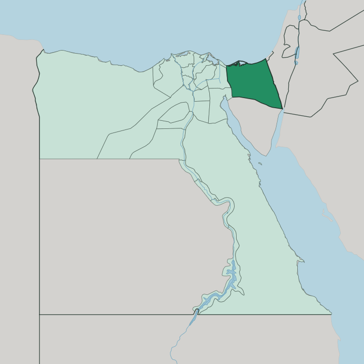
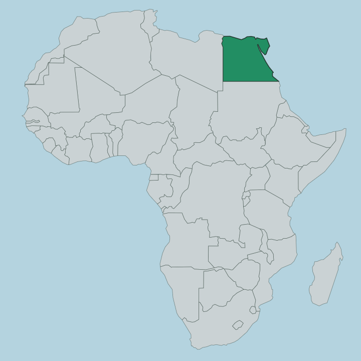
Towns & cities in North Sinai
Pick a town or city — each links to where to stay.
El Arish is the practical base, and almost the only one. It is the capital and the largest city on the Sinai Peninsula, and its palm-fringed Mediterranean beach is the reason most people come to the coast at all. Beds thin out fast beyond the town.
Inland the governorate is desert plateau and sand, crossed by Bedouin tracks rather than dotted with hotels. The salt lagoon of Lake Bardawil breaks the shore to the west, drawing fishermen and birds rather than resorts. Choose El Arish if you want the palm-lined sands and a town to sleep in; the deeper desert is for those travelling with local Bedouin guides.
About North Sinai
North Sinai is desert with a coast.
What is North Sinai known for?
El Arish, its capital and the largest city on the Sinai Peninsula, anchors a Mediterranean shore lined with dense rows of date palms that set its beaches apart from the rest of the coast. Behind the town the land climbs into the arid El-Tih plateau and the sand seas that fill most of the governorate. This is Bedouin country, home to tribes who have lived off the desert for centuries.
The Gaza border sits close to the east, and the Suez Canal marks the far western edge.
Where is North Sinai?
North Sinai covers the northern half of the Sinai Peninsula, the wedge of Egypt that bridges Africa and Asia. The Mediterranean Sea forms its whole northern edge. Along that coast runs a low plain of sand dunes and date-palm groves, widest around El Arish, the capital and the largest city on the peninsula.
Behind the plain the ground lifts into the El-Tih plateau, a broad limestone tableland of arid rock and sand that fills the bulk of the governorate. It is big and nearly empty. This is one of the least densely settled parts of the country, most of its people gathered on the coastal strip while the interior stays open desert crossed by Bedouin tribes.
Its borders read like a map of the wider region. The Gaza Strip lies to the east, where the town of Rafah sits astride the frontier. South Sinai Governorate takes over below, and there the plateau breaks into the rugged high mountains that crowd the southern tip of the peninsula.
Away to the west the Suez Canal cuts the land, separating Sinai from the African mainland of Egypt. Draining the plateau is the Wadi al-Arish, the longest seasonal watercourse in the Sinai, a dry bed for most of the year that runs north to empty into the Mediterranean beside its namesake city. Rain almost never falls, so the wadi almost never flows.
What is North Sinai like?
The desert here belongs to the Bedouin. These Arab tribes have crossed the Sinai Peninsula for centuries, keeping herds, reading the wadis for water, and holding to codes of hospitality and kinship that outlast any government drawn on the map. Much of that life is now half-settled around the coast and the towns rather than fully nomadic, but the old skills have not vanished.
Embroidery is one of them, worked in tight geometric patterns that mark out each tribe. Poetry is another, recited aloud to carry stories, lineage and grievance down the generations. El Arish is where desert and coast meet in daily life.
Its market trades in dates from the palm groves that fringe the town, and fish landed from the Mediterranean beside them. Arabic is the language, spoken in the Bedouin dialects of the peninsula as much as in the standard tongue of the rest of Egypt. The governorate has long felt like a frontier, a thin edge of the country pressed between the sea and the Gaza border, and that border has shaped its recent decades as sharply as the desert shaped its older ones.
Life is lived close to the land and close to the line.
What is the history of North Sinai?
North Sinai has always been a road between continents. Armies, caravans and pilgrims crossed its coastal strip for millennia, and El Arish grew as a fortified stop on that route, its Ottoman-era fort guarding the eastern approach to Egypt. The modern story turns on one line.
Israel took the whole Sinai Peninsula in the 1967 war and held El Arish and the northern coast for years. The Egypt-Israel Peace Treaty of 1979 reversed that, and Israeli forces completed their withdrawal from the peninsula in 1982, returning North Sinai to Egyptian rule. Its frontier position has kept it in the news ever since.
What is the climate of North Sinai?
North Sinai has a hot desert climate cooled along its northern edge. The Mediterranean tempers El Arish and the coastal palm belt, bringing breezier, milder summers than the searing plateau behind. Inland the El-Tih tableland turns harsher, hot and dry, with sharp swings between day and night.
Rain is rare and comes in winter, when a downpour can send the Wadi al-Arish into brief flood before it drains to the sea. Most days the wadi stays bone dry.
How do you get to North Sinai?
Reaching North Sinai means crossing the Sinai Peninsula from mainland Egypt. The usual approach is overland from the west, over the Suez Canal by tunnel or bridge and then along the Mediterranean coast road toward El Arish, the governorate's capital and transport hub. That road strings the coastal towns together.
El Arish has a small airport as well, though the long desert drive is how most travellers actually arrive. To the east the route ends at the Gaza border, not a through road for visitors.
Good for
Updated July 2026