India
State of Nāgāland, India — Towns & Travel Guide


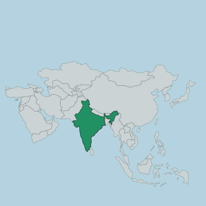
Nāgāland is a mountainous state in far north-eastern India, wedged against the Myanmar border where the Naga Hills rise.
About State of Nāgāland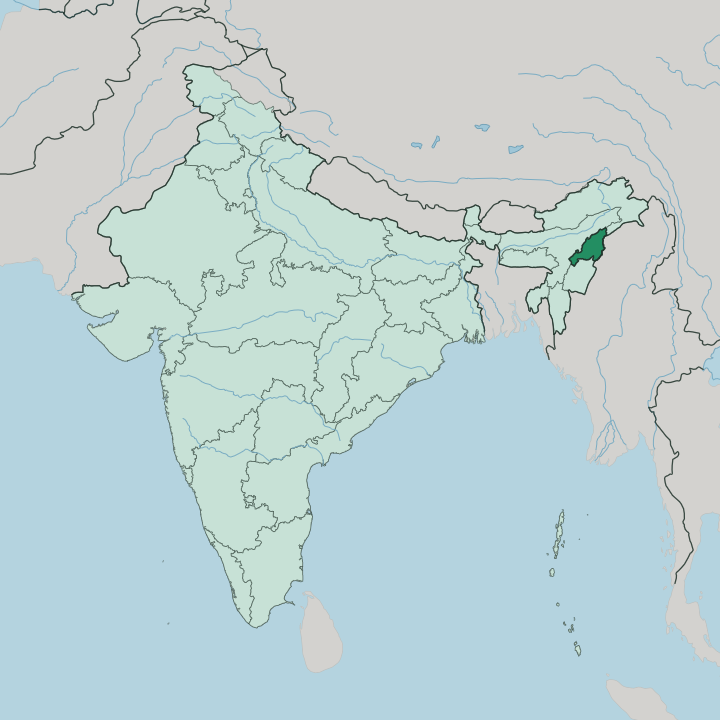
Towns & cities in State of Nāgāland
Pick a town or city — each links to where to stay.
Two places anchor a trip. Kohima, the hill capital, keeps most of the guesthouses and sits closest to the Kisama festival ground and the war cemetery on its terraced ridge. Dimapur is the other.
The state's largest city holds its only railhead and airport, spread across the flat land where the hills give out toward Assam. Beyond the two, beds thin fast in the tribal villages, where homestays run by Angami, Ao and Konyak families are the usual way to sleep. Choose Kohima if you want the Hornbill crowds and the cool ridge air; choose Dimapur if you are arriving by train or plane and want the plains close by.
About State of Nāgāland
Seventeen major tribes share these hills.
What is State of Nāgāland known for?
That is the first thing visitors learn about Nāgāland, and it shapes almost everything they see, from the terraced rice fields carved into the slopes to the log drums kept in village morungs. Each December the Hornbill Festival gathers those tribes at Kisama, near the capital Kohima, for ten days of dance, song and feasting. The peaks reach their height at Mount Saramati on the Myanmar frontier.
Kohima itself is known for a different reason, as the site of the 1944 battle that turned back the Japanese advance into India.
Where is State of Nāgāland?
Nāgāland sits in the far north-east of India, a narrow strip of hills pressed up against the Myanmar border. Nearly all of it is mountain. The Naga Hills fold across the whole state, rising from the plains in the west and climbing steadily toward the east, where they merge into the Patkai ranges along the frontier with Myanmar.
The land peaks at Mount Saramati, the highest point in the state, on that eastern border. Only in the far west, around Dimapur, does the ground flatten into a strip of the Assam plain. Three neighbours ring it on the Indian side.
Assam lies to the west, Arunachal Pradesh to the north, and Manipur to the south, while Myanmar closes off the entire eastern edge. Rivers cut the ranges into steep, forested valleys. The Doyang is the longest that runs through the state, draining the central hills westward toward the Brahmaputra system on the plains.
Terraced rice fields step down many of the slopes, the work of generations of hill farmers. Kohima, the capital, stands high on one of those southern ridges. Everything about the state is vertical, and the hills decide where roads go and where villages cling.
What is State of Nāgāland like?
Nāgāland is a land of many peoples rather than one. Seventeen major tribes hold the hills, among them the Angami, the Ao and the Konyak, and each keeps its own tongue, dress and set of festivals. Dozens of distinct languages are spoken across so small a space that neighbouring valleys often cannot understand one another.
English serves as the common thread that ties them, and it is the state's official language. Christianity arrived with American Baptist missionaries in the nineteenth century and took deep root, so most villages are built around a church. Much of the older culture survives in the villages themselves.
The morung, a bachelors' dormitory and carved log house, was long the heart of tribal learning, and shawls woven in tribe-specific patterns still mark who a person is. Every December that heritage is gathered in one place. The Hornbill Festival, staged at Kisama outside Kohima, brings the tribes together for ten days of war dances, folk song, wrestling and the pounding of great hollowed log drums.
Rice is the staple of every table. The bird the festival is named for, the hornbill, carries its own weight in Naga symbolism, standing for strength and alertness, and its feathers once crowned warriors' headdresses.
What is the history of State of Nāgāland?
The Naga peoples held these hills long before any outside power reached them. British administrators pushed into the Naga Hills through the nineteenth century and folded the district into the province of Assam. Then came the war.
In 1944 Japanese forces drove to the edge of Kohima, and the fighting on the capital's ridge became one of the turning points of the Burma campaign. Statehood followed a long push for Naga autonomy, and on 1 December 1963 Nāgāland was inaugurated as the sixteenth state of India, carved out of Assam with Kohima as its capital.
What is the climate of State of Nāgāland?
Nāgāland runs on the monsoon. The wet season sweeps in from May and pours through September, dumping most of the year's rain across the hills and turning the terraced slopes a deep green. Altitude tempers the heat, so Kohima on its high ridge stays cool and pleasant while Dimapur down on the Assam plain sits warmer and more humid.
The dry months from October into April are the settled season, when the skies clear and the Hornbill crowds arrive. Landslides close hill roads in the heavy rains.
How do you get to State of Nāgāland?
Almost everyone comes in through Dimapur. The city holds the state's only commercial airport and its only railway station, both down on the flat western edge near Assam, with flights and trains from Kolkata and Guwahati. Kohima has neither.
Reaching the capital means a taxi ride of roughly 75 kilometres up the highway from Dimapur, a climb of two or three hours into the hills that the monsoon can stretch out badly. From Kohima the mountain roads fan out to the tribal villages beyond.
Good for
Updated July 2026