India
Manipur, India — Towns & Travel Guide


Manipur is a hill-ringed state of northeastern India, its Imphal Valley cupped by mountains toward Myanmar.
About Manipur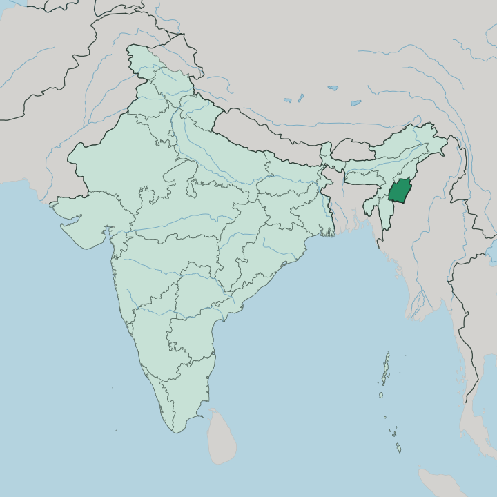
Towns & cities in Manipur
Pick a town or city — each links to where to stay.
Imphal is where almost every visit is based. The capital sits in the middle of the valley, close to Kangla, the old fortified seat of the Meitei kings, and it holds most of the state's hotels and homestays. From there the sights are day trips.
Moirang and the Loktak shore lie to the south, near the floating park and the fishers' huts on the phumdi. Ukhrul, the Tangkhul Naga hill town, rises to the east above the valley floor. Base yourself in Imphal for a first visit; move out to Moirang or Ukhrul when you want the lake or the hills at your door.
About Manipur
Loktak is the reason many people come.
What is Manipur known for?
The lake carries floating mats of matted vegetation called phumdi, and one of them holds Keibul Lamjao, the only floating national park in the world, last refuge of the endangered Sangai deer. Around the water spreads the flat Imphal Valley, home of the Meitei and their weaving, their dance, and the old game of polo that grew up here. Beyond the valley the land climbs into blue hills settled by Naga and Kuki-Zo communities.
Green and quiet, it feels a long way from the rest of India.
Where is Manipur?
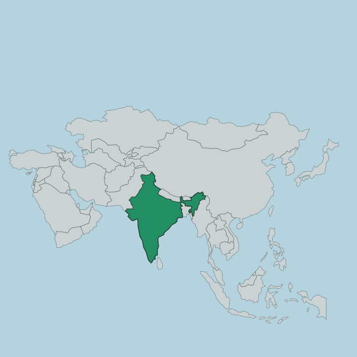
Manipur sits in the far east of northeastern India, pressed against the border with Myanmar. Two neighbours frame it inside India. Nagaland lies to the north, Assam to the west, and Mizoram falls away to the south, while the whole eastern edge runs along Myanmar's Sagaing Region and Chin State. Most of the state is hill country.
Ridge after ridge of forested mountains rises around a single broad exception at the centre, the Imphal Valley, an oval of flat alluvial land that makes up only about a tenth of Manipur's area yet holds most of its people. The valley drains through the Manipur River and its tributaries into Loktak Lake, the largest freshwater lake in northeastern India, whose floating phumdi carry the Keibul Lamjao park. Off the western hills a second, separate river gathers.
The Barak rises in the Manipur Hills, swings north to trace part of the boundary with Assam, and eventually carries the state's water down toward the Bengal plain far beyond its borders. Between the wet green valley floor and the blue ranges that wall it in, Manipur reads as a bowl set among mountains. The hills belong to the Naga and Kuki-Zo peoples; the valley belongs to the Meitei.
What is Manipur like?
Culture in Manipur splits between the valley and the hills. On the valley floor live the Meitei, most of them Hindu of a Vaishnavite cast, and their world sets much of what the state is known for. Ras Lila, the graceful classical dance built around Krishna, was born among them and carries their name across India.
Weaving is theirs too. Meitei women work back-strap looms to make the phanek, the striped wrapped skirt, and much of the valley's trade passes through women's hands at markets like Imphal's Ima Keithel, run entirely by mothers. Polo is a Manipuri invention, played here on stocky local ponies long before the British carried the game abroad.
The hills tell a different story. Naga communities in the north and Kuki-Zo in the south, most of them Christian, speak their own Tibeto-Burman tongues and keep their own festivals, dress, and village councils. Between these worlds runs the shared thread of language.
Meitei, written in its own Meitei Mayek script, serves as the state's official tongue and the common speech of the valley. The result is not one culture but several, layered by altitude, faith, and the wall of hills that has always divided plain from ridge.
What is the history of Manipur?
Manipur was a kingdom first. Meitei rulers governed from Kangla in Imphal for centuries, and a written code of the realm dates back to the reign of King Loiyumba around the year 1110. Independence ended with the Anglo-Manipur War of 1891.
A British force stormed the valley, hoisted the Union Jack over Kangla, and hanged the general Tikendrajit for waging war on the Empire. War returned in 1944, when the Battle of Imphal turned back the Japanese advance during the Second World War. Statehood came in 1972.
What is the climate of Manipur?
Manipur runs warm and humid, tempered by its height. The Imphal Valley sits well above the sea, so summers stay milder than the Indian plains and winters turn genuinely cool at night. Rain rules the calendar.
The southwest monsoon soaks the hills and valley from June into September, swelling the Manipur River and lifting Loktak Lake until its floating phumdi ride higher on the water. Skies clear through the drier, cooler months that follow, which is when most travellers come.
How do you get to Manipur?
Most travellers fly into Imphal. Bir Tikendrajit International Airport sits just outside the capital and links it by air with Kolkata, Delhi, Guwahati and other Indian cities, which for most people is the only practical way in. There is no railway across the hills yet, so the overland route means a long road climb from Dimapur in Nagaland, several hours north through Kohima.
Imphal's own roads then fan out to Loktak Lake and the hill towns beyond.
Good for
Updated July 2026