Iraq
Babil Governorate, Iraq — Towns & Travel Guide


Babil Governorate holds the ruins of ancient Babylon on the Euphrates in central Iraq, with Hillah as its capital.
About Babil Governorate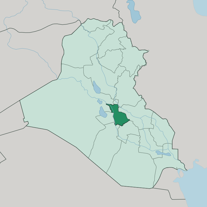
Towns & cities in Babil Governorate
Pick a town or city — each links to where to stay.
Almost everyone stays in Hillah. The provincial capital on the Shatt al-Hillah carries nearly all the beds, and the Babylon ruins lie a short drive north. The excavated city has no hotels of its own, so a room in Hillah doubles as the base for the site.
Kifl and Musayyib are day stops rather than overnights. If you have come for the archaeology or the shrine of Ezekiel, choose Hillah and travel out from there each morning.
About Babil Governorate
One name carries this province.
What is Babil Governorate known for?
The ruins of ancient Babylon stand a few kilometres north of Hillah, the seat of Nebuchadnezzar II and, centuries earlier, of Hammurabi and his code of laws. UNESCO added the site to the World Heritage list in 2019. The reconstructed Ishtar Gate and the mud-brick walls draw travellers who come mainly for the archaeology, though the province is farmland fed by the Euphrates as much as it is old stone.
The tomb of the prophet Ezekiel at Kifl pulls pilgrims south of the capital.
Where is Babil Governorate?
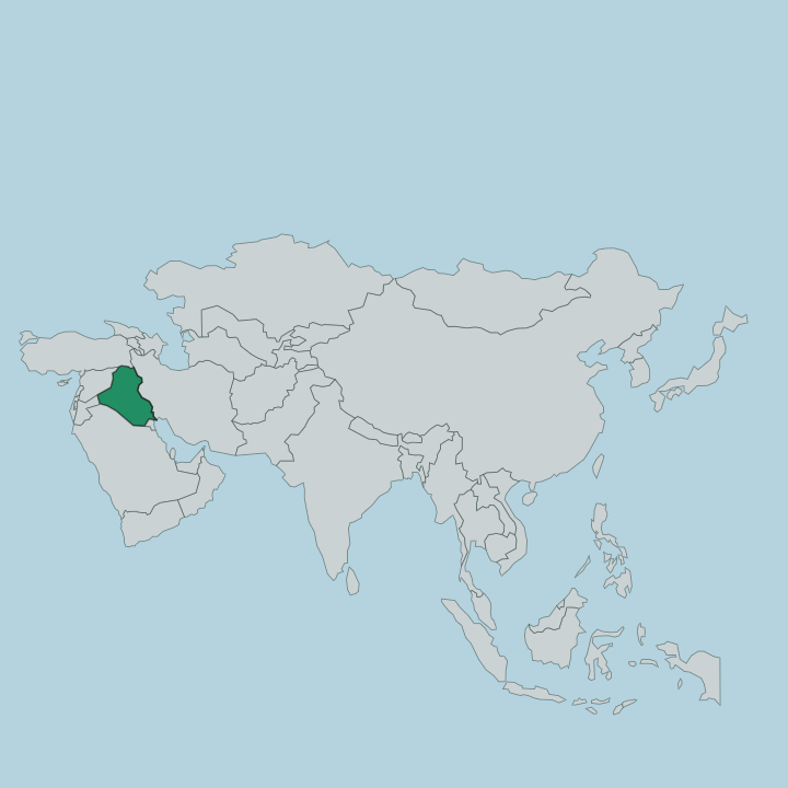
Babil Governorate sits in central Iraq, on the Euphrates roughly a hundred kilometres south of Baghdad. It is flat alluvial plain. The land belongs to the great floodplain of southern Mesopotamia, where the Euphrates has laid down silt for thousands of years and left soil that farmers still work.
At Musayyib in the north of the province the river splits, and its eastern arm, the Shatt al-Hillah, threads south through Hillah and on past most of the towns. That branching channel is the reason the province is green at all. Away from the water the ground dries quickly toward open desert, so life clings to the irrigated strips along the river and its distributary canals.
Hillah stands on the Shatt al-Hillah near the middle of the province, opposite the ruins of Babylon on the old course of the Euphrates. The governorate reaches north toward Baghdad and south and west toward the shrine cities of Karbala and Najaf, with the desert margin closing in on its western edge. Rail and road follow the river north to the capital.
The province is small by Iraqi standards but densely farmed, and its five districts, among them Hilla, Mahawil, Musayyib and Hashimiya, cluster along the same ribbon of water.
What is Babil Governorate like?
The deep past presses close here. This is Babylonian ground, and the name Babil is simply the Arabic form of Babylon, so the province wears its ancient identity in its very name. Daily life is thoroughly modern and overwhelmingly Arab.
Arabic is the everyday language, and the population is largely Shia Muslim, tied to the great pilgrimage routes that run through the region toward Karbala and Najaf just beyond its edges. Farming shapes the rhythm of the province. Date palms line the canals, and fields of maize and legumes fill the irrigated plain around Hillah, where markets and mills turn on the harvest.
The tomb of the prophet Ezekiel at Kifl adds a older, Jewish and later Islamic thread to the same landscape, a shrine that has drawn pilgrims across faiths for centuries. Hillah itself is a working provincial city rather than a resort, with a riverfront corniche along the Shatt al-Hillah and the everyday commerce of a farming hub. Poets and scholars came from medieval Hillah, and the town has long been a centre of learning.
Culture here is layered rather than staged, ancient stone and living faith sharing the same fertile plain.
What is the history of Babil Governorate?
History here is measured in millennia. Babylon rose on the Euphrates early in the second millennium BC, and under Hammurabi, who ruled from 1792 to 1750 BC, it became the capital of a wide empire and the seat of his famous law code. It peaked again under Nebuchadnezzar II, king from 605 to 562 BC, when the Neo-Babylonian Empire raised the Ishtar Gate and the walls whose foundations still stand.
The ancient city fell and was gradually abandoned, and centuries later medieval Hillah grew up nearby on the Shatt al-Hillah, becoming the regional town whose name the modern capital still carries. The governorate around it takes its name, Babil, straight from that first city.
What is the climate of Babil Governorate?
Babil has a hot desert climate. Summers on the Euphrates plain are long, dry and fierce, with the sun beating down on Hillah for months on end and little relief until autumn. What rain comes falls in the winter, when the province turns briefly mild and the fields drink.
Nothing waters the land in summer but the river and its canals, which is why the irrigated strip along the Shatt al-Hillah stays green while the desert edge to the west bakes. Spring and autumn are the kinder seasons for a visit to the ruins.
How do you get to Babil Governorate?
Most visitors come from Baghdad. The capital's airport is the usual arrival point for Iraq, and Hillah lies about a hundred kilometres south of it by road. A highway and a rail line both run down the Euphrates from Baghdad to Hillah, so the province is an easy day's reach or a short drive from the capital.
Many travellers fold Babylon into a wider loop through the shrine cities of Karbala and Najaf, which sit just beyond the governorate to the south and west. Within Babil, taxis and hired cars cover the short hops between Hillah, the ruins and Kifl.
Good for
Updated July 2026