Iraq
Kirkuk Governorate, Iraq — Towns & Travel Guide


Kirkuk Governorate spreads across northern Iraq, where the Zagros foothills meet oilfield plains and Baba Gurgur's flame still burns.
About Kirkuk Governorate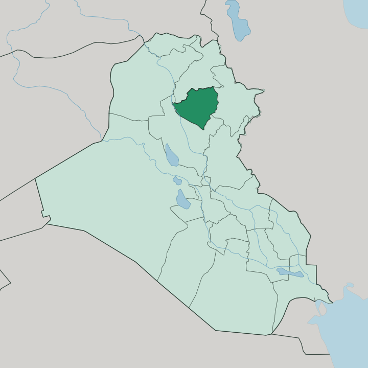
Towns & cities in Kirkuk Governorate
Pick a town or city — each links to where to stay.
 Iraq
Iraq
Kirkuk
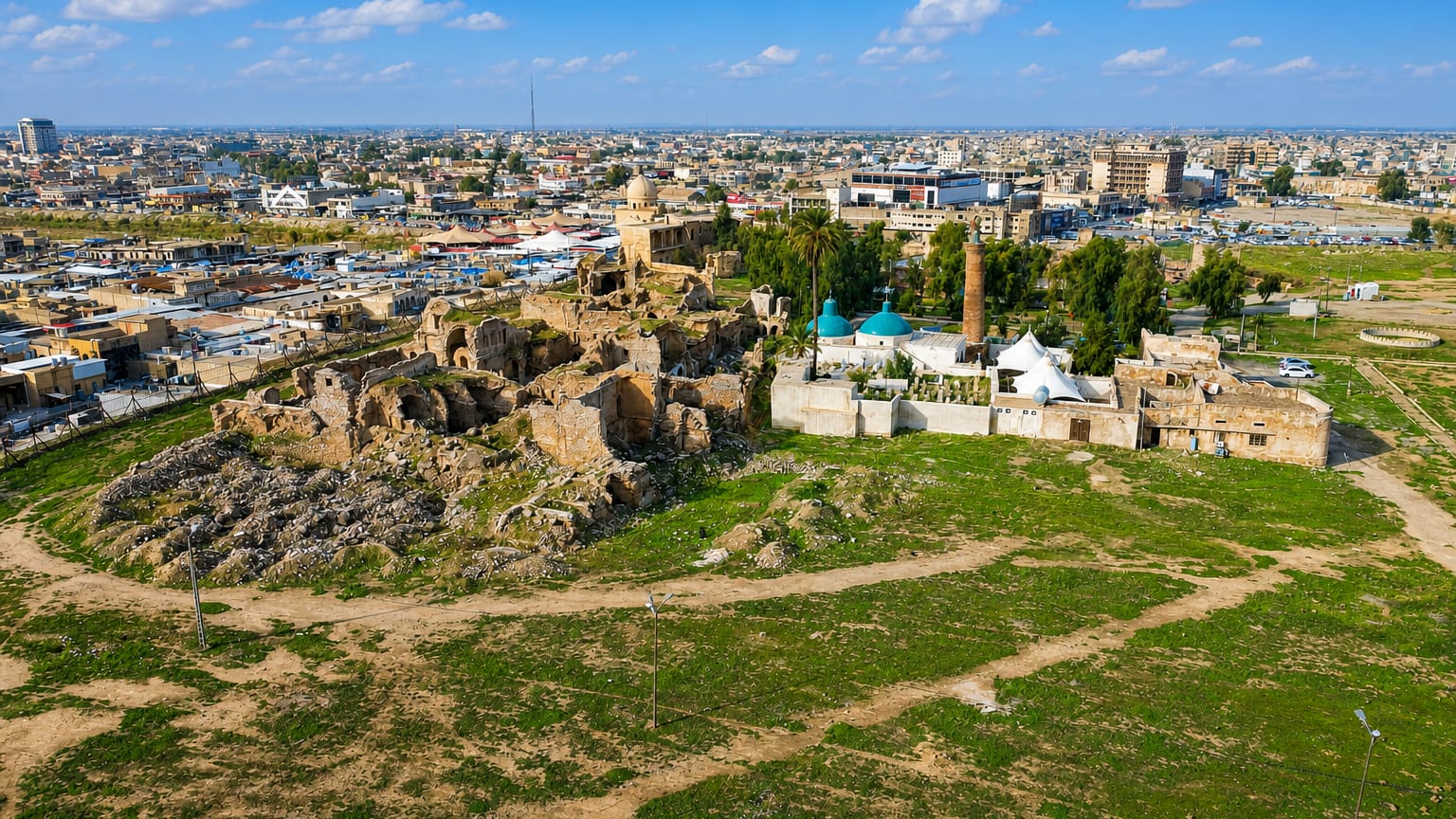
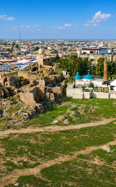
The Kirkuk Citadel stands on its ancient mound above the Khasa River in Kirkuk, a long-inhabited city in northern Iraq and the seat of Kirkuk Governorate.Where to stay →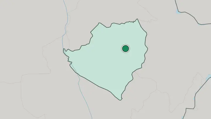
About Kirkuk Governorate
Oil made this province famous.
What is Kirkuk Governorate known for?
The Baba Gurgur field north-west of the city gushed in 1927 and ranked as the largest known reserve on earth until Saudi Arabia's Ghawar was found, and its natural-gas flame has drawn travellers since Alexander's day. Kirkuk city holds the other draw: an ancient citadel on a tell above the Khasa River, once called Arrapha. Kurds, Turkmen and Arabs all claim it.
That mix, layered over Assyrian and Ottoman ruins, gives the governorate a character no single group defines.
Where is Kirkuk Governorate?
Kirkuk Governorate lies in northern Iraq, roughly halfway between Baghdad and the Kurdish highlands. The land here is a threshold. To the north and east the Zagros Mountains rise toward Iran, and their foothills push into the province; to the south and west the ground flattens into the open plains that run down toward the capital.
Kirkuk city stands on that seam, built up around a tell above the Khasa River, a modest watercourse that threads through the centre. The governorate covers close to ten thousand square kilometres of that transitional country. Water comes mostly from the Lesser Zab, which forms much of the boundary with Erbil to the north.
At Dibis the river is dammed and its flow diverted into a network of canals that irrigate the Kirkuk plain, turning otherwise dry land into wheat and cotton fields. Diyala lies to the south, Saladin to the west, Sulaymaniyah to the east. The famous oil sits underground, in the anticline that runs beneath Kirkuk and surfaces as the flames of Baba Gurgur north-west of the city.
Every direction tells a different story. Mountains one way, plains the other, the Tigris basin gathering it all downstream.
What is Kirkuk Governorate like?
Three peoples share this ground. Kurds, Turkmen and Arabs have lived alongside one another in Kirkuk for centuries, and each carries its own language, music and memory of the place, with Syriac-speaking Christians and other minorities woven in besides. Arabic, Kurdish, Turkish and Syriac are all heard in the streets and the bazaar.
The provincial capital wears that plurality openly, and the old citadel above the Khasa River stands at the heart of it as a symbol every community claims for its own. Much of the governorate beyond the city is rural and agricultural, its rhythm set by the irrigated fields of the Kirkuk plain and the herding of the drier margins. Oil shaped the modern identity as much as any older tradition.
The industry drew workers of every background into the city through the twentieth century, and the wealth beneath the ground made Kirkuk a prize that outsiders fought over, sometimes to the cost of the people who actually lived there. That tension is real and unresolved. Yet the shared bazaar, the shared table, the shared streets below the tell are just as real, and they are what a visitor meets first.
What is the history of Kirkuk Governorate?
The story starts deep. Under the ancient name Arrapha the site of Kirkuk was a settlement in the second millennium BC, and clay tablets found near the citadel prove it, while the Assyrians made it a centre in the first millennium BC. Ottoman rule followed the conquest of Baghdad in 1534, and Kirkuk became a garrison and trading post on the road to Istanbul.
Modern history turned on oil after the 1927 gusher. From 1976 the province was renamed At-Ta'mim, meaning nationalisation, for the state's seizure of the oil; the name Kirkuk was restored in later years.
What is the climate of Kirkuk Governorate?
Summers here are brutal. Kirkuk has a hot semi-arid climate, and from late spring the plains bake under long, rainless months of fierce heat that keep most people indoors through the middle of the day. Winters are mild by contrast, cool enough for jackets, with what little rain the province gets falling between autumn and early spring.
Snow is rare on the plain, though the Zagros foothills to the north-east see it more often. The best months to travel are the shoulder seasons, when the heat has broken but the roads are still dry.
How do you get to Kirkuk Governorate?
Most travellers reach Kirkuk Governorate by road. Kirkuk city has an airport that reopened to civil flights, but many travellers still drive up from Baghdad to the south or over from Erbil to the north, since those hubs carry the bulk of the region's international traffic. The city sits at a road junction that has mattered for centuries, linking the capital with the Kurdish north and the plains to the west.
Inside the governorate, roads fan out from Kirkuk to Hawija, Daquq and Dibis. There is no passenger rail to speak of.
Good for
Updated July 2026