Iraq
Nineveh Governorate, Iraq — Towns & Travel Guide


Nineveh Governorate spreads across northern Iraq around Mosul and the Tigris, where the ruins of ancient Nineveh still stand.
Find your area →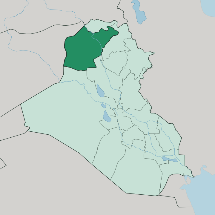
Towns & cities in Nineveh Governorate
Pick a town or city — each links to where to stay.
 Iraq
Iraq
Mosul
The Tigris divides Mosul, a major city in northern Iraq and capital of Nineveh Governorate, facing the ancient Assyrian ruins of Nineveh across the water.Where to stay →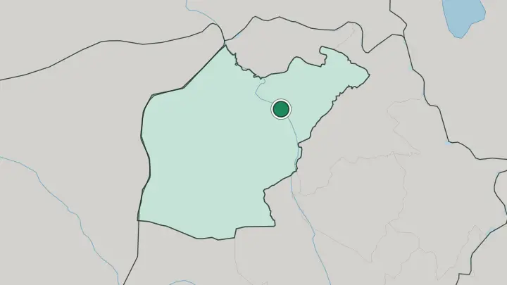
About Nineveh Governorate
This is Assyrian heartland.
What is Nineveh Governorate known for?
The mounds of ancient Nineveh rise on the east bank of the Tigris, directly across the water from Mosul, the provincial capital and the province's one true city. Thirty kilometres south lie the palaces of Nimrud, another royal seat of the same Assyrian kings. West of the city the Nineveh Plains carry a cluster of Christian and Yazidi towns, while the Sinjar range breaks the horizon further out toward Syria.
Mosul, the Tigris, and the old Assyrian ruins are why most people come.
Where is Nineveh Governorate?
Nineveh Governorate fills the north-west corner of Iraq, a broad tableland pressed against the Syrian border. The Tigris is its spine. The river enters from the north out of the Kurdish hills, slides past Mosul on both banks, and carries on southward toward the rest of Iraq, gathering the small Khosr and the Great Zab along the way.
To the east of the river the land opens into the Nineveh Plains, a fertile lowland running up to the foothills that climb toward the Kurdish mountains. West of Mosul the country dries out. It flattens into steppe and rolling desert broken only by the long spine of the Sinjar range, which lifts abruptly above the plain near the frontier with Syria.
The province borders the Kurdistan governorates of Dohuk and Erbil to the north and east, Kirkuk and Saladin down the eastern and southern edges, and Anbar's desert to the south-west. Mosul stands almost at the centre of it all, where the Tigris cuts the province in two. Its position on the river has made it the crossing point and market of the whole north for centuries.
Everything else is measured from Mosul.
What is Nineveh Governorate like?
Few places in Iraq hold as many peoples in one province. Arabs form the majority in and around Mosul and out across the western steppe, most of them Sunni Muslims who give the city its dominant character. The Nineveh Plains, east of the Tigris, are the great exception.
This lowland is the largest concentration of Christians left in Iraq, its towns filled with Syriac and Chaldean churches, Aramaic still spoken in the streets of Bakhdida, and monasteries scattered over the flat land. Out west the mix changes again. Tal Afar is a Turkmen town, its people speaking a Turkic tongue and split between Sunni and Shia, while the Sinjar range shelters the Yazidis, followers of an ancient faith centred on the Peacock Angel and bound to the mountain itself.
Mosul carries the weight of it all. The old city on the Tigris was a warren of alleyways, courtyard houses, mosques, and churches before much of it fell in the fighting, and its slow rebuilding is the province's central story. Arabic is the working language everywhere, with Kurdish, Turkmen, and Neo-Aramaic heard alongside it depending on which town you stand in.
Food, music, and prayer differ street by street. What binds the province is the river and the ruins, not any single people.
What is the history of Nineveh Governorate?
The province takes its name from Nineveh, capital of the Neo-Assyrian Empire and for a stretch the largest city on earth, until a coalition of Babylonians and Medes sacked it in 612 BC. Assyrian kings ruled here for generations. They governed first from Nimrud to the south, then from Nineveh itself on the Tigris, opposite what is now Mosul.
When the empire fell the mounds were left to the plain. Mosul grew up on the far bank in the centuries after, a trading city on the caravan roads that gave its name to the cloth called muslin. The two seats across the water tell the arc of the place, from Assyrian capital to Iraqi provincial seat.
What is the climate of Nineveh Governorate?
The climate is hot and semi-arid, with a sharp split between the seasons. Summers are brutal. From June to September the sky stays cloudless for weeks and afternoon heat in Mosul climbs well past forty, while the western steppe toward Sinjar bakes even harder and drier.
Winters turn cool and wet, the only time real rain reaches the Tigris valley, greening the Nineveh Plains for a few short months before the dry returns. Spring is the window worth aiming for. April and May bring mild days and the last of the rains before summer shuts the country down.
How do you get to Nineveh Governorate?
Mosul is the way in. The city's airport on the western edge of the province has returned to service after years of ruin, with flights linking it to Baghdad and the wider country. Many travellers still arrive overland instead, driving the couple of hours from Erbil in Kurdistan, whose international airport is the nearest large one.
From Mosul the roads fan out to everywhere that matters: east across the Tigris to the Nineveh Plains, south to Nimrud, west to Tal Afar and the Sinjar range near Syria. Inside the province the car is how you move.
Common questions
What is the best area to stay in Nineveh Governorate?
Mosul: a first base beside the Nineveh ruins.
Good for
Updated July 2026