Jordan
Muḩāfaz̧at az Zarqā’, Jordan — Towns & Travel Guide


Muḩāfaz̧at az Zarqā' is Jordan's industrial heartland east of Amman, built around the Zarqa River and its refinery and phosphate towns.
Find your area →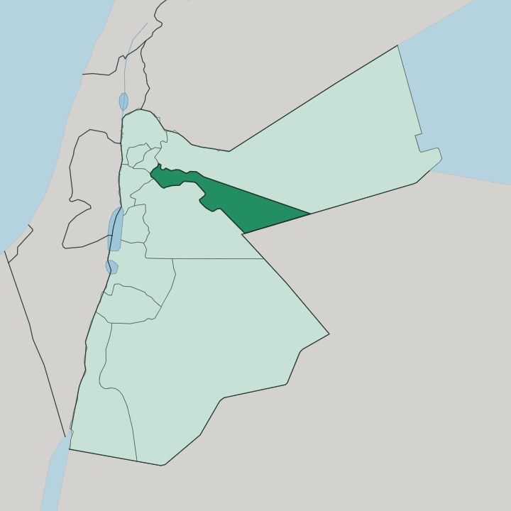
Towns & cities in Muḩāfaz̧at az Zarqā’
Pick a town or city — each links to where to stay.
Zarqa is the base here. As the governorate's capital and largest city, it sits on the Amman-Zarqa highway with the widest choice of rooms, though it stays a working industrial place rather than a resort. Russeifa fills the corridor toward Amman and runs into it as one continuous urban sprawl.
Most travellers who reach Qasr al Hallabat come out for the day from Amman, since beds thin out fast once you leave the river towns for the Syrian Desert. Choose Zarqa if you want to sleep near the refinery country and the desert-castle road east.
About Muḩāfaz̧at az Zarqā’
What is Muḩāfaz̧at az Zarqā’ known for?
This is Jordan's factory floor. The governorate holds the country's only oil refinery, run by the Jordan Petroleum Refinery Company since 1956, and a chain of heavy industry strung along the Zarqa River. Zarqa, its capital, grew from a railway station on the Hejaz line into the kingdom's second city and the old home of the Arab Legion.
Russeifa, the next city west, made its name on phosphate dug from the hills after 1935. Out in the desert stands Qasr al Hallabat, a Roman fort the Umayyads rebuilt as a palace.
Where is Muḩāfaz̧at az Zarqā’?
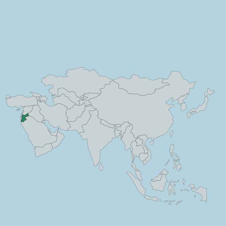
The governorate lies just east of Amman, its capital city Zarqa about 25 kilometres out along the highway. It splits cleanly in two. The crowded western strip belongs to the Zarqa River basin, where Zarqa and Russeifa run together into the wider Amman conurbation, one of the largest built-up areas in the Levant.
Everything to the east is different. There the land opens into the Syrian Desert plateau, a gravel and basalt tableland that carries the governorate's border out to Saudi Arabia in the far south-east. Water decides where people live.
The Zarqa River, the second largest tributary of the lower Jordan after the Yarmouk, rises in springs near Amman and cuts a broad valley north-west through the governorate before dropping toward the Jordan Valley far below. Along that valley sits the industrial belt. Mafraq Governorate borders it to the north, Amman Governorate to the south and west, and the desert stretches away to the east.
The river towns are green and packed. Beyond them the plateau is nearly empty, and the emptiness runs for a long way.
What is Muḩāfaz̧at az Zarqā’ like?
Zarqa was built by newcomers. Chechen refugees founded the town in 1902, driven south by the Ottoman-Russian wars and the Circassian expulsions from the Caucasus, and the Chechen community here later filled the ranks of the Mobile Force that became the Arab Legion. That military root still marks the place.
The city grew up around barracks and a railway station rather than any old bazaar, and its temper is practical, working, unshowy. Arabic is the everyday language, as across the kingdom. What sets this governorate apart is its industrial character.
Refinery workers, phosphate miners and factory hands gave the towns a blue-collar identity you feel in the crowded, plain-fronted streets of Zarqa and Russeifa. It is not a place that trades on beauty. The pull is the desert edge just beyond the last houses, where Qasr al Hallabat carries carved stucco, frescoes and mosaics left by Umayyad builders who turned a frontier fort into a country palace.
Everyday grind and imperial ruins sit side by side.
What is the history of Muḩāfaz̧at az Zarqā’?
People have lived along the Zarqa River since the Bronze Age, and the Ammonites and later the Nabateans left their mark on this ground. The Romans held the frontier from forts like Qasr al Hallabat, which the Umayyad caliph Hisham rebuilt in the 8th century as a decorated desert palace. The modern story is short and abrupt.
Chechen settlers founded Zarqa in 1902 beside a new Hejaz-railway station, phosphate mining opened at Russeifa in 1935, and the refinery came in 1956. War-driven migration built it.
What is the climate of Muḩāfaz̧at az Zarqā’?
The governorate runs dry. Zarqa has a cold semi-arid climate, with hot summer days on the plateau and cool, sometimes cold winter nights when almost all the year's scant rain arrives. The Syrian Desert to the east is drier still, baked and treeless.
Only the Zarqa River basin holds enough water for the crowded towns of the west. Little rain falls at all.
How do you get to Muḩāfaz̧at az Zarqā’?
Amman is the gateway. Nearly every traveller lands there first, then covers the short 25 kilometres east on the Amman-Zarqa highway into the governorate. The Hejaz Jordan Railway still carries passengers through Zarqa, one of the few working lines left in the kingdom, linking it with Amman and Mafraq.
Getting around inside is easy on the highway that ties Russeifa, Zarqa and the capital into one belt. Reaching Qasr al Hallabat out east needs a car on the desert road.
Common questions
What is the best area to stay in Muḩāfaz̧at az Zarqā’?
Qasr al Hallabat and the desert east: day-tripping to the desert castles from a river-town base.
Good for
Updated July 2026