Kenya
Trans Nzoia, Kenya — Towns & Travel Guide


Trans Nzoia is Kenya's breadbasket, a high farming county spread between Mount Elgon and the Nzoia River in the country's far west.
About Trans Nzoia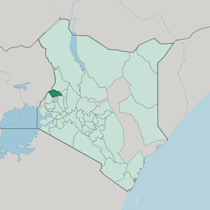


Towns & cities in Trans Nzoia
Pick a town or city — each links to where to stay.
Kitale is the obvious base. The county town holds most of the hotels, the museum, and the roads that fan out to everything else. Endebess sits higher up, the last stop before the Chorlim Gate into Mount Elgon National Park, and suits anyone heading for the caves and the moorland above.
For the sitatunga, stay out near Kwanza, within reach of the Saiwa Swamp boardwalks at first light when the antelope come to feed. The Cherang'any side, off toward the eastern hills, trades farm country for forest ridges and quiet walking. Pick Kitale first.
About Trans Nzoia
Maize is the answer.
What is Trans Nzoia known for?
Trans Nzoia grows more of it than almost anywhere else in Kenya, and the county's deep volcanic soils and steady highland rains have earned it the name of the country's breadbasket. Kitale, the county town, sits at the centre of that trade as the northern terminus of the old railway line. Beyond the farms, two small parks pull travellers off the highway: Saiwa Swamp, the smallest national park in Kenya, protects the shy sitatunga antelope, while Mount Elgon National Park climbs an extinct volcano riddled with lava-tube caves.
The Kitale Museum holds the region's oldest public collection.
Where is Trans Nzoia?
Trans Nzoia sits high in the Kenyan highlands, roughly 380 km by road northwest of Nairobi. It fills a broad, tilted plain caught between two great landmarks: the bulk of Mount Elgon to the west and northwest, and the long line of the Cherang'any Hills rising to the east. The Republic of Uganda lies just across the mountain, sharing both the volcano and the Suam River border.
To the south the county meets Bungoma and Kakamega, to the east West Pokot, and to the southeast the plateau runs on into Uasin Gishu and Elgeyo-Marakwet. Kitale stands near the middle of it all. The land itself is a continuation of the Uasin Gishu Plateau, high and level and floored with the dark volcanic soil that makes the county farm.
Mount Elgon is the giant here, an old shield volcano and the second-highest mountain in Kenya, its forested slopes climbing toward moorland and bare rock. Rivers lace the whole plain. Fifteen rivers rise off the mountain and the hills, threading across the plain before they gather into the Nzoia River, which carries their flow southwest to Lake Victoria.
That river gave the county its name. Trans Nzoia means the land across the Nzoia, a label the British drew when they mapped this corner of the Rift Valley.
What is Trans Nzoia like?
Few Kenyan counties are as mixed as this one. When the settler farms were broken up and redistributed after independence, families came from every corner of the country to work the maize land, and the county came to speak nearly every Kenyan tongue at its markets. The Luhya and the Kalenjin are the largest communities, with Kikuyu, Kisii, Luo, Teso and Turkana families farming alongside them.
Swahili and English tie the whole mix together. That farming life sets the rhythm: planting with the long rains, the green wall of maize through the middle of the year, and the harvest that feeds much of Kenya. The Kitale Museum is the place to read that history.
Opened in the settler years and later taken over by the National Museums of Kenya, it keeps traditional homesteads from the Luhya, the Maasai and the Turkana in its grounds, along with a snake house and one of the country's larger crocodile pits. Newer traditions have taken root too. Kitale hosts an annual film week, begun in the town in 2023.
Out in the wetlands of Saiwa Swamp, the local people call the sitatunga the ghost of the swamp, for the way the antelope sinks under the reeds and vanishes when it is startled.
What is the history of Trans Nzoia?
The Sabaot were here first, herding on the open plains below Mount Elgon before colonial rule pushed them aside. Kitale itself was laid out as a district centre in 1920, on an old caravan road. After the First World War the British handed the surrounding land to ex-soldiers under a settlement scheme, and the maize farms spread fast once the Uganda Railway pushed a branch line up from Eldoret in 1926.
The crop made the county. Trans Nzoia stayed part of the wider Rift Valley through independence in 1963, and became a county in its own right in 2013, when devolution redrew the Kenyan map.
What is the climate of Trans Nzoia?
Height keeps Trans Nzoia cool. The farms sit high on the plateau, so days stay mild and nights turn genuinely cold for the tropics, dipping toward single figures up near Mount Elgon. Rain is the county's real wealth.
It falls across three seasons, heavy long rains from March to May, a wet spell through the middle of the year, and shorter showers late in the year, and the volcano's slopes wring extra moisture from the passing weather. That steady water is what keeps the fields green.
How do you get to Trans Nzoia?
Most people drive. Kitale lies about 380 km northwest of Nairobi, a five- to six-hour run through Nakuru and Eldoret on the trunk road that carries on toward South Sudan. Eldoret keeps the nearest full airport, its international runway roughly an hour's drive to the south.
Kitale has its own airstrip on the edge of town for light aircraft, and it is the northern end of the Kenyan railway. Westward, the Suam crossing on Mount Elgon opens the back road into Uganda.
Good for
Updated July 2026