Kenya
Elegeyo-Marakwet, Kenya — Towns & Travel Guide


Elgeyo-Marakwet is a Rift Valley county in Kenya, its escarpment falling from Iten's high running roads to the hot Kerio Valley floor.
About Elegeyo-Marakwet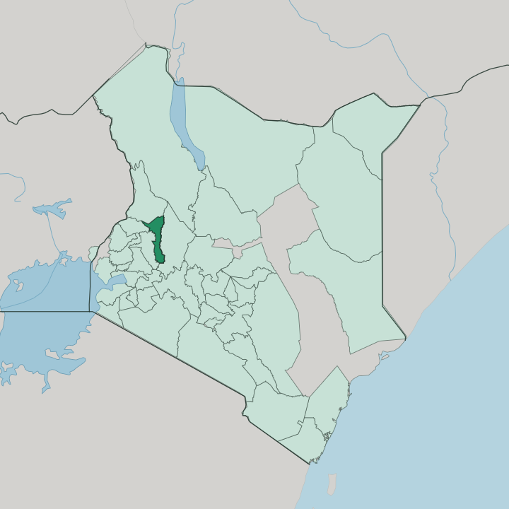


Towns & cities in Elegeyo-Marakwet
Pick a town or city — each links to where to stay.
Iten is the obvious base. The capital sits on the edge of the Elgeyo Escarpment, where guesthouses and running camps share the ridge with sweeping views down into the Kerio Valley. For heat and quiet, drop to the valley floor, where a handful of lodges look up at the escarpment wall.
Trekkers head north instead, into the forests and moorland of the Cherangani Hills above Kapsowar. Chepkorio holds the southern highlands, a cool run of potato and dairy farms along the escarpment's upper rim.
About Elegeyo-Marakwet
Iten made this county famous.
What is Elegeyo-Marakwet known for?
Runners climb the red-dirt roads above the town, and Olympic and world champions have trained on the Elgeyo Escarpment for decades, which earned Iten a World Athletics Heritage Plaque. Below that wall of rock the land drops into the Kerio Valley, a hot trench of the Great Rift Valley where the Kerio River runs the length of the valley floor. The county takes its name from its two peoples, the Keiyo and the Marakwet, both branches of the Kalenjin.
Where is Elegeyo-Marakwet?
Elgeyo-Marakwet forms a long, narrow strip through Kenya's part of the Great Rift Valley. It runs roughly north to south. The whole county tilts eastward off a high plateau, spills over the Elgeyo Escarpment, and bottoms out on the floor of the Kerio Valley, so the land falls from cool forest and moorland to hot, dry scrub within a few kilometres.
Iten stands right on the lip of that escarpment, high above the valley. The Kerio River marks the eastern edge, running the length of the valley between the escarpment and the Tugen Hills over in neighbouring Baringo. Those three zones could not be more different.
Up top, a plateau of forest and moorland rides above the escarpment, climbing north into the Cherangani Hills, whose peaks, Kamologon, Chebon, and Chepkotit, form the county's highest ground. The Cherangani ridge closes the county's northern end. Down in the Kerio Valley the floor sinks to hot, thinly settled lowland, the driest ground in the county.
Neighbours ring it on every side: West Pokot to the north, Uasin Gishu across the highlands to the west, and Trans Nzoia off the north-west shoulder. The Marakwet hold the northern reaches, the Keiyo the highlands to the south.
What is Elegeyo-Marakwet like?
Two Kalenjin peoples share the county, and the split follows the land. The Keiyo, also called the Elgeyo, farm the southern highlands; the Marakwet hold the north, from the Cherangani slopes down into the valley. Both are agro-pastoral, herding cattle and goats on the high tops and cropping the warmer ground below.
The Marakwet are known for something rarer. For generations they have maintained a network of irrigation furrows that carry water off the Cherangani Hills, down the face of the escarpment, and out across the dry Kerio Valley floor to their fields, hand-cut channels, tended by whole clans, some reckoned to be centuries old. The other thing the county is known for is speed.
Running is woven into daily life on the highlands around Iten, where children run to school on the escarpment roads and grown athletes chase Olympic and world titles on the same red dirt. Foreign runners come to train at altitude beside them, and the town supports a small industry of camps, coaches, and physiotherapists around the sport. Kalenjin is the shared tongue, alongside Swahili and English.
Honey gathered in the valley, ceremonies keyed to age-sets, and long-distance running all belong to the same Kalenjin culture. It is a small county with an outsized name.
What is the history of Elegeyo-Marakwet?
Elgeyo and Marakwet were run as two separate colonial districts from 1920, until the administration folded them together into a single Elgeyo-Marakwet district in 1926. For most of the century that follows, the area sat inside Kenya's old Rift Valley Province. Devolution redrew the map.
When Kenya's 2010 constitution replaced the provinces with 47 counties, Elgeyo-Marakwet became one of them in 2013, and Iten, long the district town, was made the county capital.
What is the climate of Elegeyo-Marakwet?
One escarpment holds two climates. The highlands above it, around Iten and up toward the Cherangani Hills, stay cool and green, with heavy rain feeding forest and moorland. Drop over the edge into the Kerio Valley and the air turns hot and dry, its thorn scrub watered only by the rivers off the ridge.
Rain comes in two seasons, a long wet spell and a shorter one, heavier on the tops than on the valley floor.
How do you get to Elegeyo-Marakwet?
No airport sits inside the county. The nearest runway is at Eldoret, over the county line in Uasin Gishu, and most people land there before driving the tarmac up onto the escarpment to Iten. From Nairobi it is a long haul north-west by road through the highlands.
Inside the county, one road matters most: the tarmac that pitches off the escarpment at Iten and switchbacks down into the Kerio Valley, among the steeper descents in Kenya.
Updated July 2026