Kenya
West Pokot, Kenya — Towns & Travel Guide


West Pokot is a highland county in north-western Kenya, climbing from the Turkwel plains to Mount Mtelo along the border with Uganda.
About West Pokot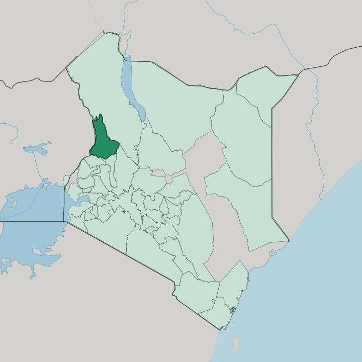


Towns & cities in West Pokot
Pick a town or city — each links to where to stay.
Kapenguria is the practical base for West Pokot, the county town where the Kapenguria Museum and most of the region's hotels and lodges cluster along the road up from Kitale. Two other spots draw overnight stays. Climbers bed down in bandas and campsites in the Sekerr highlands before the walk up Mount Mtelo, while a handful of guesthouses sit near the Turkwel Gorge and its reservoir in the drier north.
If you want a wider choice of rooms, Kitale lies just over the southern border in Trans Nzoia and makes an easy jumping-off town. Stay in Kapenguria to be close to the museum and the market.
About West Pokot
What is West Pokot known for?
Two things carry West Pokot's name. One is Kapenguria, the county town where the British tried Jomo Kenyatta and five fellow nationalists in 1952, and whose old detention cells house the Kapenguria Museum. The other is the land itself and the Pokot who work it, a cattle-herding people of the Kalenjin family whose homesteads and livestock markets spread across the plains below the Cherangani Hills.
Walkers come for Mount Mtelo and the Turkwel Gorge; historians come for the trial that helped make a president.
Where is West Pokot?
West Pokot sits in the far north-west of Kenya, pressed against the border with Uganda. It belongs to the highlands that flank the western wall of the Rift Valley. Turkana County lies to the north, Baringo to the east, Elgeyo-Marakwet to the south-east, and Trans Nzoia across the southern line. Kapenguria, the county town, stands up on the wetter highland edge above the plains.
The land tilts hard. In the space of a day's drive it drops from cool ridges above 3,000 metres to hot, dusty plains where the herders keep their cattle. Three landscapes divide the county.
The dry plains of the north run toward the Turkwel River, which the Turkwel Dam holds back in a deep gorge before the water drops on into the arid country beyond. A spine of green ranges rises through the middle, crowned by Mount Mtelo, the highest of the Sekerr peaks. Higher up, the air turns cold.
The Cherangani Hills close the south-east, their forests marking the boundary with Elgeyo-Marakwet. Two permanent rivers, the Weiwei and the Muruny, water the valleys where the Pokot terrace their fields.
What is West Pokot like?
The county takes its character from the Pokot, a Nilotic people counted among the wider Kalenjin. Wealth walks on four legs here. Herds measure a family's standing, pass between families to seal a marriage, and thread through the songs, initiations, and age-set rituals that carry a young person into adulthood.
Two ways of living split the community. The plains Pokot drive cattle, goats, and camels across the dry lowlands, while the hill Pokot terrace sorghum, millet, and maize down the wetter slopes. Rain, not the calendar, sets the rhythm of the year's work.
Language marks the people as much as livestock does. They speak Pökoot, a Kalenjin tongue, alongside the Swahili and English heard across Kenya. Livestock markets at Kapenguria draw herders down from the hills.
Beadwork, ochre, and bright metal ornament belong to dress for ceremonies and market days. The homestead, ringed by a thorn fence against raiders and wild animals, is the basic unit of Pokot society. Alongside them in the south-eastern forests are the Sengwer, hunter-gatherers of the Cherangani woods whose way of life has narrowed as the woodland is cleared.
What is the history of West Pokot?
West Pokot's place in the national story was written at Kapenguria. In 1952 the colonial government tried Jomo Kenyatta and five other independence leaders here, in a courtroom deliberately chosen for its distance from the crowds of the capital. All six were convicted and jailed.
Kenyatta went on to lead independent Kenya from 1963, and the cells that held the accused reopened as the Kapenguria Museum in 1993. The wider district sat inside the old Rift Valley province until 2013, when the constitution turned it into a county in its own right.
What is the climate of West Pokot?
West Pokot holds two climates at once. The northern plains around the Turkwel are hot and semi-arid, while the Cherangani Hills and the Sekerr highlands stay cool and green year-round. Rain comes in two seasons: the long rains from March to June and the shorter rains of October and November.
Neither is reliable. Drought can wither the grazing one year and flash floods tear through the valleys the next, and that swing between too little water and too much shapes life on the land more than any average could.
How do you get to West Pokot?
Reaching West Pokot means a long road north. Most travellers come up the highway from Kitale, the nearest large town, which climbs the escarpment into Kapenguria at the heart of the county. The last stretch gains height fast.
From Nairobi the drive runs several hundred kilometres north-west through the string of Rift Valley towns, and the closest airport with scheduled flights is at Eldoret, a few hours further south. Beyond the tarmac, dirt tracks fan out to Sigor, the Turkwel dam, and the mountain villages, and many of them turn to mud once the rains arrive.
Updated July 2026